
| Memorials | : | 0 |
| Location | : | Orton, Kettering Borough, England |
| Coordinate | : | 52.4068200, -0.8171200 |
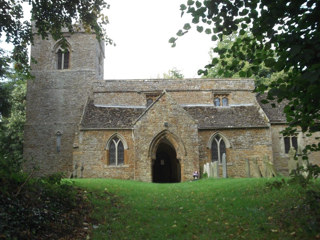
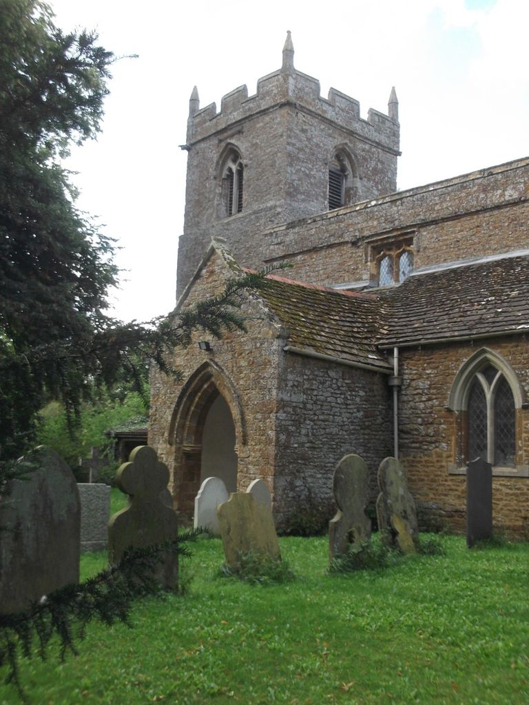
| Description | : | All Saints was a chapel of Rothwell until 1964, when it became redundant by 1966. It now houses the Orton Trust, founded in 1968 to teach traditional stonemasonry techniques. |
frequently asked questions (FAQ):
-
Where is All Saints Churchyard?
All Saints Churchyard is located at Main Street Orton, Kettering Borough ,Northamptonshire , NN14 1LJEngland.
-
All Saints Churchyard cemetery's updated grave count on graveviews.com?
0 memorials
-
Where are the coordinates of the All Saints Churchyard?
Latitude: 52.4068200
Longitude: -0.8171200
Nearby Cemetories:
1. Saint Leonard's Churchyard
Loddington, Kettering Borough, England
Coordinate: 52.3971985, -0.8041003
2. Rothwell Cemetery
Rothwell, Kettering Borough, England
Coordinate: 52.4165400, -0.8000300
3. All Saints Churchyard
Thorpe Malsor, Kettering Borough, England
Coordinate: 52.4027430, -0.7760140
4. St Andrew's Church
Great Cransley, Kettering Borough, England
Coordinate: 52.3816667, -0.7850000
5. St Giles Churchyard
Desborough, Kettering Borough, England
Coordinate: 52.4398300, -0.8202300
6. Desborough Cemetery
Desborough, Kettering Borough, England
Coordinate: 52.4412100, -0.8032800
7. Kettering Crematorium
Kettering, Kettering Borough, England
Coordinate: 52.4054820, -0.7480680
8. Saint Catherine
Draughton, Daventry District, England
Coordinate: 52.3840770, -0.8821840
9. St Andrew Churchyard
Arthingworth, Daventry District, England
Coordinate: 52.4255400, -0.8914700
10. Saint Mary the Virgin
Maidwell, Daventry District, England
Coordinate: 52.3854950, -0.9007770
11. Saint Peter and Saint Paul Churchyard
Kettering, Kettering Borough, England
Coordinate: 52.3969000, -0.7266000
12. All Saints Churchyard
Brixworth, Daventry District, England
Coordinate: 52.3835815, -0.7309842
13. London Road Cemetery
Kettering, Kettering Borough, England
Coordinate: 52.3956500, -0.7241100
14. Independent Chapel Burial Yard
Old, Daventry District, England
Coordinate: 52.3514947, -0.8506201
15. All Saints Churchyard
Braybrooke, Kettering Borough, England
Coordinate: 52.4538160, -0.8764390
16. Saint Andrew Churchyard
Old, Daventry District, England
Coordinate: 52.3503600, -0.8484200
17. All Saints Churchyard
Lamport, Daventry District, England
Coordinate: 52.3637900, -0.8883600
18. St. Deny's Churchyard
Kelmarsh, Daventry District, England
Coordinate: 52.4060590, -0.9207120
19. All Saints Churchyard
Pytchley, Kettering Borough, England
Coordinate: 52.3641220, -0.7384500
20. St. Peter's Churchyard
Walgrave, Daventry District, England
Coordinate: 52.3404255, -0.8248900
21. Walgrave Cemetery
Walgrave, Daventry District, England
Coordinate: 52.3385720, -0.8314720
22. St Peter and St Paul Churchyard
Scaldwell, Daventry District, England
Coordinate: 52.3459100, -0.8732100
23. St. Mary's Churchyard
Brampton Ash, Kettering Borough, England
Coordinate: 52.4796000, -0.8402000
24. St Mary the Virgin Churchyard
Brampton, Kettering Borough, England
Coordinate: 52.4797580, -0.8400370