
| Memorials | : | 0 |
| Location | : | Old, Daventry District, England |
| Coordinate | : | 52.3514947, -0.8506201 |
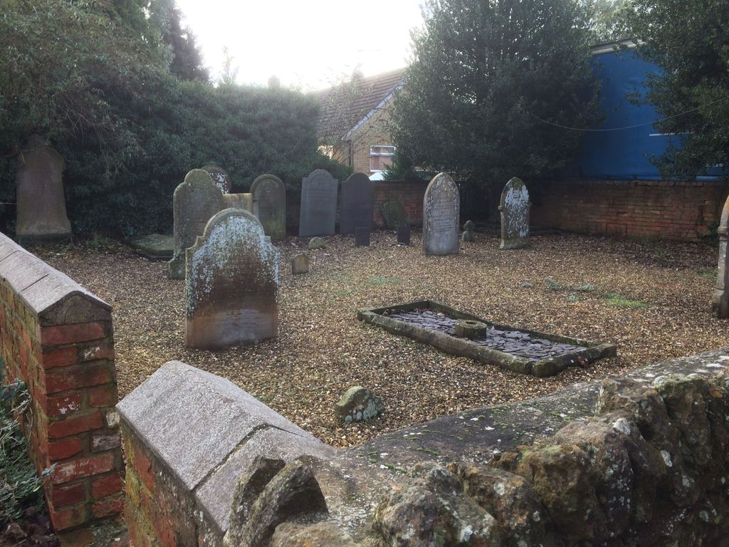
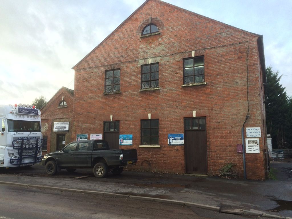
| Description | : | Small burial yard of a former independent chapel located on Scaldwell road in Old, Northamptonshire. The chapel buildings still exist and are now (as seen in 2021) the location on Hamsons General Haulage. In 1870-72, John Marius Wilson's Imperial Gazetteer of England and Wales described Old as: "OLD, or Wold, village and a parish in Brixworth district, Northampton. The village stands 2¾ miles S E of Lamport r. station, and 6½ S W of Kettering; and has a post-office under Northampton. The parish comprises 1, 650 acres. Real property, £3, 874. Pop., 472. Houses, 118. The property is divided among a few.... Read More |
frequently asked questions (FAQ):
-
Where is Independent Chapel Burial Yard?
Independent Chapel Burial Yard is located at next to Hamsons Haulage, Scaldwell Rd, Old, Northamptonshire Old, Daventry District ,Northamptonshire , NN6 9RBEngland.
-
Independent Chapel Burial Yard cemetery's updated grave count on graveviews.com?
0 memorials
-
Where are the coordinates of the Independent Chapel Burial Yard?
Latitude: 52.3514947
Longitude: -0.8506201
Nearby Cemetories:
1. Saint Andrew Churchyard
Old, Daventry District, England
Coordinate: 52.3503600, -0.8484200
2. St Peter and St Paul Churchyard
Scaldwell, Daventry District, England
Coordinate: 52.3459100, -0.8732100
3. Walgrave Cemetery
Walgrave, Daventry District, England
Coordinate: 52.3385720, -0.8314720
4. St. Peter's Churchyard
Walgrave, Daventry District, England
Coordinate: 52.3404255, -0.8248900
5. All Saints Churchyard
Lamport, Daventry District, England
Coordinate: 52.3637900, -0.8883600
6. St. Mary & All Saints Churchyard
Holcot, Daventry District, England
Coordinate: 52.3208630, -0.8390120
7. Saint Catherine
Draughton, Daventry District, England
Coordinate: 52.3840770, -0.8821840
8. Saint Mary the Virgin
Maidwell, Daventry District, England
Coordinate: 52.3854950, -0.9007770
9. St Andrew's Church
Great Cransley, Kettering Borough, England
Coordinate: 52.3816667, -0.7850000
10. All Saints Churchyard
Pitsford, Daventry District, England
Coordinate: 52.3066700, -0.8952200
11. Saint Leonard's Churchyard
Loddington, Kettering Borough, England
Coordinate: 52.3971985, -0.8041003
12. All Saints Churchyard
Orton, Kettering Borough, England
Coordinate: 52.4068200, -0.8171200
13. Ss Peter and Paul Churchyard
Sywell, Wellingborough Borough, England
Coordinate: 52.2968890, -0.7965030
14. St Andrew Churchyard
Spratton, Daventry District, England
Coordinate: 52.3243520, -0.9483460
15. All Saints Churchyard
Cottesbrooke, Daventry District, England
Coordinate: 52.3552260, -0.9588300
16. St. Leonard Churchyard
Hardwick, Wellingborough Borough, England
Coordinate: 52.3195551, -0.7533578
17. St. Mary's Churchyard
Orlingbury, Wellingborough Borough, England
Coordinate: 52.3426000, -0.7397000
18. All Saints Churchyard
Thorpe Malsor, Kettering Borough, England
Coordinate: 52.4027430, -0.7760140
19. St. Deny's Churchyard
Kelmarsh, Daventry District, England
Coordinate: 52.4060590, -0.9207120
20. All Saints Churchyard
Pytchley, Kettering Borough, England
Coordinate: 52.3641220, -0.7384500
21. Old St John the Baptist Churchyard
Boughton, Daventry District, England
Coordinate: 52.2836464, -0.8801961
22. St John the Baptist Churchyard
Boughton, Daventry District, England
Coordinate: 52.2861187, -0.8971496
23. Rothwell Cemetery
Rothwell, Kettering Borough, England
Coordinate: 52.4165400, -0.8000300
24. Saint Michael's Churchyard
Haselbech, Daventry District, England
Coordinate: 52.3891890, -0.9556720