
| Memorials | : | 0 |
| Location | : | Bedworth, Nuneaton and Bedworth Borough, England |
| Phone | : | 02476 310688 |
| Coordinate | : | 52.4790300, -1.4724590 |
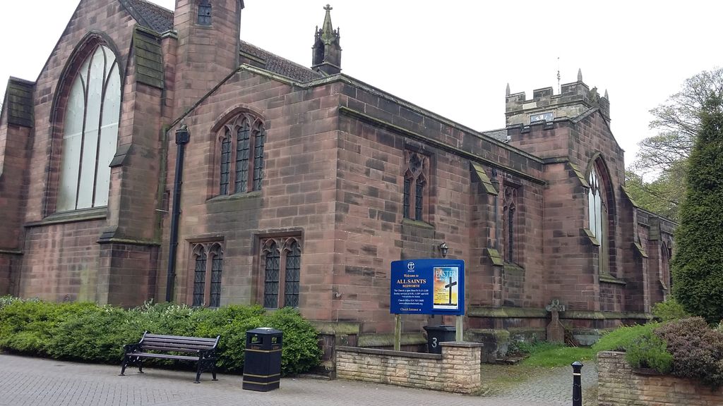
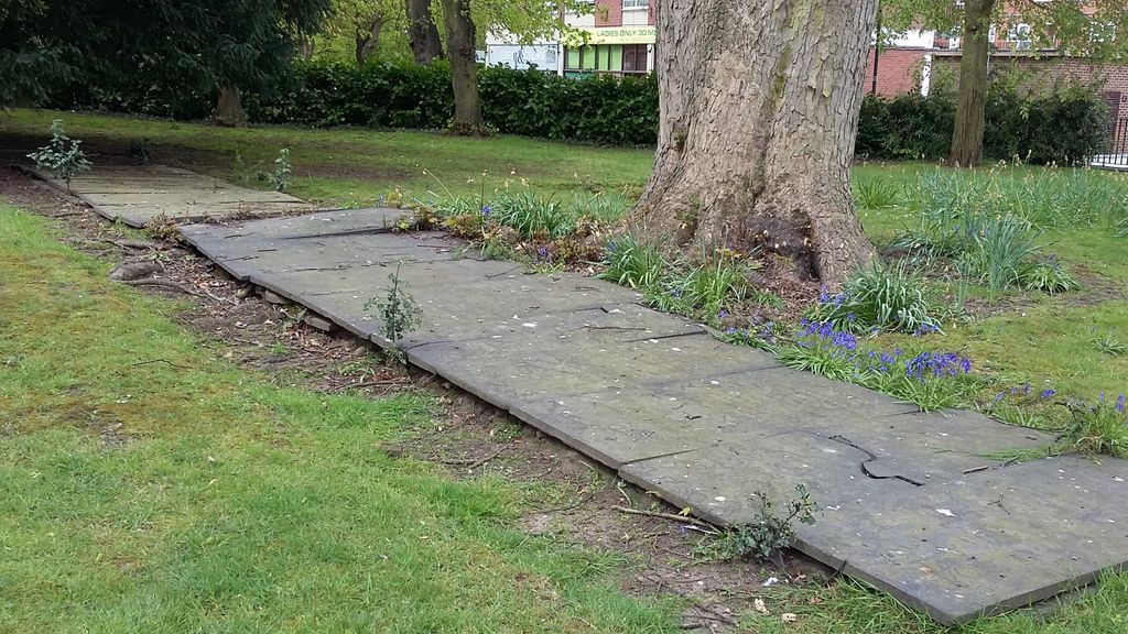
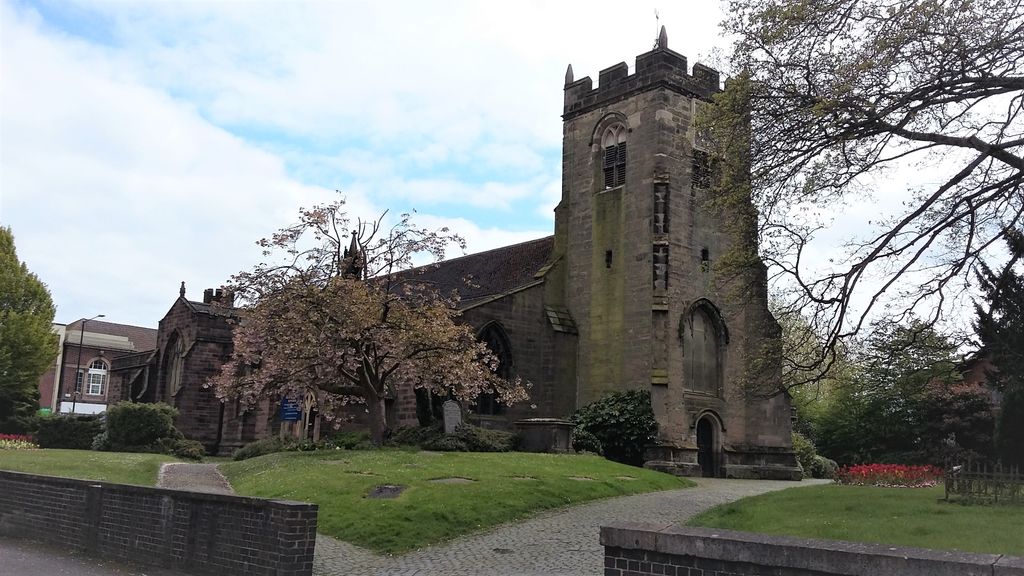
| Description | : | Please note that the majority of the gravestones that were in the churchyard that surrounds the church (there is an extension through the gate to a cemetery) have been lain on the ground in three rows (those in the picture are also laying on top of other gravestones unfortunately) so many are now weathered and illegible. There are a handful which have been propped up around a footpath to the rear of the church which date from the 1800s. |
frequently asked questions (FAQ):
-
Where is All Saints Churchyard?
All Saints Churchyard is located at High Street Bedworth, Nuneaton and Bedworth Borough ,Warwickshire , CV12 8NHEngland.
-
All Saints Churchyard cemetery's updated grave count on graveviews.com?
0 memorials
-
Where are the coordinates of the All Saints Churchyard?
Latitude: 52.4790300
Longitude: -1.4724590
Nearby Cemetories:
1. Coventry Road Cemetery
Bedworth, Nuneaton and Bedworth Borough, England
Coordinate: 52.4775590, -1.4734910
2. Old Meeting House URC Burial Ground
Bedworth, Nuneaton and Bedworth Borough, England
Coordinate: 52.4815660, -1.4714170
3. Marston Lane Cemetery
Bedworth, Nuneaton and Bedworth Borough, England
Coordinate: 52.4883470, -1.4678740
4. Our Lady of the Sacred Heart Catholic Church
Bulkington, Nuneaton and Bedworth Borough, England
Coordinate: 52.4816820, -1.4341200
5. St Giles Churchyard
Exhall, Nuneaton and Bedworth Borough, England
Coordinate: 52.4623930, -1.5003010
6. St James Churchyard
Bulkington, Nuneaton and Bedworth Borough, England
Coordinate: 52.4773830, -1.4256900
7. Erdbury Priory
Arbury, Nuneaton and Bedworth Borough, England
Coordinate: 52.5002190, -1.5074930
8. Barnacle Chapel Churchyard
Rugby Borough, England
Coordinate: 52.4590430, -1.4350380
9. All Saints Churchyard
Chilvers Coton, Nuneaton and Bedworth Borough, England
Coordinate: 52.5133100, -1.4659600
10. Lentons Lane Cemetery
Coventry, Metropolitan Borough of Coventry, England
Coordinate: 52.4476000, -1.4469500
11. Attleborough Cemetery
Attleborough, Nuneaton and Bedworth Borough, England
Coordinate: 52.5116943, -1.4494337
12. Holy Trinity Churchyard
Attleborough, Nuneaton and Bedworth Borough, England
Coordinate: 52.5144020, -1.4563310
13. Our Lady of the Angels Catholic Church
Nuneaton, Nuneaton and Bedworth Borough, England
Coordinate: 52.5174450, -1.4667010
14. Walsgrave-on Sowe Cemetery
Walsgrave on Sowe, Metropolitan Borough of Coventry, England
Coordinate: 52.4420000, -1.4498100
15. St Nicolas Churchyard
Nuneaton, Nuneaton and Bedworth Borough, England
Coordinate: 52.5214150, -1.4626130
16. Heart of England Crematorium
Nuneaton, Nuneaton and Bedworth Borough, England
Coordinate: 52.5182420, -1.4425920
17. Foleshill Road United Reformed Churchyard
Foleshill, Metropolitan Borough of Coventry, England
Coordinate: 52.4373320, -1.4919190
18. St. Paul's Cemetery
Coventry, Metropolitan Borough of Coventry, England
Coordinate: 52.4383200, -1.5047500
19. Shilton Cemetery
Shilton, Rugby Borough, England
Coordinate: 52.4560640, -1.4076450
20. St Andrew's Churchyard
Shilton, Rugby Borough, England
Coordinate: 52.4556900, -1.4071560
21. St Paul's Churchyard
Stockingford, Nuneaton and Bedworth Borough, England
Coordinate: 52.5191000, -1.5100000
22. Oaston Road Cemetery
Nuneaton, Nuneaton and Bedworth Borough, England
Coordinate: 52.5244040, -1.4574020
23. Saint James Parish Churchyard
Ansty, Rugby Borough, England
Coordinate: 52.4498190, -1.4132490
24. Abbey Church
Nuneaton, Nuneaton and Bedworth Borough, England
Coordinate: 52.5256800, -1.4770800