
| Memorials | : | 0 |
| Location | : | Exhall, Nuneaton and Bedworth Borough, England |
| Coordinate | : | 52.4623930, -1.5003010 |
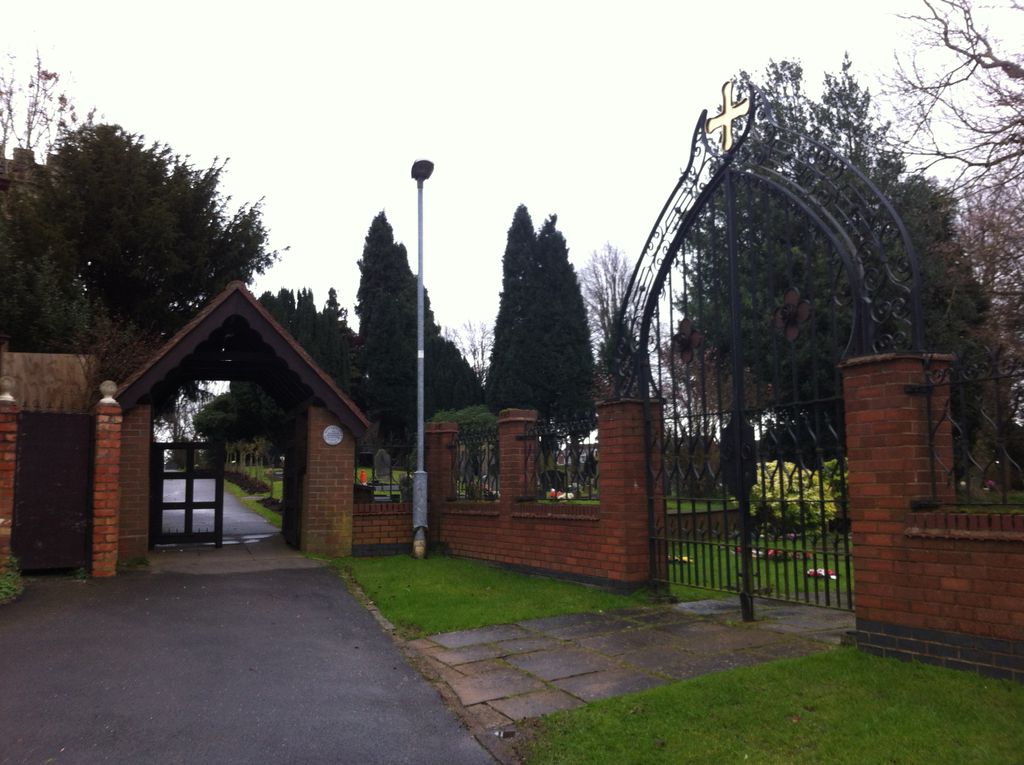
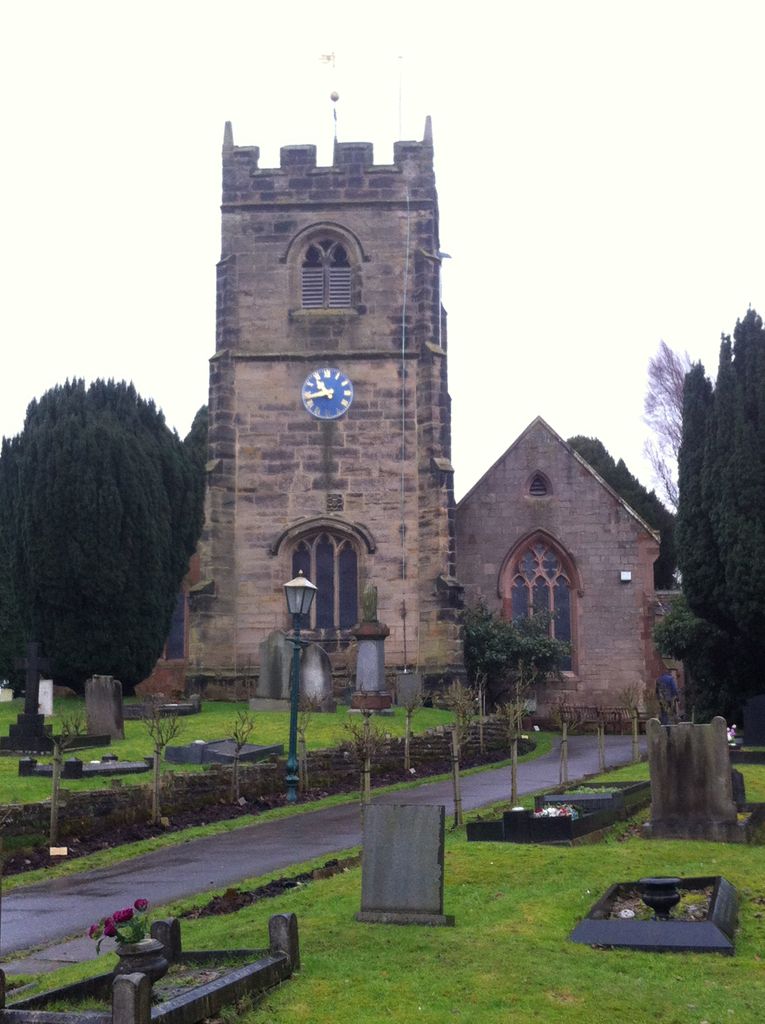
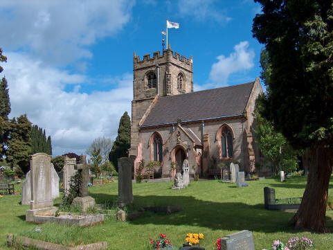
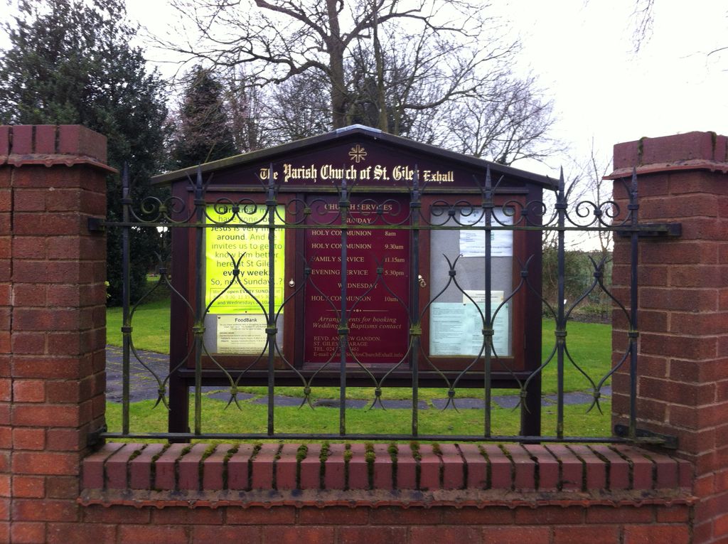
| Description | : | St Giles Church, Exhall is Bedworth's oldest building. A place of worship has stood on this site since the twelfth century. Today it is a place of worship and prayer for a lively Christian family as well as an important focal point for the wider community in Ash Green and Exhall. We believe that life without faith is incomplete. We try to be a Church that welcomes everyone, and enables all - whatever their starting point - to explore and grow in the Christian faith. We hope you find our web site helpful. Our real prayer is... Read More |
frequently asked questions (FAQ):
-
Where is St Giles Churchyard?
St Giles Churchyard is located at St Giles Exhall, Nuneaton and Bedworth Borough ,Warwickshire , CV7 9AA.England.
-
St Giles Churchyard cemetery's updated grave count on graveviews.com?
0 memorials
-
Where are the coordinates of the St Giles Churchyard?
Latitude: 52.4623930
Longitude: -1.5003010
Nearby Cemetories:
1. Coventry Road Cemetery
Bedworth, Nuneaton and Bedworth Borough, England
Coordinate: 52.4775590, -1.4734910
2. All Saints Churchyard
Bedworth, Nuneaton and Bedworth Borough, England
Coordinate: 52.4790300, -1.4724590
3. St. Paul's Cemetery
Coventry, Metropolitan Borough of Coventry, England
Coordinate: 52.4383200, -1.5047500
4. Foleshill Road United Reformed Churchyard
Foleshill, Metropolitan Borough of Coventry, England
Coordinate: 52.4373320, -1.4919190
5. Old Meeting House URC Burial Ground
Bedworth, Nuneaton and Bedworth Borough, England
Coordinate: 52.4815660, -1.4714170
6. St. Thomas Churchyard
Keresley, Metropolitan Borough of Coventry, England
Coordinate: 52.4395700, -1.5358000
7. Marston Lane Cemetery
Bedworth, Nuneaton and Bedworth Borough, England
Coordinate: 52.4883470, -1.4678740
8. Corley Parish Churchyard
Corley, North Warwickshire Borough, England
Coordinate: 52.4632100, -1.5577050
9. Lentons Lane Cemetery
Coventry, Metropolitan Borough of Coventry, England
Coordinate: 52.4476000, -1.4469500
10. Walsgrave-on Sowe Cemetery
Walsgrave on Sowe, Metropolitan Borough of Coventry, England
Coordinate: 52.4420000, -1.4498100
11. Erdbury Priory
Arbury, Nuneaton and Bedworth Borough, England
Coordinate: 52.5002190, -1.5074930
12. Barnacle Chapel Churchyard
Rugby Borough, England
Coordinate: 52.4590430, -1.4350380
13. Our Lady of the Sacred Heart Catholic Church
Bulkington, Nuneaton and Bedworth Borough, England
Coordinate: 52.4816820, -1.4341200
14. St Mary Magdalen
Coventry, Metropolitan Borough of Coventry, England
Coordinate: 52.4236750, -1.4621960
15. St Mary Magdalene Wyken
Coventry, Metropolitan Borough of Coventry, England
Coordinate: 52.4236580, -1.4620770
16. St. Mary the Virgin Churchyard
Astley, North Warwickshire Borough, England
Coordinate: 52.5019060, -1.5432740
17. St James Churchyard
Bulkington, Nuneaton and Bedworth Borough, England
Coordinate: 52.4773830, -1.4256900
18. All Saints Churchyard
Allesley, Metropolitan Borough of Coventry, England
Coordinate: 52.4230817, -1.5563453
19. St Michael Churchyard
Coventry, Metropolitan Borough of Coventry, England
Coordinate: 52.4115820, -1.4747430
20. Saint Mary's Priory and Cathedral Coventry
Coventry, Metropolitan Borough of Coventry, England
Coordinate: 52.4089000, -1.5085000
21. Holy Trinity Churchyard
Coventry, Metropolitan Borough of Coventry, England
Coordinate: 52.4085450, -1.5093060
22. Coventry Cathedral
Coventry, Metropolitan Borough of Coventry, England
Coordinate: 52.4083290, -1.5067360
23. Saint James Parish Churchyard
Ansty, Rugby Borough, England
Coordinate: 52.4498190, -1.4132490
24. St Michael's Cathedral
Coventry, Metropolitan Borough of Coventry, England
Coordinate: 52.4080000, -1.5071840