
| Memorials | : | 0 |
| Location | : | Shilton, Rugby Borough, England |
| Coordinate | : | 52.4560640, -1.4076450 |
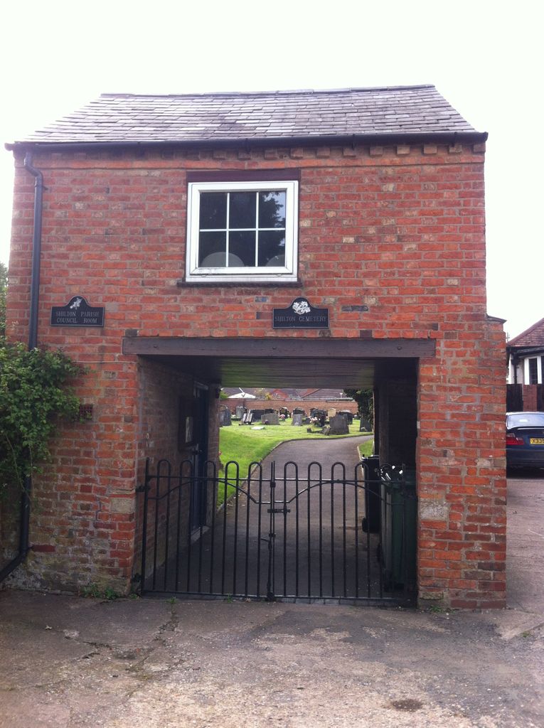
| Description | : | Shilton & Barnacle Parish Council owns and maintains the cemetery in Church Road, Shilton. The cemetery is located between St Andrew’s church and Shilton garage, and has very limited car parking on-site. Visitors are encouraged to use the free public car park further along Church Road (in the direction of Ansty) and then walk the short distance to the cemetery. |
frequently asked questions (FAQ):
-
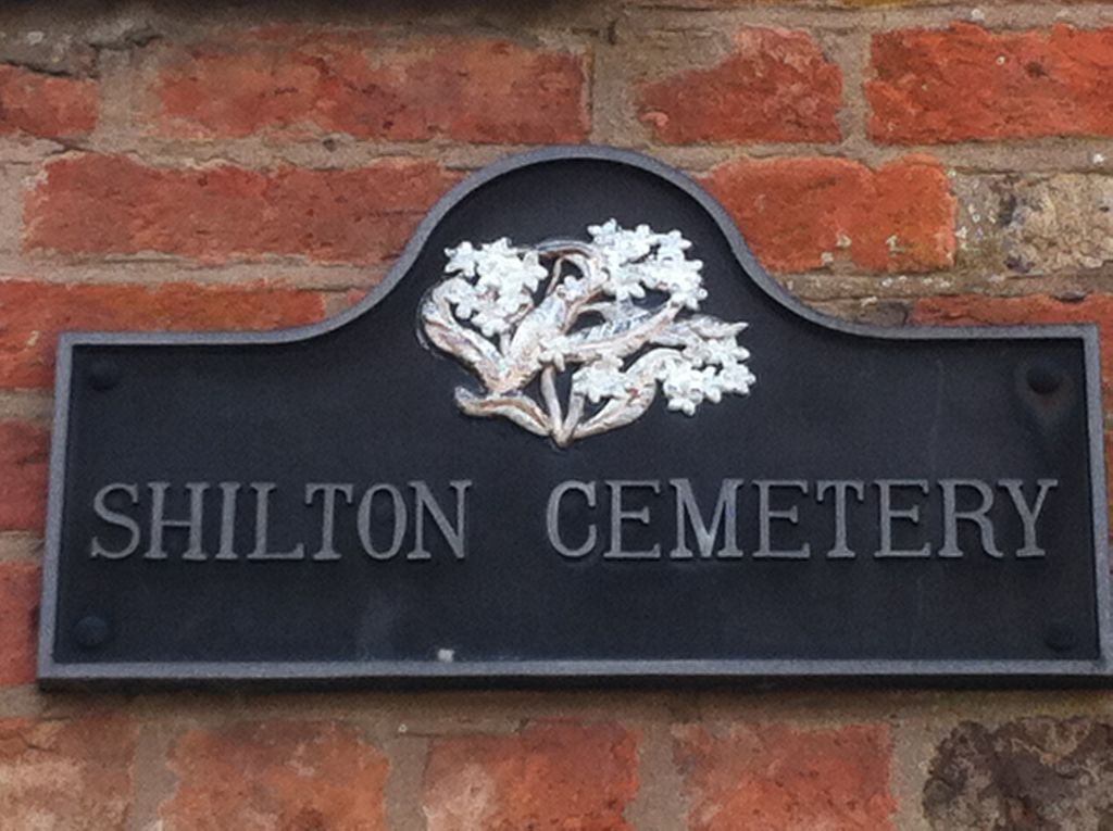
Where is Shilton Cemetery?
Shilton Cemetery is located at Church Lane Shilton, Rugby Borough ,Warwickshire ,England.
-
Shilton Cemetery cemetery's updated grave count on graveviews.com?
0 memorials
-
Where are the coordinates of the Shilton Cemetery?
Latitude: 52.4560640
Longitude: -1.4076450
Nearby Cemetories:
1. St Andrew's Churchyard
Shilton, Rugby Borough, England
Coordinate: 52.4556900, -1.4071560
2. Saint James Parish Churchyard
Ansty, Rugby Borough, England
Coordinate: 52.4498190, -1.4132490
3. Barnacle Chapel Churchyard
Rugby Borough, England
Coordinate: 52.4590430, -1.4350380
4. St James Churchyard
Bulkington, Nuneaton and Bedworth Borough, England
Coordinate: 52.4773830, -1.4256900
5. Lentons Lane Cemetery
Coventry, Metropolitan Borough of Coventry, England
Coordinate: 52.4476000, -1.4469500
6. All Saints Churchyard
Withybrook, Rugby Borough, England
Coordinate: 52.4574170, -1.3626220
7. Walsgrave-on Sowe Cemetery
Walsgrave on Sowe, Metropolitan Borough of Coventry, England
Coordinate: 52.4420000, -1.4498100
8. Our Lady of the Sacred Heart Catholic Church
Bulkington, Nuneaton and Bedworth Borough, England
Coordinate: 52.4816820, -1.4341200
9. Wolvey Baptist Churchyard
Wolvey, Rugby Borough, England
Coordinate: 52.4870250, -1.3670310
10. St John the Baptist Churchyard
Wolvey, Rugby Borough, England
Coordinate: 52.4880490, -1.3671940
11. Wolvey Cemetery
Wolvey, Rugby Borough, England
Coordinate: 52.4869130, -1.3642870
12. Coventry Road Cemetery
Bedworth, Nuneaton and Bedworth Borough, England
Coordinate: 52.4775590, -1.4734910
13. All Saints Churchyard
Bedworth, Nuneaton and Bedworth Borough, England
Coordinate: 52.4790300, -1.4724590
14. St Mary Magdalene Wyken
Coventry, Metropolitan Borough of Coventry, England
Coordinate: 52.4236580, -1.4620770
15. St Mary Magdalen
Coventry, Metropolitan Borough of Coventry, England
Coordinate: 52.4236750, -1.4621960
16. Old Meeting House URC Burial Ground
Bedworth, Nuneaton and Bedworth Borough, England
Coordinate: 52.4815660, -1.4714170
17. Marston Lane Cemetery
Bedworth, Nuneaton and Bedworth Borough, England
Coordinate: 52.4883470, -1.4678740
18. St. Botolph Churchyard
Burton Hastings, Rugby Borough, England
Coordinate: 52.5055000, -1.3976000
19. Congregational Chapel Burial Ground
Stretton under Fosse, Rugby Borough, England
Coordinate: 52.4290070, -1.3381370
20. Brinklow Cemetery
Brinklow, Rugby Borough, England
Coordinate: 52.4161320, -1.3556710
21. St John the Baptist Churchyard
Brinklow, Rugby Borough, England
Coordinate: 52.4130320, -1.3590600
22. Foleshill Road United Reformed Churchyard
Foleshill, Metropolitan Borough of Coventry, England
Coordinate: 52.4373320, -1.4919190
23. St Edith's Churchyard
Monks Kirby, Rugby Borough, England
Coordinate: 52.4444360, -1.3195900
24. St. Edith Churchyard
Monks Kirby, Rugby Borough, England
Coordinate: 52.4439800, -1.3192500