
| Memorials | : | 0 |
| Location | : | Bulach, Stadtkreis Karlsruhe, Germany |
| Coordinate | : | 48.9885000, 8.3801000 |
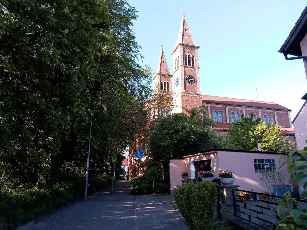
| Description | : | Der Friedhof wurde im 14. Jahrhundert westlich der Kirche St. Cyriakus angelegt und 1920 zugunsten des 1896 angelegten neuen Friedhofs im Süden von Bulach aufgegeben. Heute befindet sich ein Schulgebäude und ein Spielplatz auf dem Gelände. The cemetery was established in the 14th century west of St. Cyriakus Church and was abandoned in 1920 in favor of a new cemetery created in 1896 in the south of Bulach. Today there is a school building and a playground on the area. |
frequently asked questions (FAQ):
-
Where is Alter Friedhof Bulach?
Alter Friedhof Bulach is located at Grünwinkler Straße 8 Bulach, Stadtkreis Karlsruhe ,Baden-Württemberg , 76135Germany.
-
Alter Friedhof Bulach cemetery's updated grave count on graveviews.com?
0 memorials
-
Where are the coordinates of the Alter Friedhof Bulach?
Latitude: 48.9885000
Longitude: 8.3801000
Nearby Cemetories:
1. Friedhof Bulach
Bulach, Stadtkreis Karlsruhe, Germany
Coordinate: 48.9839600, 8.3742300
2. Friedhof Oberreut
Oberreut, Stadtkreis Karlsruhe, Germany
Coordinate: 48.9885793, 8.3690911
3. Friedhof Beiertheim
Beiertheim, Stadtkreis Karlsruhe, Germany
Coordinate: 48.9944648, 8.3864104
4. Friedhof Rüppurr
Rüppurr, Stadtkreis Karlsruhe, Germany
Coordinate: 48.9709000, 8.3996200
5. Friedhof Grünwinkel
Grünwinkel, Stadtkreis Karlsruhe, Germany
Coordinate: 49.0065000, 8.3545000
6. Gefallenendenkmal Rüppurr
Rüppurr, Stadtkreis Karlsruhe, Germany
Coordinate: 48.9685350, 8.4022270
7. Evangelische Stadtkirche Karlsruhe
Karlsruhe, Stadtkreis Karlsruhe, Germany
Coordinate: 49.0085380, 8.4044580
8. Karlsruher Pyramide
Karlsruhe, Stadtkreis Karlsruhe, Germany
Coordinate: 49.0092200, 8.4039400
9. Alter Friedhof Karlsruhe
Karlsruhe, Stadtkreis Karlsruhe, Germany
Coordinate: 49.0066680, 8.4165160
10. Jüdischer Friedhof an der Kriegsstraße Karlsruhe
Karlsruhe, Stadtkreis Karlsruhe, Germany
Coordinate: 49.0053000, 8.4184528
11. Friedhof Mühlburg
Mühlburg, Stadtkreis Karlsruhe, Germany
Coordinate: 49.0150000, 8.3561000
12. Friedhof Daxlanden
Daxlanden, Stadtkreis Karlsruhe, Germany
Coordinate: 49.0069000, 8.3386000
13. Großherzogliche Grabkapelle Karlsruhe
Karlsruhe, Stadtkreis Karlsruhe, Germany
Coordinate: 49.0198590, 8.4201550
14. Orthodoxer jüdischer Friedhof Karlsruhe
Karlsruhe, Stadtkreis Karlsruhe, Germany
Coordinate: 49.0144700, 8.4307300
15. Neuer jüdischer Friedhof Karlsruhe
Karlsruhe, Stadtkreis Karlsruhe, Germany
Coordinate: 49.0148300, 8.4317200
16. Friedhof Ettlingen
Ettlingen, Landkreis Karlsruhe, Germany
Coordinate: 48.9491000, 8.4151000
17. Hauptfriedhof Karlsruhe
Karlsruhe, Stadtkreis Karlsruhe, Germany
Coordinate: 49.0174620, 8.4354290
18. Friedhof Forchheim
Forchheim, Landkreis Karlsruhe, Germany
Coordinate: 48.9796000, 8.3098000
19. Friedhof Nordweststadt
Nordweststadt, Stadtkreis Karlsruhe, Germany
Coordinate: 49.0342000, 8.3628000
20. Neuer Friedhof Wolfartsweier
Wolfartsweier, Stadtkreis Karlsruhe, Germany
Coordinate: 48.9739589, 8.4492275
21. Friedhof Durlach-Aue
Durlach, Stadtkreis Karlsruhe, Germany
Coordinate: 48.9871550, 8.4546440
22. Alter Friedhof Ettlingen
Ettlingen, Landkreis Karlsruhe, Germany
Coordinate: 48.9437700, 8.4103900
23. Alter Friedhof Wolfartsweier
Wolfartsweier, Stadtkreis Karlsruhe, Germany
Coordinate: 48.9751000, 8.4520000
24. Friedhof Rintheim
Rintheim, Stadtkreis Karlsruhe, Germany
Coordinate: 49.0163421, 8.4465934