
| Memorials | : | 0 |
| Location | : | Fussen, Landkreis Ostallgäu, Germany |
| Coordinate | : | 47.5680860, 10.7030540 |
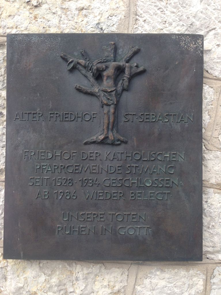
| Description | : | Established in 1528 along the old Saint Sebastian Church, it still sees a few burials today. Owned by the Catholic Diocese of Augsburg. Other cemeteries in the city are. Managed and owned by the city: - Waldfriedhof Füssen - Friedhof Hopfen am See (Gemeindefriedhof) Managed by the Catholic Congregations of Füssen: - Alter Friedhof St. Sebastian in Füssen - Katholischer Friedhof Hopfen am See - Friedhof Weissensee |
frequently asked questions (FAQ):
-
Where is Alter Friedhof St. Sebastian in Füssen?
Alter Friedhof St. Sebastian in Füssen is located at Klosterstrasse Fussen, Landkreis Ostallgäu ,Bavaria (Bayern) , 87629Germany.
-
Alter Friedhof St. Sebastian in Füssen cemetery's updated grave count on graveviews.com?
0 memorials
-
Where are the coordinates of the Alter Friedhof St. Sebastian in Füssen?
Latitude: 47.5680860
Longitude: 10.7030540
Nearby Cemetories:
1. Waldfriedhof Füssen
Fussen, Landkreis Ostallgäu, Germany
Coordinate: 47.5795220, 10.7073350
2. Friedhof Waltenhofen
Waltenhofen, Landkreis Oberallgäu, Germany
Coordinate: 47.5863890, 10.7291110
3. Kirchhof Hopfen am See
Fussen, Landkreis Ostallgäu, Germany
Coordinate: 47.6052950, 10.6853410
4. Friedhof Hopfen am See Gemeindefriedhof
Fussen, Landkreis Ostallgäu, Germany
Coordinate: 47.6058660, 10.6857650
5. Katholischer Friedhof Weissensee bei Füssen
Fussen, Landkreis Ostallgäu, Germany
Coordinate: 47.5735040, 10.6389450
6. Friedhof Bayerniederhofen
Halblech, Landkreis Ostallgäu, Germany
Coordinate: 47.6249014, 10.8006797
7. Friedhof Pfronten
Pfronten, Landkreis Ostallgäu, Germany
Coordinate: 47.5842828, 10.5542438
8. Friedhof St. Ulrich
Seeg, Landkreis Ostallgäu, Germany
Coordinate: 47.6534648, 10.6040439
9. Friedhof Nesselwang
Nesselwang, Landkreis Ostallgäu, Germany
Coordinate: 47.6269171, 10.5007204
10. Steingaden
Steingaden, Landkreis Weilheim-Schongau, Germany
Coordinate: 47.7016670, 10.8624720
11. Friedhof Wildsteig
Wildsteig, Landkreis Weilheim-Schongau, Germany
Coordinate: 47.7017096, 10.9363596
12. Kirche St. Pankratius
Marktoberdorf, Landkreis Ostallgäu, Germany
Coordinate: 47.7773209, 10.6147911
13. Friedhof Marktoberdorf
Marktoberdorf, Landkreis Ostallgäu, Germany
Coordinate: 47.7811811, 10.6221476
14. Alter Friedhof Geisenried
Geisenried, Landkreis Ostallgäu, Germany
Coordinate: 47.7701164, 10.5614843
15. Friedhof Unterammergau
Unterammergau, Landkreis Garmisch-Partenkirchen, Germany
Coordinate: 47.6137300, 11.0280800
16. Kirchhof Ehrwald
Ehrwald, Reutte Bezirk, Austria
Coordinate: 47.3987500, 10.9203000
17. Friedhof Oberthingau
Oberthingau, Landkreis Ostallgäu, Germany
Coordinate: 47.7549800, 10.5186000
18. Pestfriedhof
Rottenbuch, Landkreis Weilheim-Schongau, Germany
Coordinate: 47.7324500, 10.9459800
19. Friedhof Bad Hindelang
Bad Hindelang, Landkreis Oberallgäu, Germany
Coordinate: 47.5065920, 10.3713050
20. Kirchfriedhof Bad Bayersoien
Bayersoien, Landkreis Garmisch-Partenkirchen, Germany
Coordinate: 47.6913400, 10.9955800
21. Friedhof Grainau
Grainau, Landkreis Garmisch-Partenkirchen, Germany
Coordinate: 47.4709980, 11.0253050
22. Friedhof Unterthingau
Unterthingau, Landkreis Ostallgäu, Germany
Coordinate: 47.7717442, 10.5076258
23. St. Peter and Paul Cemetery
Oberammergau, Landkreis Garmisch-Partenkirchen, Germany
Coordinate: 47.5956700, 11.0689900
24. St. Rochus Cemetery
Bad Kohlgrub, Landkreis Garmisch-Partenkirchen, Germany
Coordinate: 47.6658499, 11.0505612