
| Memorials | : | 226 |
| Location | : | Cedar Hill, Surry County, USA |
| Coordinate | : | 36.3671265, -80.5306778 |
| Description | : | From the interchange of NC Highway 268 and US Highway 52 in Pilot Mountain, NC, travel 2.5 miles west on NC Highway 268; turn left on Pilot Power Dam Road. Travel 0.4 miles on Pilot Power Dam Road; the cemetery will be on the right. |
frequently asked questions (FAQ):
-
Where is Ararat-Cedar Hill Primitive Baptist Church?
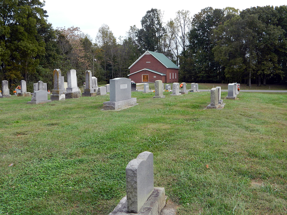
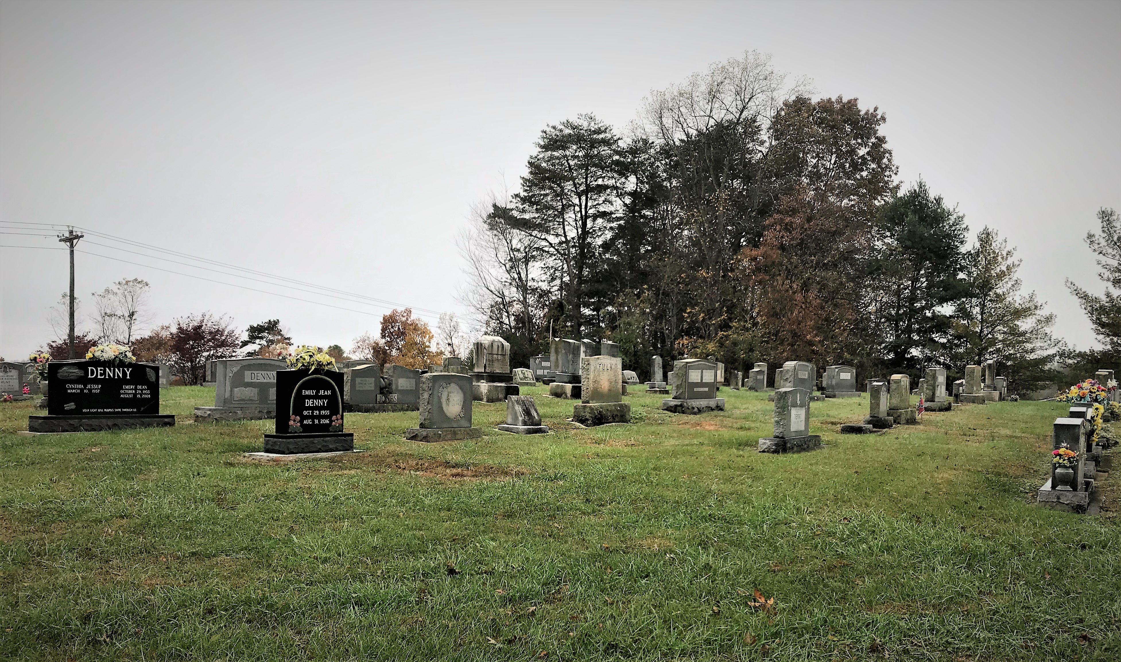
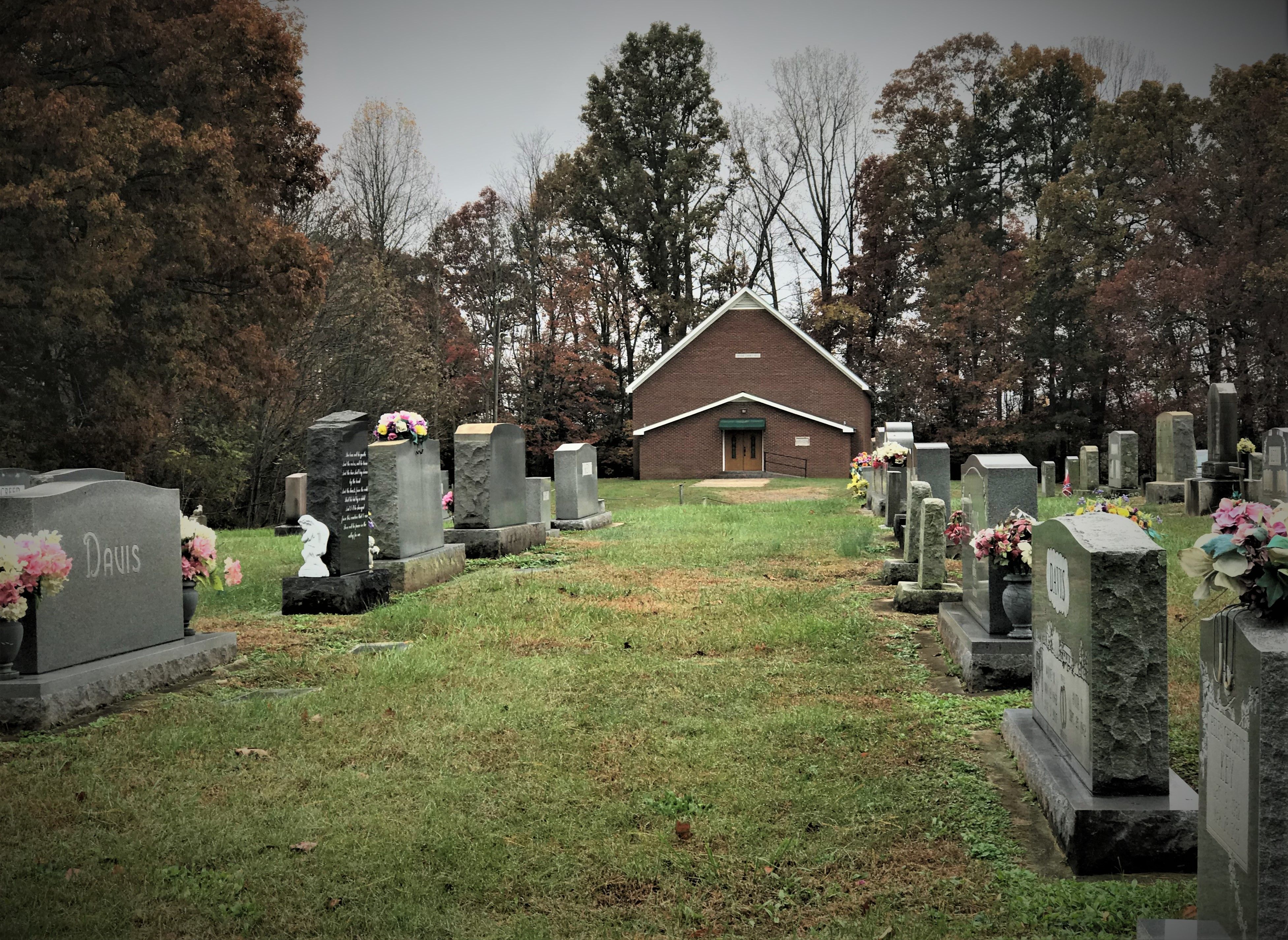
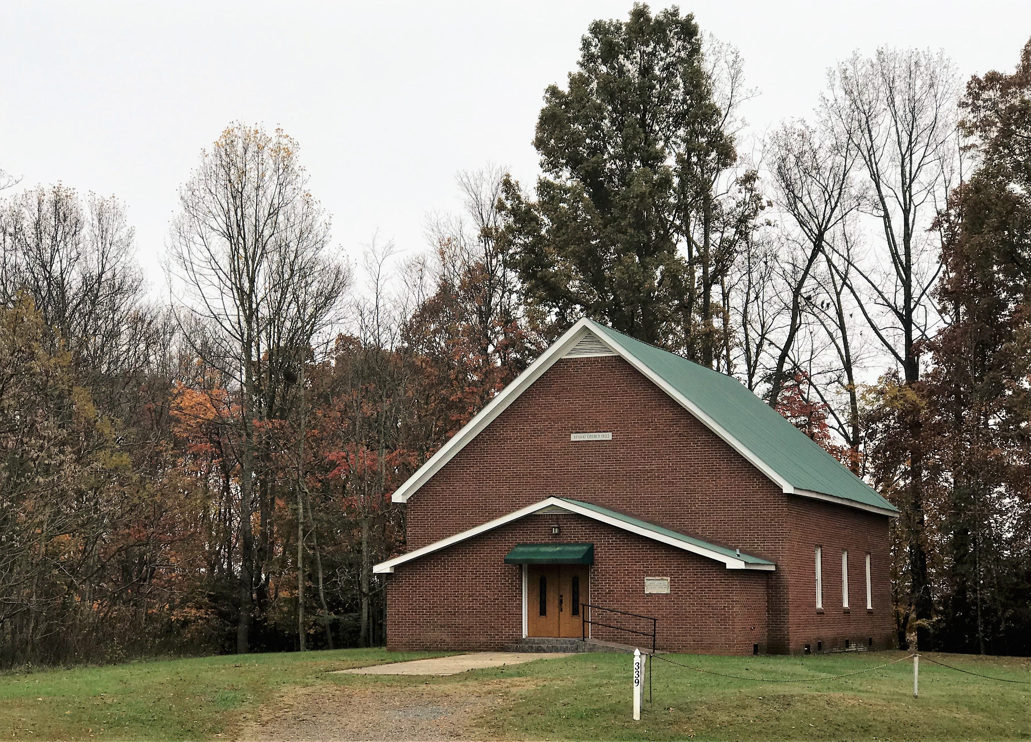
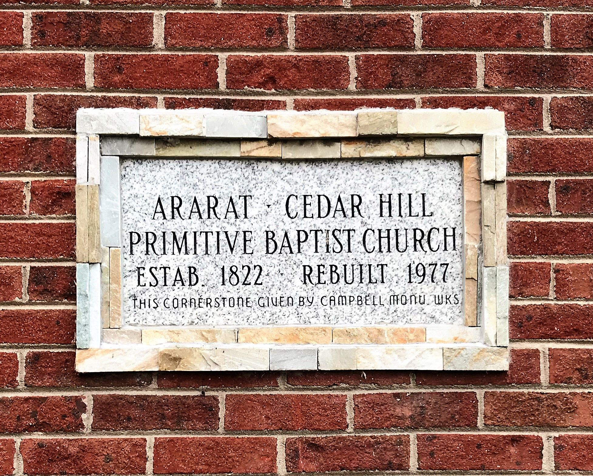
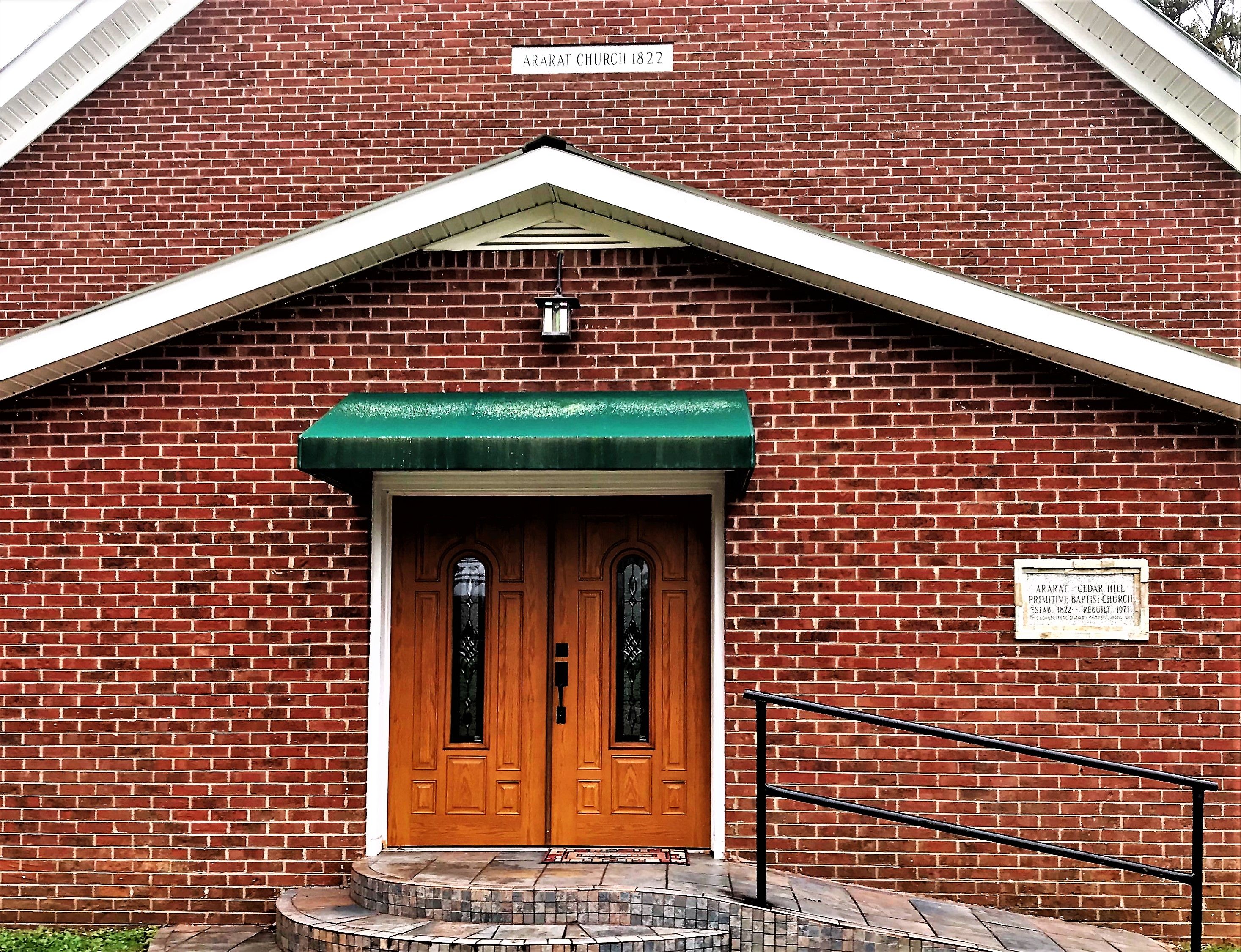
Ararat-Cedar Hill Primitive Baptist Church is located at 339 Pilot Power Dam Road Cedar Hill, Surry County ,North Carolina , 27041USA.
-
Ararat-Cedar Hill Primitive Baptist Church cemetery's updated grave count on graveviews.com?
1 memorials
-
Where are the coordinates of the Ararat-Cedar Hill Primitive Baptist Church?
Latitude: 36.3671265
Longitude: -80.5306778
Nearby Cemetories:
1. Azariah Denny Family Cemetery
Pilot Mountain, Surry County, USA
Coordinate: 36.3647220, -80.5367780
2. Cox Cemetery
Pilot Mountain, Surry County, USA
Coordinate: 36.3743890, -80.5353890
3. Carey Bird Denny Cemetery
Pilot Mountain, Surry County, USA
Coordinate: 36.3582000, -80.5177500
4. William C. Patterson Cemetery
Siloam, Surry County, USA
Coordinate: 36.3591330, -80.5502130
5. Whitakers Chapel United Methodist Church Cemetery
Pilot Mountain, Surry County, USA
Coordinate: 36.3763008, -80.5105057
6. Hyatt Family Cemetery
Siloam, Surry County, USA
Coordinate: 36.3644700, -80.5544300
7. Hills Grove Baptist Church Cemetery
Cedar Hill, Surry County, USA
Coordinate: 36.3580180, -80.5536350
8. Pinnacle View Baptist Church Cemetery
Shoals, Surry County, USA
Coordinate: 36.3454700, -80.5089900
9. Old Pine Hill Community UMC Cemetery
Siloam, Surry County, USA
Coordinate: 36.3592491, -80.5677490
10. Gibbons Family Cemetery
Ararat, Surry County, USA
Coordinate: 36.3747570, -80.5682480
11. Atkinson Family Cemetery
Mount Airy, Surry County, USA
Coordinate: 36.3796940, -80.5682370
12. John Denny Cemetery
Pilot Mountain, Surry County, USA
Coordinate: 36.3755989, -80.4910965
13. Moser and Ashburn Cemetery
Siloam, Surry County, USA
Coordinate: 36.3502780, -80.5702780
14. New Hope Cemetery
Ararat, Surry County, USA
Coordinate: 36.4043890, -80.5428610
15. Pilot View Cemetery
Shoals, Surry County, USA
Coordinate: 36.3298440, -80.5155410
16. Johnson and Potts Cemetery
Ararat, Surry County, USA
Coordinate: 36.3650000, -80.5796700
17. Friendly Chapel Church Cemetery
Pilot Mountain, Surry County, USA
Coordinate: 36.3635292, -80.4816132
18. Isaac Whitaker Family Cemetery
Siloam, Surry County, USA
Coordinate: 36.3406060, -80.5682690
19. John Wesley Hill Cemetery
Pilot Mountain, Surry County, USA
Coordinate: 36.4000282, -80.5012817
20. Bennett Cemetery
Pilot Mountain, Surry County, USA
Coordinate: 36.3988991, -80.4957962
21. Tucker-Stone Cemetery
Surry County, USA
Coordinate: 36.3990000, -80.4954167
22. Stanford Methodist Church Cemetery
Siloam, Surry County, USA
Coordinate: 36.3410560, -80.5727650
23. Sulphur Springs Baptist Church Cemetery
Pilot Mountain, Surry County, USA
Coordinate: 36.4074440, -80.5108871
24. Anchor Baptist Church Cemetery
Ararat, Surry County, USA
Coordinate: 36.4055550, -80.5556050