
| Memorials | : | 14 |
| Location | : | Pilot Mountain, Surry County, USA |
| Coordinate | : | 36.3647220, -80.5367780 |
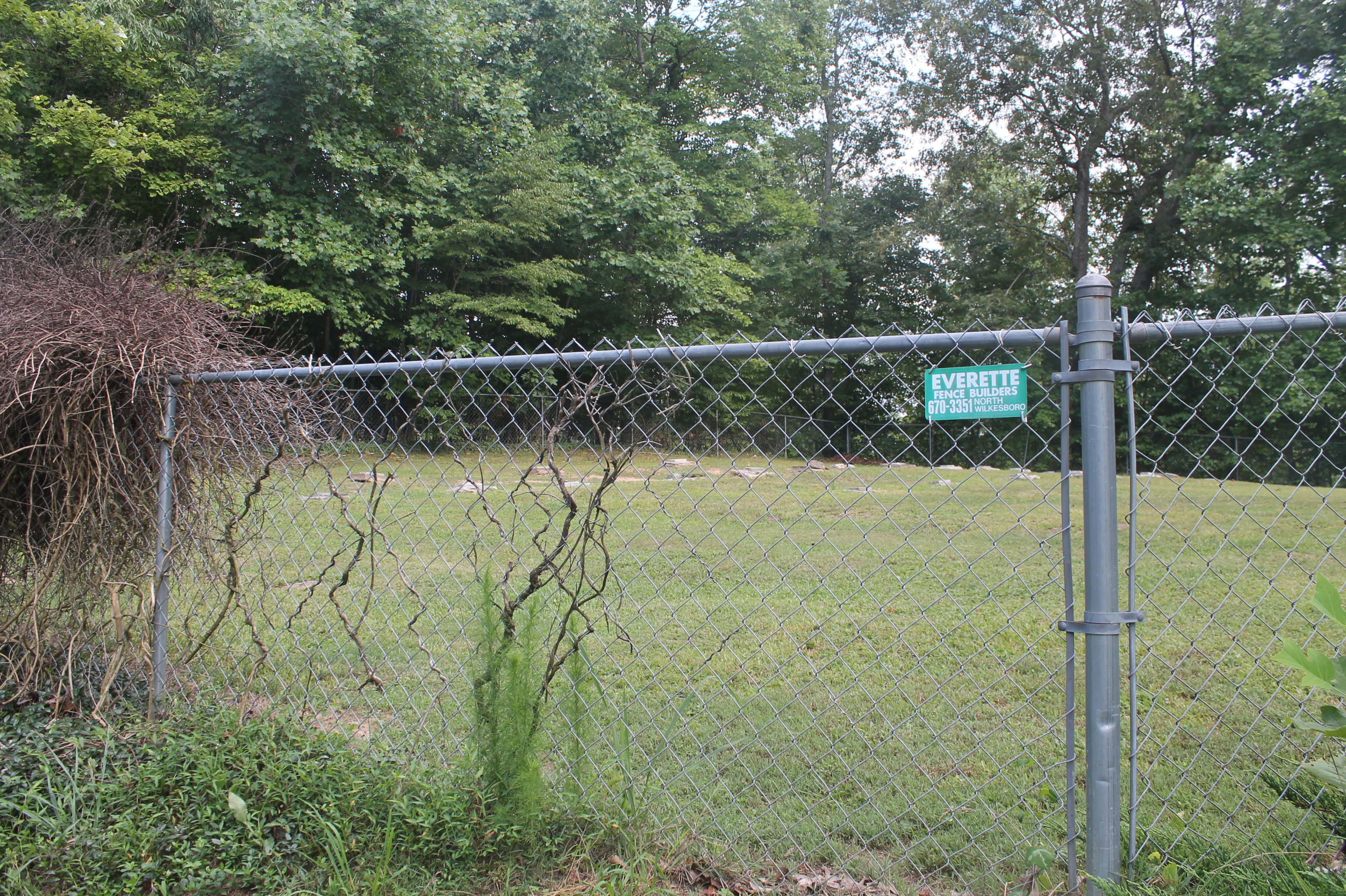
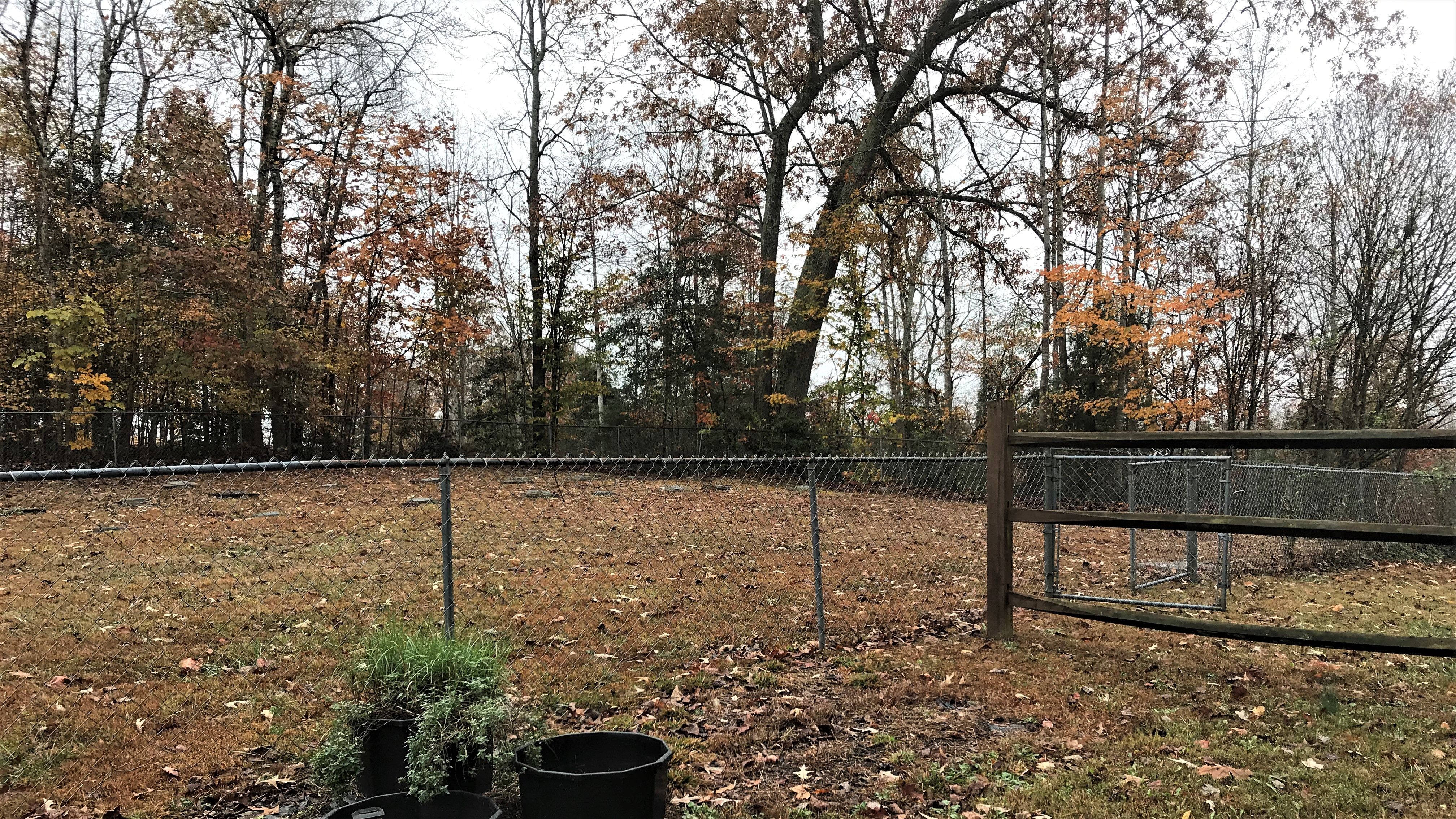
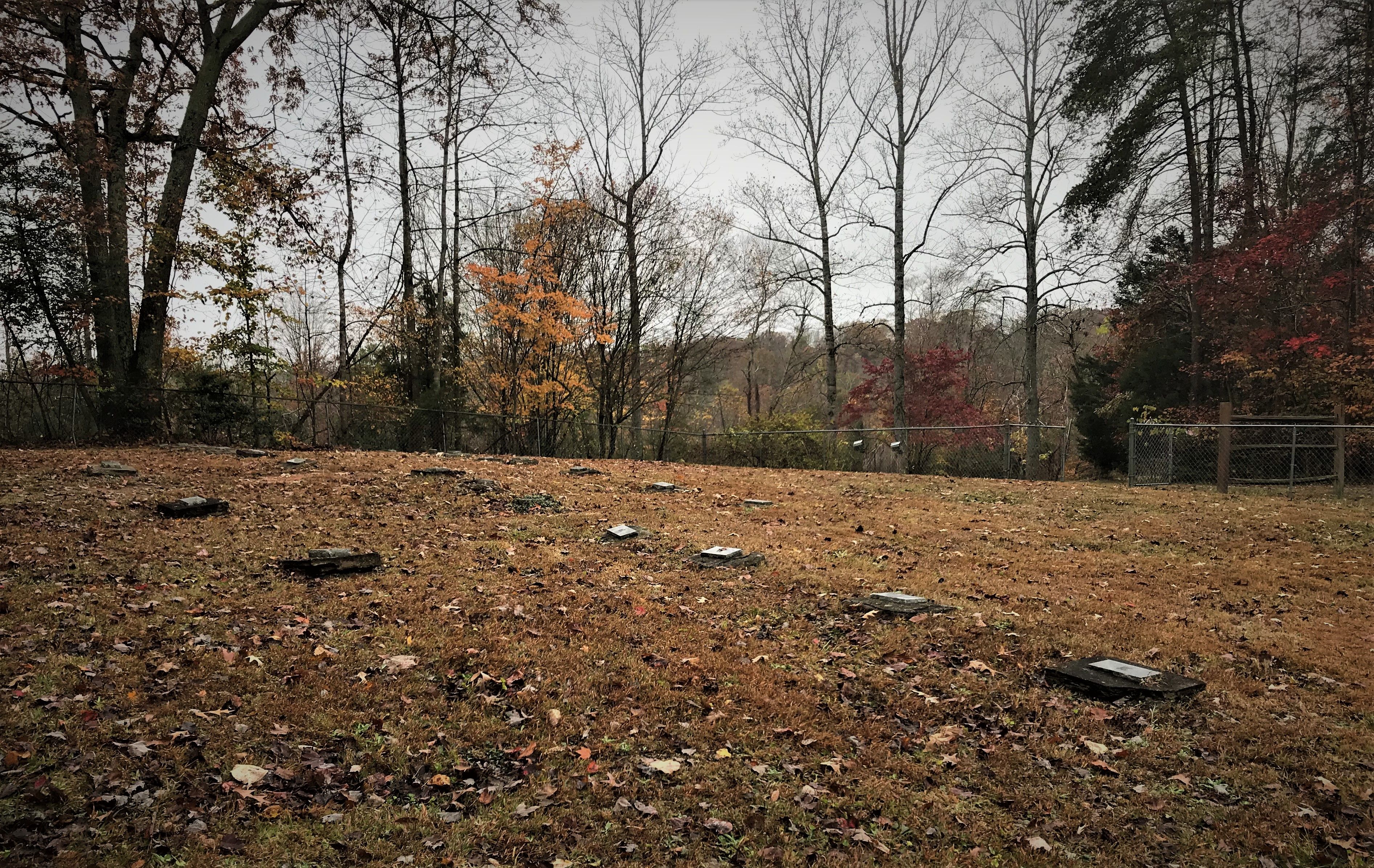
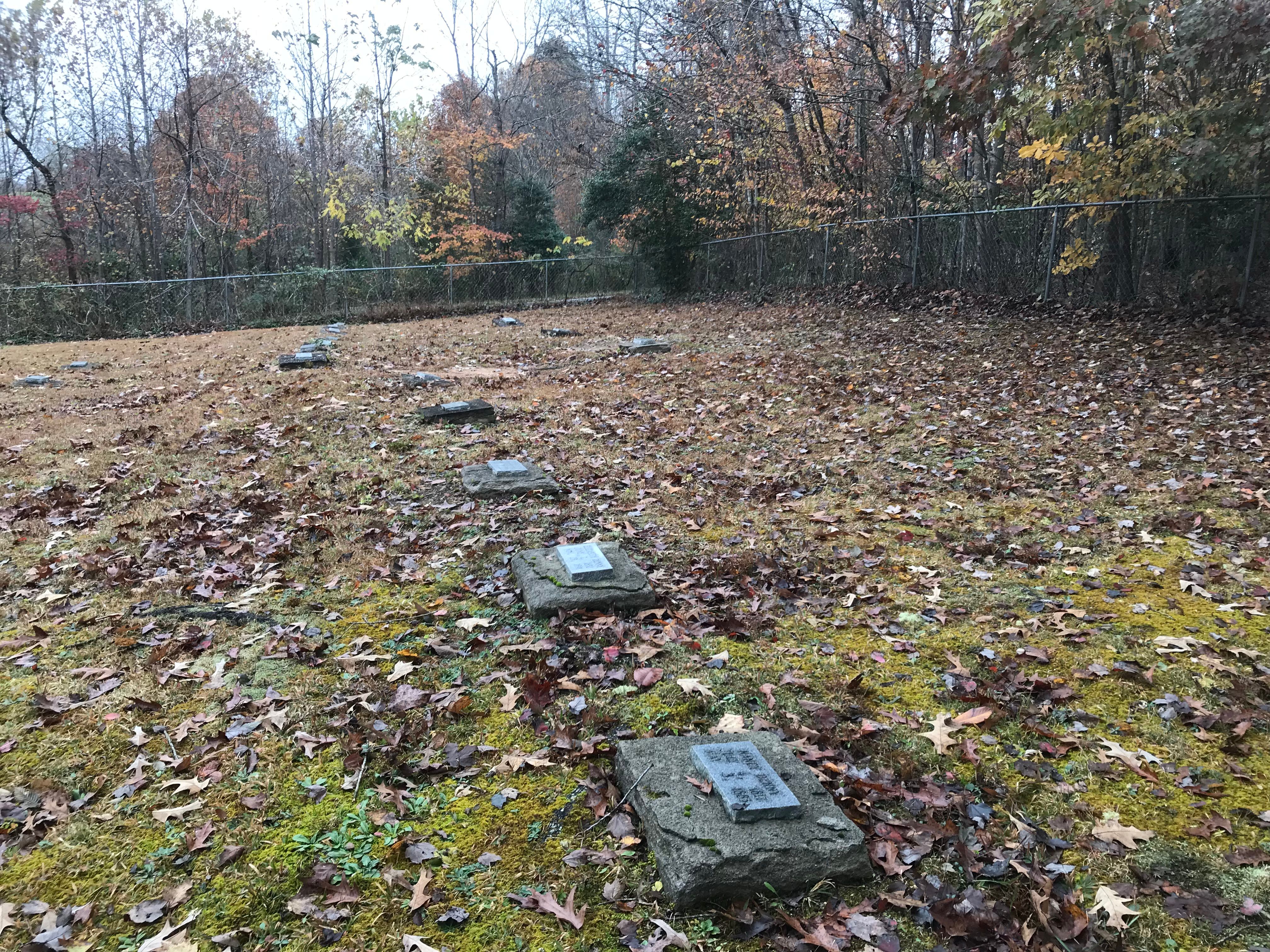
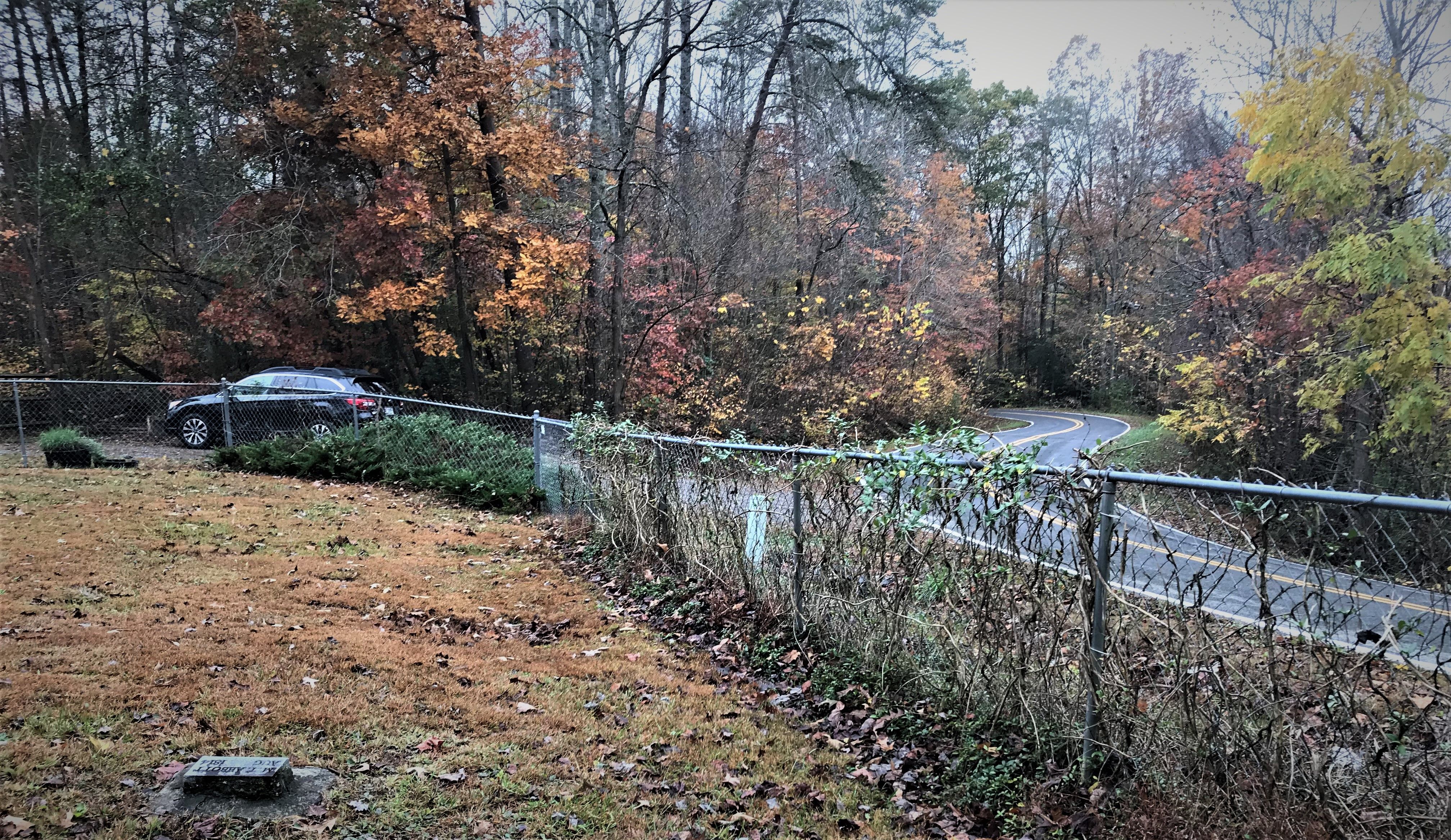
| Description | : | Directions: From intersection of US Hwy 52 and NC Hwy 268 in Pilot Mountain, go west on NC Hwy 268 for 2.5 miles and turn left on Pilot Power Dam Rd. Go .8 miles and cemetery is on the left. Cemetery is on private property and surrounded by a 4ft high chain link fence and gate is not locked but is located inside another gate that allows access to the private property at 541 Pilot Power Dam Road. In March of 2006, the gate was not locked. All stones are flat on the ground and some are... Read More |
frequently asked questions (FAQ):
-
Where is Azariah Denny Family Cemetery?
Azariah Denny Family Cemetery is located at Pilot Power Dam Rd Pilot Mountain, Surry County ,North Carolina ,USA.
-
Azariah Denny Family Cemetery cemetery's updated grave count on graveviews.com?
14 memorials
-
Where are the coordinates of the Azariah Denny Family Cemetery?
Latitude: 36.3647220
Longitude: -80.5367780
Nearby Cemetories:
1. Ararat-Cedar Hill Primitive Baptist Church
Cedar Hill, Surry County, USA
Coordinate: 36.3671265, -80.5306778
2. Cox Cemetery
Pilot Mountain, Surry County, USA
Coordinate: 36.3743890, -80.5353890
3. William C. Patterson Cemetery
Siloam, Surry County, USA
Coordinate: 36.3591330, -80.5502130
4. Hyatt Family Cemetery
Siloam, Surry County, USA
Coordinate: 36.3644700, -80.5544300
5. Hills Grove Baptist Church Cemetery
Cedar Hill, Surry County, USA
Coordinate: 36.3580180, -80.5536350
6. Carey Bird Denny Cemetery
Pilot Mountain, Surry County, USA
Coordinate: 36.3582000, -80.5177500
7. Whitakers Chapel United Methodist Church Cemetery
Pilot Mountain, Surry County, USA
Coordinate: 36.3763008, -80.5105057
8. Old Pine Hill Community UMC Cemetery
Siloam, Surry County, USA
Coordinate: 36.3592491, -80.5677490
9. Gibbons Family Cemetery
Ararat, Surry County, USA
Coordinate: 36.3747570, -80.5682480
10. Atkinson Family Cemetery
Mount Airy, Surry County, USA
Coordinate: 36.3796940, -80.5682370
11. Pinnacle View Baptist Church Cemetery
Shoals, Surry County, USA
Coordinate: 36.3454700, -80.5089900
12. Moser and Ashburn Cemetery
Siloam, Surry County, USA
Coordinate: 36.3502780, -80.5702780
13. Johnson and Potts Cemetery
Ararat, Surry County, USA
Coordinate: 36.3650000, -80.5796700
14. Isaac Whitaker Family Cemetery
Siloam, Surry County, USA
Coordinate: 36.3406060, -80.5682690
15. Stanford Methodist Church Cemetery
Siloam, Surry County, USA
Coordinate: 36.3410560, -80.5727650
16. John Denny Cemetery
Pilot Mountain, Surry County, USA
Coordinate: 36.3755989, -80.4910965
17. Pilot View Cemetery
Shoals, Surry County, USA
Coordinate: 36.3298440, -80.5155410
18. Key Cemetery
Ararat, Surry County, USA
Coordinate: 36.3795770, -80.5825170
19. New Hope Cemetery
Ararat, Surry County, USA
Coordinate: 36.4043890, -80.5428610
20. Mount Zion Baptist Church Cemetery
Ash Hill, Surry County, USA
Coordinate: 36.3949432, -80.5725021
21. Anchor Baptist Church Cemetery
Ararat, Surry County, USA
Coordinate: 36.4055550, -80.5556050
22. Ararat Cemetery
Ararat, Surry County, USA
Coordinate: 36.4054130, -80.5561350
23. Friendly Chapel Church Cemetery
Pilot Mountain, Surry County, USA
Coordinate: 36.3635292, -80.4816132
24. Pine Hill Cemetery
Pine Hill, Surry County, USA
Coordinate: 36.3495560, -80.5889969