
| Memorials | : | 0 |
| Location | : | Altstadt, Stadtkreis München, Germany |
| Coordinate | : | 48.1340320, 11.5718650 |
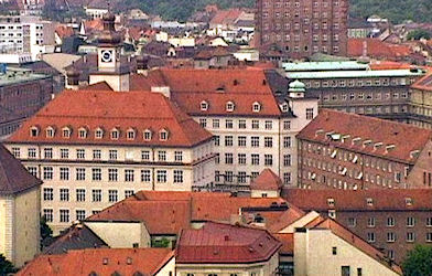
| Description | : | Parts of the Angerkloster ("Cloister in the Meadow") date to the 13th century when it was built as a Franciscan Friary. When the Poor Clares arrived in Munich in the 14th century, it was given to them for a monastery by the friars. The Poor Clares were there for 500 years until the wave of secularism under Napoleon swept across Europe and they were expelled. King Ludwig I of Bavaria gave it to Blessed Theresia Gerhardinger in 1843. Located at Unterer Anger 2 on Sankt-Jakobs-Platz in Munich, it is the Bavarian Motherhouse of the School Sisters of Notre Dame (Arme... Read More |
frequently asked questions (FAQ):
-
Where is Angerkloster?
Angerkloster is located at Unterer Anger 2 Altstadt, Stadtkreis München ,Bavaria (Bayern) , D-80331Germany.
-
Angerkloster cemetery's updated grave count on graveviews.com?
0 memorials
-
Where are the coordinates of the Angerkloster?
Latitude: 48.1340320
Longitude: 11.5718650
Nearby Cemetories:
1. Jakobskirche
Altstadt, Stadtkreis München, Germany
Coordinate: 48.1340860, 11.5720260
2. Peterskirche
Altstadt, Stadtkreis München, Germany
Coordinate: 48.1364900, 11.5760200
3. Klostergruft der Servitinnen
Munich (München), Stadtkreis München, Germany
Coordinate: 48.1374754, 11.5675332
4. Frauenkirche Cathedral
Altstadt, Stadtkreis München, Germany
Coordinate: 48.1385670, 11.5730430
5. Saint Michael's Church
Altstadt, Stadtkreis München, Germany
Coordinate: 48.1387280, 11.5704100
6. Bürgersaalkirche
Altstadt, Stadtkreis München, Germany
Coordinate: 48.1390410, 11.5682690
7. Alter Franziskaner Friedhof (Defunct)
Altstadt, Stadtkreis München, Germany
Coordinate: 48.1399340, 11.5783860
8. Salvator Churchyard
Altstadt, Stadtkreis München, Germany
Coordinate: 48.1415990, 11.5749600
9. Alter Südfriedhof München
Isarvorstadt, Stadtkreis München, Germany
Coordinate: 48.1272202, 11.5649996
10. Theatinerkirche
Altstadt, Stadtkreis München, Germany
Coordinate: 48.1420700, 11.5767800
11. Saint Bonifaz Basilica
Maxvorstadt, Stadtkreis München, Germany
Coordinate: 48.1438904, 11.5641670
12. Ludwigskirche
Maxvorstadt, Stadtkreis München, Germany
Coordinate: 48.1488770, 11.5812642
13. Ostfriedhof Munich
Munich (München), Stadtkreis München, Germany
Coordinate: 48.1201101, 11.5900883
14. Alter Nordfriedhof
Maxvorstadt, Stadtkreis München, Germany
Coordinate: 48.1530960, 11.5713290
15. Ostfriedhof München
Giesing, Stadtkreis München, Germany
Coordinate: 48.1177788, 11.5888891
16. Haidhauser Friedhof
Haidhausen, Stadtkreis München, Germany
Coordinate: 48.1340670, 11.6043190
17. Bogenhausener Friedhof
Bogenhausen, Stadtkreis München, Germany
Coordinate: 48.1477780, 11.6013890
18. Sendlinger Friedhof
Sendling, Stadtkreis München, Germany
Coordinate: 48.1157036, 11.5369864
19. Alter Israelitischer Friedhof
Sendling, Stadtkreis München, Germany
Coordinate: 48.1099730, 11.5457390
20. Erlöserkirche Schwabing
Schwabing, Stadtkreis München, Germany
Coordinate: 48.1645600, 11.5879400
21. Kirchhof Sankt Maria Ramersdorf
Ramersdorf, Stadtkreis München, Germany
Coordinate: 48.1140950, 11.6150460
22. Neuhausener Friedhof
Neuhausen, Stadtkreis München, Germany
Coordinate: 48.1548470, 11.5295170
23. Friedhof am Perlacher Forst
Fasangarten, Stadtkreis München, Germany
Coordinate: 48.0991470, 11.5964970
24. St. Mina in Berg am Laim
Berg am Laim, Stadtkreis München, Germany
Coordinate: 48.1269200, 11.6295700