
| Memorials | : | 0 |
| Location | : | Sendling, Stadtkreis München, Germany |
| Phone | : | 49 89 23 199 343 |
| Website | : | www.muenchen.de/rathaus/Stadtverwaltung/Referat-fuer-Gesundheit-und-Umwelt/Friedhof_und_Bestattung/SFM/Friedhoefe/Friedhof_S |
| Coordinate | : | 48.1157036, 11.5369864 |
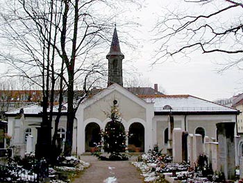
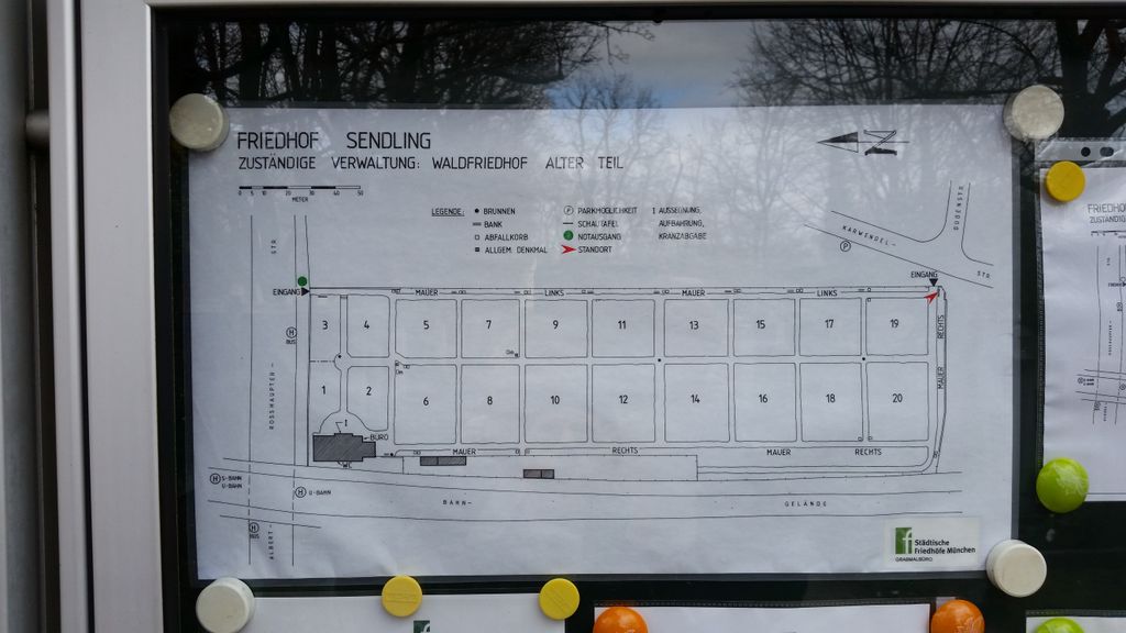
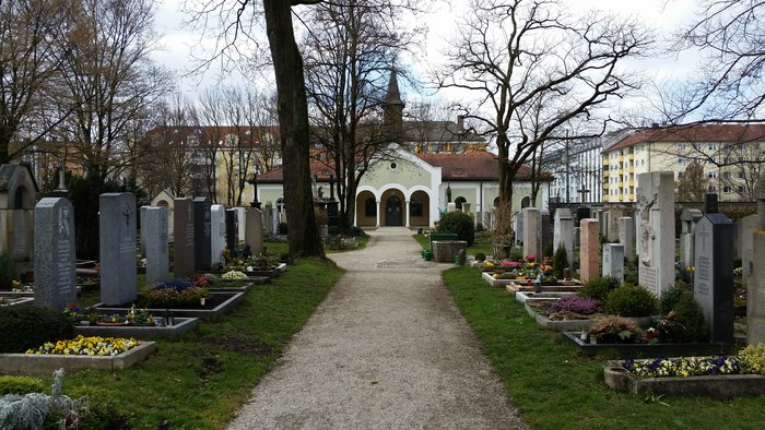
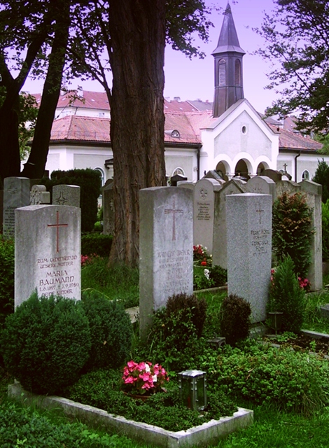
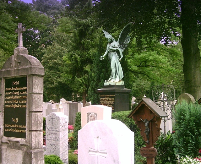
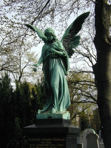
| Description | : | This cemetery was opened in 1872 for the village of Sendling which soon after was incorporated into the city of Munich in 1877. The cemetery contains on a surface of 20.700 square meters about 4200 graves. It lies immediately next to the railroad. The cemetery has two entries, one at the Albert-Roßhaupterstr. and one at the Karwendelstr. Opening times are : from November until February: 8 -17h March: 8-18h from April until August: 8-20h from September until October: 8-19h The minimal repose period of the graves is 10 years for each deceased adult person. For children younger... Read More |
frequently asked questions (FAQ):
-
Where is Sendlinger Friedhof?
Sendlinger Friedhof is located at Albert-Rosshaupter-Strasse 5 Sendling, Stadtkreis München ,Bavaria (Bayern) , 81369Germany.
-
Sendlinger Friedhof cemetery's updated grave count on graveviews.com?
0 memorials
-
Where are the coordinates of the Sendlinger Friedhof?
Latitude: 48.1157036
Longitude: 11.5369864
Nearby Cemetories:
1. Alter Israelitischer Friedhof
Sendling, Stadtkreis München, Germany
Coordinate: 48.1099730, 11.5457390
2. Alter Südfriedhof München
Isarvorstadt, Stadtkreis München, Germany
Coordinate: 48.1272202, 11.5649996
3. Angerkloster
Altstadt, Stadtkreis München, Germany
Coordinate: 48.1340320, 11.5718650
4. Jakobskirche
Altstadt, Stadtkreis München, Germany
Coordinate: 48.1340860, 11.5720260
5. Klostergruft der Servitinnen
Munich (München), Stadtkreis München, Germany
Coordinate: 48.1374754, 11.5675332
6. Bürgersaalkirche
Altstadt, Stadtkreis München, Germany
Coordinate: 48.1390410, 11.5682690
7. Waldfriedhof München
Grosshadern, Stadtkreis München, Germany
Coordinate: 48.1027780, 11.4936110
8. Saint Michael's Church
Altstadt, Stadtkreis München, Germany
Coordinate: 48.1387280, 11.5704100
9. Frauenkirche Cathedral
Altstadt, Stadtkreis München, Germany
Coordinate: 48.1385670, 11.5730430
10. Peterskirche
Altstadt, Stadtkreis München, Germany
Coordinate: 48.1364900, 11.5760200
11. Saint Bonifaz Basilica
Maxvorstadt, Stadtkreis München, Germany
Coordinate: 48.1438904, 11.5641670
12. Ostfriedhof München
Giesing, Stadtkreis München, Germany
Coordinate: 48.1177788, 11.5888891
13. Kirchhof St.-Ulrich
Laim, Stadtkreis München, Germany
Coordinate: 48.1398961, 11.4995437
14. Ostfriedhof Munich
Munich (München), Stadtkreis München, Germany
Coordinate: 48.1201101, 11.5900883
15. Salvator Churchyard
Altstadt, Stadtkreis München, Germany
Coordinate: 48.1415990, 11.5749600
16. Alter Franziskaner Friedhof (Defunct)
Altstadt, Stadtkreis München, Germany
Coordinate: 48.1399340, 11.5783860
17. Waldfriedhof-Italienischer Militärfriedhof
Grosshadern, Stadtkreis München, Germany
Coordinate: 48.0975400, 11.4883760
18. Theatinerkirche
Altstadt, Stadtkreis München, Germany
Coordinate: 48.1420700, 11.5767800
19. Friedhof Solln
Solln, Stadtkreis München, Germany
Coordinate: 48.0788300, 11.5177960
20. Friedhof Grosshadern
Grosshadern, Stadtkreis München, Germany
Coordinate: 48.1138460, 11.4782660
21. Neuhausener Friedhof
Neuhausen, Stadtkreis München, Germany
Coordinate: 48.1548470, 11.5295170
22. Friedhof Forstenried Heilig-Kreuz-Friedhof
Forstenried, Stadtkreis München, Germany
Coordinate: 48.0856020, 11.4942360
23. Waldfriedhof Krieger-Ehrenhain
Grosshadern, Stadtkreis München, Germany
Coordinate: 48.0991000, 11.4786200
24. Friedhof am Perlacher Forst
Fasangarten, Stadtkreis München, Germany
Coordinate: 48.0991470, 11.5964970