
| Memorials | : | 0 |
| Location | : | Grizzly, Jefferson County, USA |
| Coordinate | : | 44.5096230, -120.9429640 |
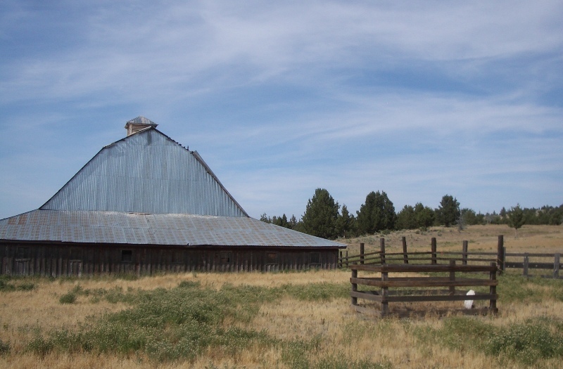
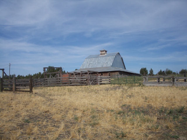
| Description | : | Henry Andrew and Sarah Margaret (Isom) Cleek (pronounced "click") built a magnificent house (which burned in 1948) out of lumber from one of the mills at Grizzly (which was planed in The Dalles). The home was used as a stage stop on the road between The Dalles and Prineville. They sold the property to Andrew Morrow around 1891. This burial is on private property. Do not attempt to enter the corral if there are cattle present: bulls are sometimes corralled here, which is dangerous! The landowner is not local but permission can be obtained at... Read More |
frequently asked questions (FAQ):
-
Where is Annie Cleek Burial Site?
Annie Cleek Burial Site is located at T12S R15E S21 Grizzly, Jefferson County ,Oregon ,USA.
-
Annie Cleek Burial Site cemetery's updated grave count on graveviews.com?
0 memorials
-
Where are the coordinates of the Annie Cleek Burial Site?
Latitude: 44.5096230
Longitude: -120.9429640
Nearby Cemetories:
1. Grizzly Cemetery
Jefferson County, USA
Coordinate: 44.4902992, -120.9332962
2. Lost Meek Rimrock Springs Burial Site
Grizzly, Jefferson County, USA
Coordinate: 44.4954450, -121.0546000
3. Dehler Grizzly Mountain Cemetery
Prineville, Crook County, USA
Coordinate: 44.4251800, -120.9356100
4. John Ellsworth McCoy Burial Site
Madras, Jefferson County, USA
Coordinate: 44.6241140, -120.9503750
5. Hay Creek Cemetery
Jefferson County, USA
Coordinate: 44.6282997, -120.9467010
6. Gray Butte Cemetery
Culver, Jefferson County, USA
Coordinate: 44.4626007, -121.0992966
7. McCoin Orchard Grave Site
Opal City, Jefferson County, USA
Coordinate: 44.4284000, -121.0888100
8. John Pearce Burial Site
Willowdale, Jefferson County, USA
Coordinate: 44.6545390, -120.9659690
9. Culver IOOF Cemetery
Culver, Jefferson County, USA
Coordinate: 44.5344009, -121.1691971
10. Mount Jefferson Memorial Park
Madras, Jefferson County, USA
Coordinate: 44.6458015, -121.1074982
11. Methodist Hill Cemetery
Metolius, Jefferson County, USA
Coordinate: 44.5639000, -121.2091980
12. Juniper Haven Cemetery
Prineville, Crook County, USA
Coordinate: 44.3153000, -120.8471985
13. Terrebonne Pioneer Cemetery
Terrebonne, Deschutes County, USA
Coordinate: 44.3486100, -121.1502800
14. Richardson Family Ranch Cemetery
Madras, Jefferson County, USA
Coordinate: 44.7327200, -120.9757900
15. Round Butte Cemetery
Jefferson County, USA
Coordinate: 44.6366997, -121.2097015
16. Sagebrush Springs Lost Meek Campsite
Gateway, Jefferson County, USA
Coordinate: 44.7499940, -121.0568900
17. Woods Cemetery
Jefferson County, USA
Coordinate: 44.7372017, -120.7583008
18. James Edwards Burial Site
Willowdale, Jefferson County, USA
Coordinate: 44.7702607, -121.0028482
19. Milo Gard Cemetery
Madras, Jefferson County, USA
Coordinate: 44.7085991, -121.1877975
20. Mill Creek Cemetery
Crook County, USA
Coordinate: 44.3208008, -120.6611023
21. Whistling Smith Burial Site
Madras, Jefferson County, USA
Coordinate: 44.7057200, -121.2260600
22. Kampfer Family Cemetery
Gateway, Jefferson County, USA
Coordinate: 44.7981830, -121.0254010
23. Brownhill Children Burial Site
Gateway, Jefferson County, USA
Coordinate: 44.7800680, -121.1071010
24. Maupin Cemetery
Ashwood, Jefferson County, USA
Coordinate: 44.7731018, -120.7536011