
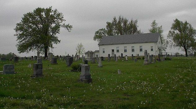
| Memorials | : | 4 |
| Location | : | Manila, Pettis County, USA |
| Coordinate | : | 38.5526200, -93.3364600 |
frequently asked questions (FAQ):
-
Where is Antioch Baptist Church Cemetery?
Antioch Baptist Church Cemetery is located at Manila, Pettis County ,Missouri ,USA.
-
Antioch Baptist Church Cemetery cemetery's updated grave count on graveviews.com?
3 memorials
-
Where are the coordinates of the Antioch Baptist Church Cemetery?
Latitude: 38.5526200
Longitude: -93.3364600

Nearby Cemetories:
1. Flat Creek Methodist Cemetery
Pettis County, USA
Coordinate: 38.5236015, -93.3638992
2. Christian Cemetery
Pettis County, USA
Coordinate: 38.5080986, -93.3371964
3. Prairie Chapel Methodist Cemetery
Pettis County, USA
Coordinate: 38.5228004, -93.3818970
4. Point Pleasant Cemetery
Green Ridge, Pettis County, USA
Coordinate: 38.5501800, -93.2717100
5. Nelson Cemetery
Washington Township, Pettis County, USA
Coordinate: 38.6106500, -93.3723300
6. New Bethel Cemetery
Sedalia, Pettis County, USA
Coordinate: 38.6191500, -93.2669600
7. Saint Johns Lutheran Cemetery
Cole Camp, Benton County, USA
Coordinate: 38.4981150, -93.2495790
8. McKee Chapel Cemetery
Sedalia, Pettis County, USA
Coordinate: 38.6396100, -93.3144800
9. Green Ridge Cemetery
Green Ridge, Pettis County, USA
Coordinate: 38.6207100, -93.4151500
10. Bourn Cemetery
Spring Fork, Pettis County, USA
Coordinate: 38.6119410, -93.2463310
11. Bethlehem Baptist Church Cemetery
Pettis County, USA
Coordinate: 38.6250000, -93.2457962
12. Saint Patricks Catholic Cemetery
Spring Fork, Pettis County, USA
Coordinate: 38.5887300, -93.2137500
13. Larkey Cemetery
Lincoln, Benton County, USA
Coordinate: 38.4500000, -93.3650000
14. Immanuel Lutheran Cemetery
Lincoln, Benton County, USA
Coordinate: 38.4500000, -93.3710000
15. Kerber Family Farm Cemetery
Cole Camp, Benton County, USA
Coordinate: 38.4438200, -93.2717500
16. Mount Olivet Church Cemetery
Cole Camp, Benton County, USA
Coordinate: 38.4416900, -93.2770200
17. Camp Branch Baptist Church Cemetery
Sedalia, Pettis County, USA
Coordinate: 38.6731900, -93.3589900
18. Asbury Good-Knight Cemetery
Pettis County, USA
Coordinate: 38.6155500, -93.1986100
19. Eastwood Cemetery
Cole Camp, Benton County, USA
Coordinate: 38.4624800, -93.2229600
20. Cole Camp Cemetery
Cole Camp, Benton County, USA
Coordinate: 38.4594002, -93.2260971
21. Clover Dale-Yancy Cemetery
Benton County, USA
Coordinate: 38.4392014, -93.4191971
22. Trinity Lutheran Cemetery
Cole Camp, Benton County, USA
Coordinate: 38.4714012, -93.2018967
23. Eickhoff Cemetery
Cole Camp, Benton County, USA
Coordinate: 38.4707600, -93.2017300
24. Cole Camp Memorial Cemetery
Cole Camp, Benton County, USA
Coordinate: 38.4692001, -93.2007980