| Memorials | : | 0 |
| Location | : | Spring Fork, Pettis County, USA |
| Coordinate | : | 38.6119410, -93.2463310 |
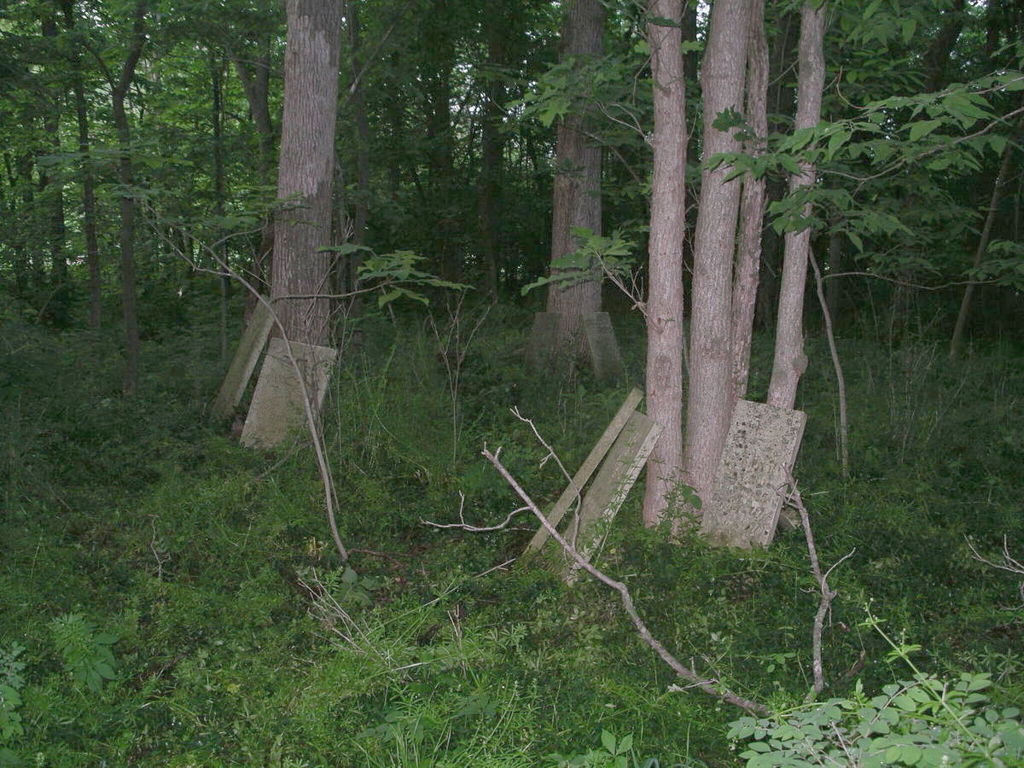
| Description | : | The Bourn Cemetery (also referred to as Brown's Chapel Cemetery) was on the farm of John R. Bourn, who obtained the original land patent. The cemetery was built close to Spring Creek, and has been washed away over the years. A recording of gravestones in 1950 listed 9 gravestones and 2 footstones. A recording in 1965 listed 8 gravestones and 6 footstones. In 2004 there were approximately 15 headstones propped up by trees. The stones are found in the forest, with no visible sign of a cemetery from the adjacent dirt road. |
frequently asked questions (FAQ):
-
Where is Bourn Cemetery?
Bourn Cemetery is located at Spring Fork, Pettis County ,Missouri ,USA.
-
Bourn Cemetery cemetery's updated grave count on graveviews.com?
0 memorials
-
Where are the coordinates of the Bourn Cemetery?
Latitude: 38.6119410
Longitude: -93.2463310
Nearby Cemetories:
1. Bethlehem Baptist Church Cemetery
Pettis County, USA
Coordinate: 38.6250000, -93.2457962
2. New Bethel Cemetery
Sedalia, Pettis County, USA
Coordinate: 38.6191500, -93.2669600
3. Saint Patricks Catholic Cemetery
Spring Fork, Pettis County, USA
Coordinate: 38.5887300, -93.2137500
4. Asbury Good-Knight Cemetery
Pettis County, USA
Coordinate: 38.6155500, -93.1986100
5. Pleasant Hill Cemetery
Sedalia, Pettis County, USA
Coordinate: 38.6341600, -93.1817000
6. McKee Chapel Cemetery
Sedalia, Pettis County, USA
Coordinate: 38.6396100, -93.3144800
7. Point Pleasant Cemetery
Green Ridge, Pettis County, USA
Coordinate: 38.5501800, -93.2717100
8. Abell Cemetery
Sedalia, Pettis County, USA
Coordinate: 38.6542015, -93.1774979
9. Memorial Park Cemetery
Sedalia, Pettis County, USA
Coordinate: 38.6824989, -93.2542038
10. Allcorn-Dumsday Cemetery
Sedalia, Pettis County, USA
Coordinate: 38.6772100, -93.2011800
11. Hebrew Cemetery
Sedalia, Pettis County, USA
Coordinate: 38.6875000, -93.2371979
12. Highland Sacred Gardens
Sedalia, Pettis County, USA
Coordinate: 38.6831017, -93.1883011
13. Lone Star Cemetery
Pettis County, USA
Coordinate: 38.5952988, -93.1382980
14. Flat Creek Baptist Cemetery
Sedalia, Pettis County, USA
Coordinate: 38.6303000, -93.1332800
15. Antioch Baptist Church Cemetery
Manila, Pettis County, USA
Coordinate: 38.5526200, -93.3364600
16. Calvary Episcopal Church Columbarium
Sedalia, Pettis County, USA
Coordinate: 38.7044800, -93.2282100
17. Shobe Cemetery
Sedalia, Pettis County, USA
Coordinate: 38.6996994, -93.2968979
18. Nelson Cemetery
Washington Township, Pettis County, USA
Coordinate: 38.6106500, -93.3723300
19. Saint John's Catholic Cemetery
Bahner, Pettis County, USA
Coordinate: 38.5686400, -93.1287400
20. Glenwood Cemetery
Sedalia, Pettis County, USA
Coordinate: 38.7163000, -93.2171500
21. Camp Branch Baptist Church Cemetery
Sedalia, Pettis County, USA
Coordinate: 38.6731900, -93.3589900
22. Calvary Cemetery
Sedalia, Pettis County, USA
Coordinate: 38.7170100, -93.2131300
23. Crown Hill Cemetery
Sedalia, Pettis County, USA
Coordinate: 38.7178001, -93.2149963
24. Saint Johns Lutheran Cemetery
Cole Camp, Benton County, USA
Coordinate: 38.4981150, -93.2495790


