
| Memorials | : | 0 |
| Location | : | Ashow, Warwick District, England |
| Coordinate | : | 52.3291370, -1.5431300 |
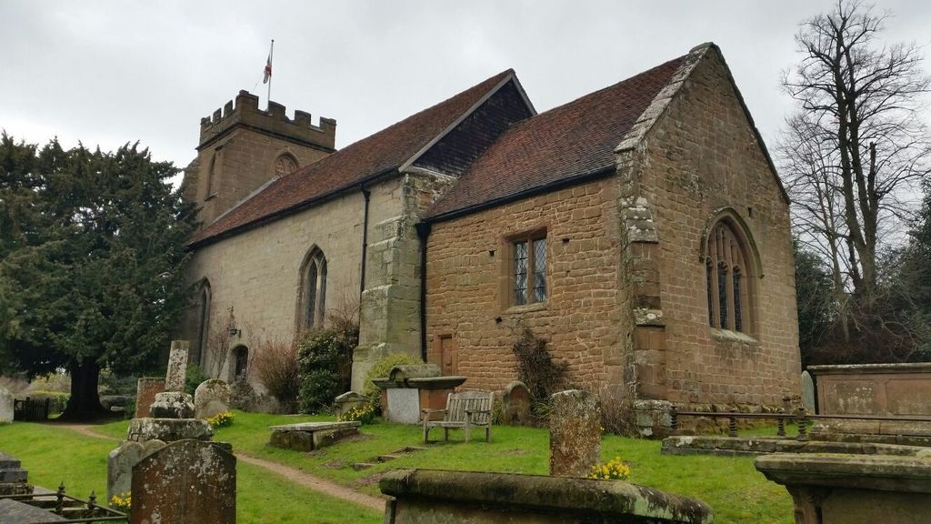
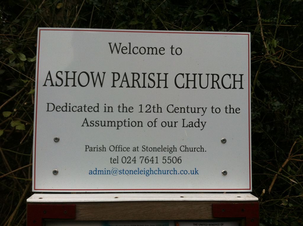
| Description | : | Parish church situated on the north bank of the river Avon in Ashow, a small village in Warwickshire, 4km SE of Kenilworth. Consists of an early 12th century chancel and nave, and a mid-15th century west tower. Originally a chapel of Leek Wotton, becoming independent between 1198 and 1215. The church is surrounded by a small, wooded churchyard extending to the west. |
frequently asked questions (FAQ):
-
Where is Assumption Of Our Lady Churchyard?
Assumption Of Our Lady Churchyard is located at Ashow, Warwick District ,Warwickshire ,England.
-
Assumption Of Our Lady Churchyard cemetery's updated grave count on graveviews.com?
0 memorials
-
Where are the coordinates of the Assumption Of Our Lady Churchyard?
Latitude: 52.3291370
Longitude: -1.5431300
Nearby Cemetories:
1. Brethren's Burial Ground
Leamington Spa, Warwick District, England
Coordinate: 52.3100860, -1.5287881
2. All Saints Churchyard
Leek Wootton, Warwick District, England
Coordinate: 52.3163100, -1.5779700
3. Oaks Road Cemetery
Kenilworth, Warwick District, England
Coordinate: 52.3372150, -1.5829420
4. St Mary's Churchyard
Stoneleigh, Warwick District, England
Coordinate: 52.3504620, -1.5161400
5. War Memorial
Lillington, Warwick District, England
Coordinate: 52.3031870, -1.5251730
6. St Mary Magdalene Churchyard
Lillington, Warwick District, England
Coordinate: 52.3031200, -1.5254140
7. St James the Great Churchyard
Old Milverton, Warwick District, England
Coordinate: 52.3037540, -1.5660450
8. St. Nicholas Church
Kenilworth, Warwick District, England
Coordinate: 52.3493100, -1.5821600
9. St Mary's Churchyard
Cubbington, Warwick District, England
Coordinate: 52.3122830, -1.4972400
10. St Augustine Churchyard
Kenilworth, Warwick District, England
Coordinate: 52.3552230, -1.5842470
11. Milverton Cemetery
Leamington Spa, Warwick District, England
Coordinate: 52.2931650, -1.5567880
12. Leamington Spa War Memorial
Leamington Spa, Warwick District, England
Coordinate: 52.2881010, -1.5346740
13. Jephson Gardens and Mill Gardens
Leamington Spa, Warwick District, England
Coordinate: 52.2872790, -1.5333650
14. All Saints
Old Milverton, Warwick District, England
Coordinate: 52.2889960, -1.5673440
15. All Saints Churchyard
Leamington Spa, Warwick District, England
Coordinate: 52.2859930, -1.5322260
16. St. Michael's Churchyard
Weston under Wetherley, Warwick District, England
Coordinate: 52.3201580, -1.4728890
17. New Street Burial Ground
Leamington Spa, Warwick District, England
Coordinate: 52.2857716, -1.5295478
18. St Mary
Leamington Spa, Warwick District, England
Coordinate: 52.2836150, -1.5216220
19. St Giles Churchyard
Bubbenhall, Warwick District, England
Coordinate: 52.3501940, -1.4730830
20. Saint John the Baptist Church
Baginton, Warwick District, England
Coordinate: 52.3698000, -1.4969000
21. St John the Baptist
Leamington Spa, Warwick District, England
Coordinate: 52.2778940, -1.5306560
22. St Nicholas Churchyard
Warwick, Warwick District, England
Coordinate: 52.2818150, -1.5819300
23. Leamington Cemetery
Leamington Spa, Warwick District, England
Coordinate: 52.2756400, -1.5282700
24. St. Mary's Collegiate Church
Warwick, Warwick District, England
Coordinate: 52.2822710, -1.5879780