
| Memorials | : | 0 |
| Location | : | Tecumseh Furnace, Cherokee County, USA |
| Coordinate | : | 33.9618530, -85.4140871 |
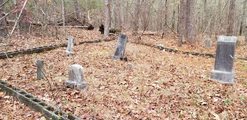
| Description | : | This cemetery is located up on the hill on the corner of the road in a heavily wooded area. There are at least 3 groupings of tombstones together with more scattered around the nearby area. I found at least 10 stones that could be read. It covers about 300 feet squared. There are many more deep depressions, about 20, with rock stone placements at the foot and head of the locations, obviously burial sites. Most readable stones are over 100 years old. |
frequently asked questions (FAQ):
-
Where is Baker Hill Cemetery?
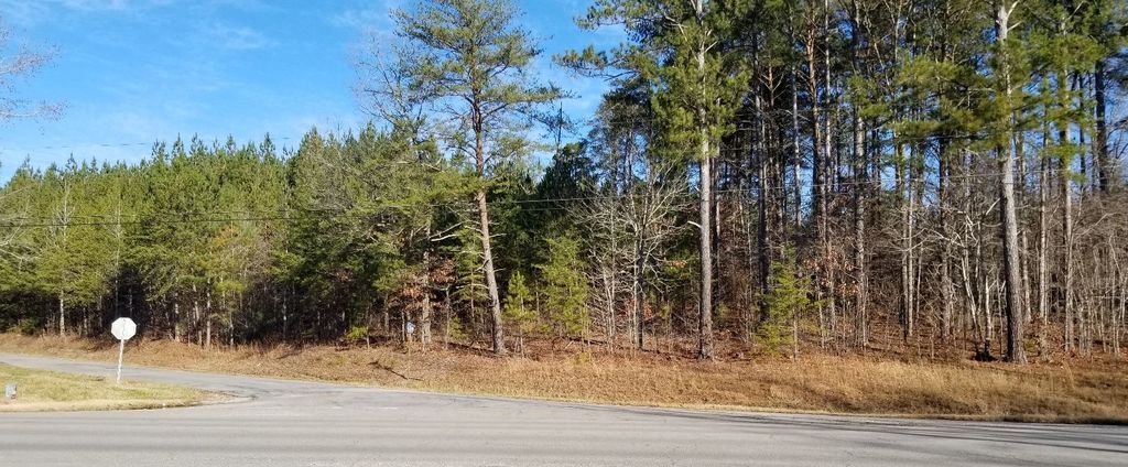
Baker Hill Cemetery is located at Highway 278 and County Rd. 126 Tecumseh Furnace, Cherokee County ,Alabama ,USA.
-
Baker Hill Cemetery cemetery's updated grave count on graveviews.com?
0 memorials
-
Where are the coordinates of the Baker Hill Cemetery?
Latitude: 33.9618530
Longitude: -85.4140871
Nearby Cemetories:
1. Cherry Grove Cemetery
Borden Springs, Cleburne County, USA
Coordinate: 33.9446983, -85.4302979
2. Cherry Grove Original Church Cemetery
Borden Springs, Cleburne County, USA
Coordinate: 33.9455986, -85.4349976
3. Arrington Chapel Cemetery
Pleasant Gap, Cherokee County, USA
Coordinate: 33.9641991, -85.4586029
4. Salem Baptist Church Cemetery
Bluffton, Cherokee County, USA
Coordinate: 34.0121994, -85.4449997
5. Church of Christ Cemetery
Borden Springs, Cleburne County, USA
Coordinate: 33.9218740, -85.4745850
6. John Borden Cemetery
Calhoun County, USA
Coordinate: 33.9214000, -85.4800000
7. Mountain Creek Baptist Church Cemetery
Borden Wheeler Springs, Cleburne County, USA
Coordinate: 33.8810997, -85.3983002
8. Union Grove Cemetery
Rock Run, Cherokee County, USA
Coordinate: 34.0158005, -85.4972000
9. Mount Pleasant Cemetery
Pleasant Gap, Cherokee County, USA
Coordinate: 33.9783470, -85.5242420
10. Pleasant Gap Cemetery
Pleasant Gap, Cherokee County, USA
Coordinate: 33.9916992, -85.5216980
11. Roe Cemetery
Cleburne County, USA
Coordinate: 33.8689003, -85.3918991
12. Philadelphia Baptist Church Cemetery
Vigo, Calhoun County, USA
Coordinate: 33.9413986, -85.5466995
13. Little Creek Cemetery
Haralson County, USA
Coordinate: 33.8861008, -85.3110962
14. Cross Roads Church Cemetery
Tallapoosa, Haralson County, USA
Coordinate: 33.8630830, -85.3430890
15. Faith Baptist Church Cemetery
Piedmont, Calhoun County, USA
Coordinate: 33.9649620, -85.5547270
16. Williams Memory Garden
Tallapoosa, Haralson County, USA
Coordinate: 33.8592110, -85.3431470
17. Wilson Family Cemetery
Vigo, Calhoun County, USA
Coordinate: 33.9130030, -85.5489440
18. Graham Cemetery
Spring Garden, Cherokee County, USA
Coordinate: 33.9694140, -85.5616508
19. Mars Hill Cemetery
Cleburne County, USA
Coordinate: 33.8394012, -85.4021988
20. Lebanon United Methodist Church Cemetery
Pleasant Gap, Cherokee County, USA
Coordinate: 34.0060997, -85.5528030
21. Hendon Cemetery
Oak Level, Cleburne County, USA
Coordinate: 33.8499985, -85.4779968
22. Oak Level Methodist Church Cemetery
Oak Level, Cleburne County, USA
Coordinate: 33.8503418, -85.4796219
23. Old Providence Cemetery
Forney, Cherokee County, USA
Coordinate: 34.0862090, -85.4380130
24. Bethel Cemetery
Forney, Cherokee County, USA
Coordinate: 34.0839005, -85.4580994