
| Memorials | : | 15 |
| Location | : | Bardon, North West Leicestershire District, England |
| Coordinate | : | 52.7027960, -1.3223480 |
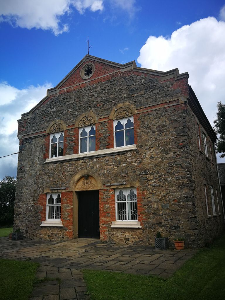
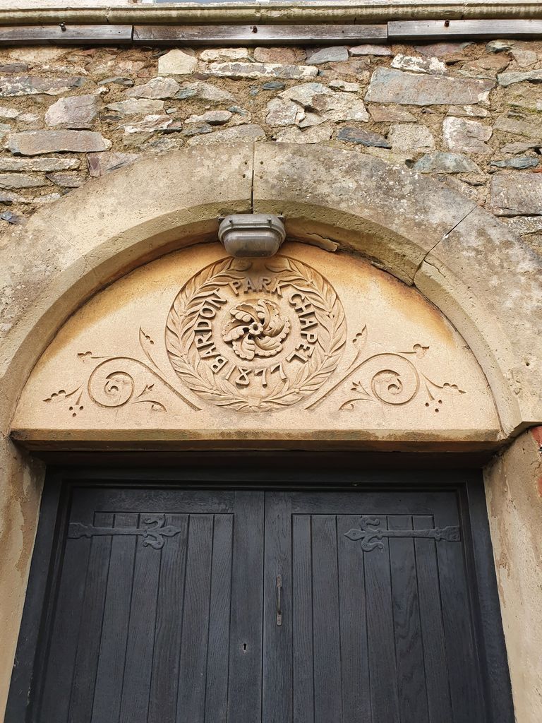
| Description | : | Bardon Park Chapel is a 300-year-old Christian meeting house at Bardon, Leicestershire, England. It stands back from the A511 road (Shaw Lane), between Coalville and Markfield, about 1.3 miles (2.1 km) west of M1 junction 22. At the time of its construction, the meeting house was set within a medieval deer park. The chapel is a Grade II Listed building. It may be the oldest non-conformist place of worship in Leicestershire and indeed across a wide area of the East Midland |
frequently asked questions (FAQ):
-
Where is Bardon Park Chapel?
Bardon Park Chapel is located at Shaw Lane Bardon, North West Leicestershire District ,Leicestershire , LE67 1SY.England.
-
Bardon Park Chapel cemetery's updated grave count on graveviews.com?
15 memorials
-
Where are the coordinates of the Bardon Park Chapel?
Latitude: 52.7027960
Longitude: -1.3223480
Nearby Cemetories:
1. St. Peter's Churchyard
Bardon, North West Leicestershire District, England
Coordinate: 52.7090700, -1.3357800
2. Broomleys Cemetery
Coalville, North West Leicestershire District, England
Coordinate: 52.7255540, -1.3402280
3. Hugglescote Cemetery
Coalville, North West Leicestershire District, England
Coordinate: 52.7067040, -1.3718090
4. Saint Michael and All Angels Churchyard
Markfield, Hinckley and Bosworth Borough, England
Coordinate: 52.6869930, -1.2793315
5. London Road Cemetery
Coalville, North West Leicestershire District, England
Coordinate: 52.7222620, -1.3647710
6. Christ Church
Coalville, North West Leicestershire District, England
Coordinate: 52.7229610, -1.3673630
7. Markfield Cemetery
Markfield, Hinckley and Bosworth Borough, England
Coordinate: 52.6878983, -1.2707406
8. Holy Rood Churchyard
Bagworth, Hinckley and Bosworth Borough, England
Coordinate: 52.6673400, -1.3367100
9. St Mary's Priory
Ulverscroft, Charnwood Borough, England
Coordinate: 52.7098890, -1.2598610
10. Mount St Bernard Abbey
Whitwick, North West Leicestershire District, England
Coordinate: 52.7413880, -1.3234470
11. St. Peter's Churchyard
Thornton Abbey, North Lincolnshire Unitary Authority, England
Coordinate: 52.6646972, -1.3089069
12. St Peter's Churchyard
Bagworth, Hinckley and Bosworth Borough, England
Coordinate: 52.6646520, -1.3091920
13. St. James the Greater Oaks in Charnwood
Whitwick, North West Leicestershire District, England
Coordinate: 52.7425430, -1.3008590
14. Ibstock Cemetery
Ibstock, North West Leicestershire District, England
Coordinate: 52.6915610, -1.3920190
15. Whitwick Cemetery
Whitwick, North West Leicestershire District, England
Coordinate: 52.7395560, -1.3623360
16. St John the Baptist Churchyard
Whitwick, North West Leicestershire District, England
Coordinate: 52.7416040, -1.3571200
17. Saint Denys Churchyard
Ibstock, North West Leicestershire District, England
Coordinate: 52.6827470, -1.4035140
18. St. Michael and All Angels Churchyard
Ravenstone, North West Leicestershire District, England
Coordinate: 52.7214130, -1.4063470
19. All Saints Churchyard
Nailstone, Hinckley and Bosworth Borough, England
Coordinate: 52.6604000, -1.3833000
20. St. Andrew's Churchyard
Thringstone, North West Leicestershire District, England
Coordinate: 52.7529090, -1.3692140
21. Newtown Linford Parish Cemetery
Newtown Linford, Charnwood Borough, England
Coordinate: 52.6812092, -1.2308014
22. All Saints Churchyard
Newtown Linford, Charnwood Borough, England
Coordinate: 52.6832010, -1.2292860
23. St Giles Churchyard
Barlestone, Hinckley and Bosworth Borough, England
Coordinate: 52.6488120, -1.3685350
24. Grace-Dieu Priory
Thringstone, North West Leicestershire District, England
Coordinate: 52.7609720, -1.3566830