
| Memorials | : | 0 |
| Location | : | Whitewater, Cape Girardeau County, USA |
| Coordinate | : | 37.2642212, -89.8592606 |
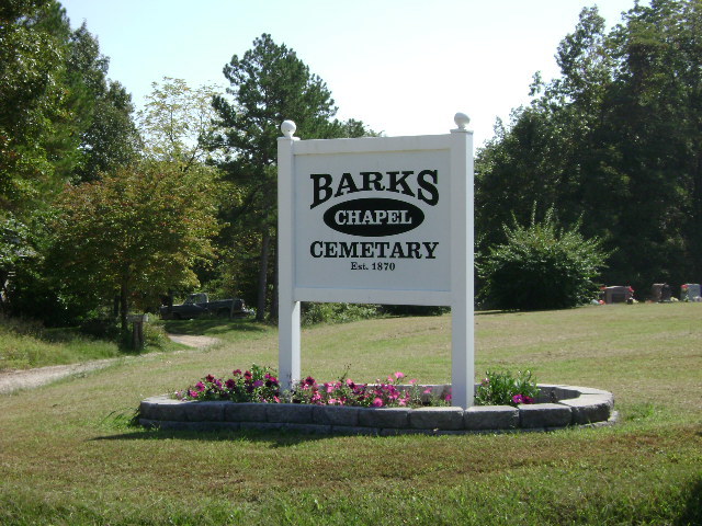
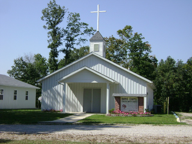
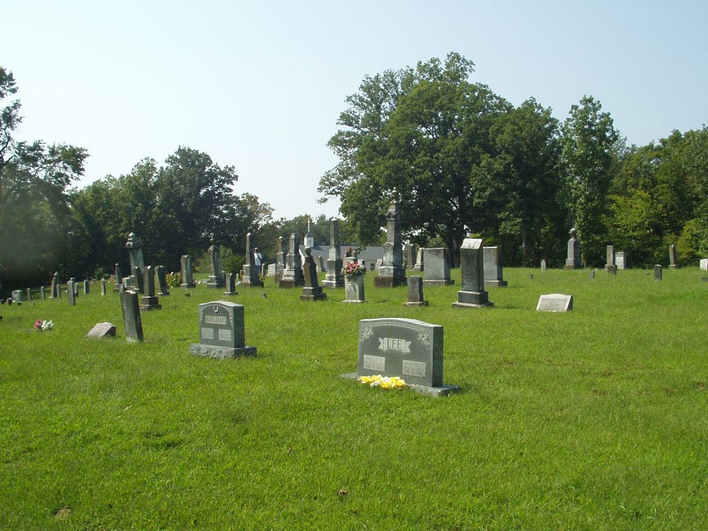
| Description | : | The Barks Chapel Cemetery is located at the Barks Chapel Church in western Cape Girardeau County, MO. From Cape Girardeau take Hwy 34 west to Gravel Hill. Turn north on Hwy U. Follow Hwy U to Crump and turn west on Cape Girardeau CR 387; continue approximately 3 miles. The cemetery is located at the junction of Cape Girardeau CR 387 and CR 391. The Barks Chapel Church was organized in 1894. Originally set up as Methodist every other Sunday, alternating with General Baptist the opposite Sundays. The church and cemetery is named after the prominent Barks family... Read More |
frequently asked questions (FAQ):
-
Where is Barks Chapel Cemetery?
Barks Chapel Cemetery is located at Cape Girardeau CR 387 and CR 391 Whitewater, Cape Girardeau County ,Missouri ,USA.
-
Barks Chapel Cemetery cemetery's updated grave count on graveviews.com?
0 memorials
-
Where are the coordinates of the Barks Chapel Cemetery?
Latitude: 37.2642212
Longitude: -89.8592606
Nearby Cemetories:
1. Stroder Cemetery
Cape Girardeau County, USA
Coordinate: 37.2860985, -89.8458023
2. Laflin Cemetery
Laflin, Bollinger County, USA
Coordinate: 37.2770157, -89.8894196
3. Proffer Cemetery
Crump, Cape Girardeau County, USA
Coordinate: 37.2807999, -89.8274994
4. Crump Cemetery
Crump, Cape Girardeau County, USA
Coordinate: 37.2771988, -89.8174973
5. Spivey Cemetery
Cape Girardeau County, USA
Coordinate: 37.2963982, -89.8386002
6. Passover Cemetery
Whitewater, Cape Girardeau County, USA
Coordinate: 37.2256012, -89.8458023
7. Stroderville Cemetery
Whitewater, Cape Girardeau County, USA
Coordinate: 37.2472000, -89.8118973
8. Hood Cemetery
Leopold, Bollinger County, USA
Coordinate: 37.2355500, -89.8980100
9. Ebenezer Cemetery
Laflin, Bollinger County, USA
Coordinate: 37.3003006, -89.8899994
10. Scott Cemetery
Leopold, Bollinger County, USA
Coordinate: 37.2186012, -89.8681030
11. Saint Johns Cemetery
Leopold, Bollinger County, USA
Coordinate: 37.2585983, -89.9282990
12. Whitewater Methodist Church Cemetery
Whitewater, Cape Girardeau County, USA
Coordinate: 37.2387300, -89.7940100
13. Perkins Cemetery
Bollinger County, USA
Coordinate: 37.2738991, -89.9313965
14. Borneman Cemetery
Cape Girardeau County, USA
Coordinate: 37.2806015, -89.7889023
15. Crader Cemetery
Huskey, Bollinger County, USA
Coordinate: 37.3280983, -89.8711014
16. Trinity Methodist Cemetery
Delta, Cape Girardeau County, USA
Coordinate: 37.2104180, -89.8120640
17. Formway Cemetery
Bollinger County, USA
Coordinate: 37.3166900, -89.9165400
18. Bailey Cemetery
Huskey, Bollinger County, USA
Coordinate: 37.3274994, -89.8957977
19. Eaker Cemetery
Lutesville, Bollinger County, USA
Coordinate: 37.2778015, -89.9516983
20. Wayne Cemetery
Drum, Bollinger County, USA
Coordinate: 37.1925000, -89.8872000
21. Allen Cemetery
Burfordville, Cape Girardeau County, USA
Coordinate: 37.3424988, -89.8475037
22. Hebenstreit Farm Family Plot
Drum, Bollinger County, USA
Coordinate: 37.1886101, -89.8936081
23. Hahn Chapel Cemetery
Marble Hill, Bollinger County, USA
Coordinate: 37.3061638, -89.9492645
24. McGuire Cemetery
Burfordville, Cape Girardeau County, USA
Coordinate: 37.3363991, -89.8028030