
| Memorials | : | 0 |
| Location | : | Lincolnville, Ottawa County, USA |
| Coordinate | : | 36.9288292, -94.7569046 |
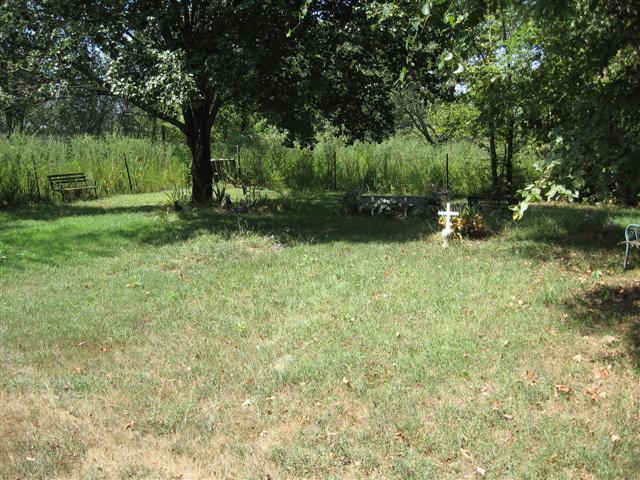
| Description | : | The cemetery is located at the south side of E60 road about 1 mile south of the former village of Lincolnville. I was only able to read 3 stones. One new burial was unmarked and there was one large stone with no readable markings. The cemetery is fairly new and is on Indian land. There is another tiny cemetery directly across the road from it. There is no sign at the cemetery. |
frequently asked questions (FAQ):
-
Where is Beaver-Buergey Cemetery?
Beaver-Buergey Cemetery is located at Lincolnville, Ottawa County ,Oklahoma ,USA.
-
Beaver-Buergey Cemetery cemetery's updated grave count on graveviews.com?
0 memorials
-
Where are the coordinates of the Beaver-Buergey Cemetery?
Latitude: 36.9288292
Longitude: -94.7569046
Nearby Cemetories:
1. Quapaw Family Cemetery
Lincolnville, Ottawa County, USA
Coordinate: 36.9296532, -94.7567368
2. Saint Marys Quapaw Cemetery
Ottawa County, USA
Coordinate: 36.9325400, -94.7543400
3. Stafford-Shapp Memorial Cemetery
Ottawa County, USA
Coordinate: 36.9373130, -94.7537270
4. Griffin Cemetery
Ottawa County, USA
Coordinate: 36.9353485, -94.7471237
5. Peoria Indian Cemetery
Peoria, Ottawa County, USA
Coordinate: 36.9143982, -94.7416992
6. Peery Cemetery
Ottawa County, USA
Coordinate: 36.9043999, -94.7780991
7. Hoffman-Quapaw Family Cemetery
Ottawa County, USA
Coordinate: 36.9425200, -94.7118800
8. Quapaw's Cemetery
Quapaw, Ottawa County, USA
Coordinate: 36.9190800, -94.8245000
9. Beattie Family Cemetery
Quapaw, Ottawa County, USA
Coordinate: 36.9583028, -94.6838727
10. Green Family Cemetery
Quapaw, Ottawa County, USA
Coordinate: 36.9690100, -94.6853800
11. Glen Abbey Memorial Gardens
Miami, Ottawa County, USA
Coordinate: 36.8717003, -94.8242035
12. Newman Cemetery
Ottawa County, USA
Coordinate: 36.9752998, -94.6761017
13. Ottawa Indian Cemetery
Miami, Ottawa County, USA
Coordinate: 36.8511920, -94.7814020
14. Pence Cemetery
Baxter Springs, Cherokee County, USA
Coordinate: 37.0128100, -94.6936900
15. Modoc Cemetery
Ottawa County, USA
Coordinate: 36.8652800, -94.6632300
16. Grand Army of the Republic Cemetery
Miami, Ottawa County, USA
Coordinate: 36.9108009, -94.8796997
17. Northeastern Oklahoma Veterans Memorial Cemetery
Commerce, Ottawa County, USA
Coordinate: 36.9268400, -94.8818300
18. Baxter Springs Cemetery
Baxter Springs, Cherokee County, USA
Coordinate: 37.0318985, -94.7696991
19. Baxter Springs City Cemetery Soldiers' Lot
Baxter Springs, Cherokee County, USA
Coordinate: 37.0320810, -94.7706520
20. Hodgkiss Cemetery
Wyandotte Township, Ottawa County, USA
Coordinate: 36.8380731, -94.6874302
21. Bland Cemetery
Wyandotte, Ottawa County, USA
Coordinate: 36.8208008, -94.7538986
22. All Saints' Garden of the Good Shepherd
Miami, Ottawa County, USA
Coordinate: 36.8780800, -94.8798100
23. Burson Cemetery
Seneca, Newton County, USA
Coordinate: 36.9110985, -94.6113968
24. Ferris Cemetery
Baxter Springs, Cherokee County, USA
Coordinate: 37.0459160, -94.7726380