
| Memorials | : | 0 |
| Location | : | Marydale, Clinton County, USA |
| Coordinate | : | 38.7117340, -89.4071140 |
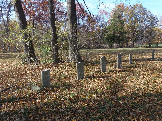
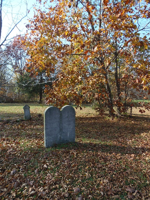
| Description | : | This inactive cemetery, about one block square in size, is located in a grove on the south side of Emerald Road. Many of the stones have fallen and most are in poor shape, but 58 graves have been identified. |
frequently asked questions (FAQ):
-
Where is Beaver Creek Baptist Church Cemetery?
Beaver Creek Baptist Church Cemetery is located at Marydale, Clinton County ,Illinois ,USA.
-
Beaver Creek Baptist Church Cemetery cemetery's updated grave count on graveviews.com?
0 memorials
-
Where are the coordinates of the Beaver Creek Baptist Church Cemetery?
Latitude: 38.7117340
Longitude: -89.4071140
Nearby Cemetories:
1. Godell Graveyard
Marydale, Clinton County, USA
Coordinate: 38.7045060, -89.4167380
2. Bowen Graveyard
Jamestown, Clinton County, USA
Coordinate: 38.7231000, -89.4029000
3. Cole Family Cemetery
Keyesport, Clinton County, USA
Coordinate: 38.7339172, -89.3852386
4. Yingst Cemetery
Carlyle, Clinton County, USA
Coordinate: 38.6828003, -89.3964005
5. Saint Peter Lutheran Church Cemetery
Stolletown, Clinton County, USA
Coordinate: 38.6876400, -89.4471000
6. Saint Felicitas Cemetery
Wheatfield Township, Clinton County, USA
Coordinate: 38.6966782, -89.4560776
7. Wisetown Cemetery
Beaver Creek, Bond County, USA
Coordinate: 38.7627983, -89.4021988
8. Noe Graveyard
Keyesport, Clinton County, USA
Coordinate: 38.7225000, -89.3398000
9. Rudolph Cemetery
Stolletown, Clinton County, USA
Coordinate: 38.6674995, -89.4608002
10. Gillespie Cemetery
New Memphis, Clinton County, USA
Coordinate: 38.7350006, -89.3308029
11. McKendree Chapel Cemetery
Keyesport Landing, Bond County, USA
Coordinate: 38.7428017, -89.3277969
12. Poor Farm Cemetery
Carlyle, Clinton County, USA
Coordinate: 38.6463970, -89.3730710
13. Shoal Creek Baptist Church Cemetery
Jamestown, Clinton County, USA
Coordinate: 38.7031034, -89.4986946
14. Baker Cemetery
Saint Rose, Clinton County, USA
Coordinate: 38.7231000, -89.5104000
15. Camp Ground Cemetery
Greenville, Bond County, USA
Coordinate: 38.7960014, -89.4094009
16. Jackson Cemetery
Jamestown, Clinton County, USA
Coordinate: 38.7333000, -89.5124000
17. Jamestown Cemetery
Jamestown, Clinton County, USA
Coordinate: 38.7349014, -89.5120010
18. Miller Graveyard
Clinton County, USA
Coordinate: 38.6381000, -89.4618000
19. Burnside Cemetery
Carlyle, Clinton County, USA
Coordinate: 38.6646000, -89.3118000
20. McNeill Cemetery
Keyesport, Clinton County, USA
Coordinate: 38.7167015, -89.2891998
21. Hickman Cemetery
Saint Rose, Clinton County, USA
Coordinate: 38.7104000, -89.5254000
22. Frogtown Cemetery
Breese, Clinton County, USA
Coordinate: 38.6487000, -89.4937000
23. Greene Cemetery
Pierron, Bond County, USA
Coordinate: 38.7849998, -89.4824982
24. Taylor Cemetery
Saint Rose, Clinton County, USA
Coordinate: 38.6647800, -89.5153800