
| Memorials | : | 0 |
| Location | : | Cessna, Bedford County, USA |
| Coordinate | : | 40.1085106, -78.5497407 |
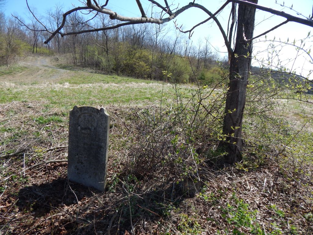
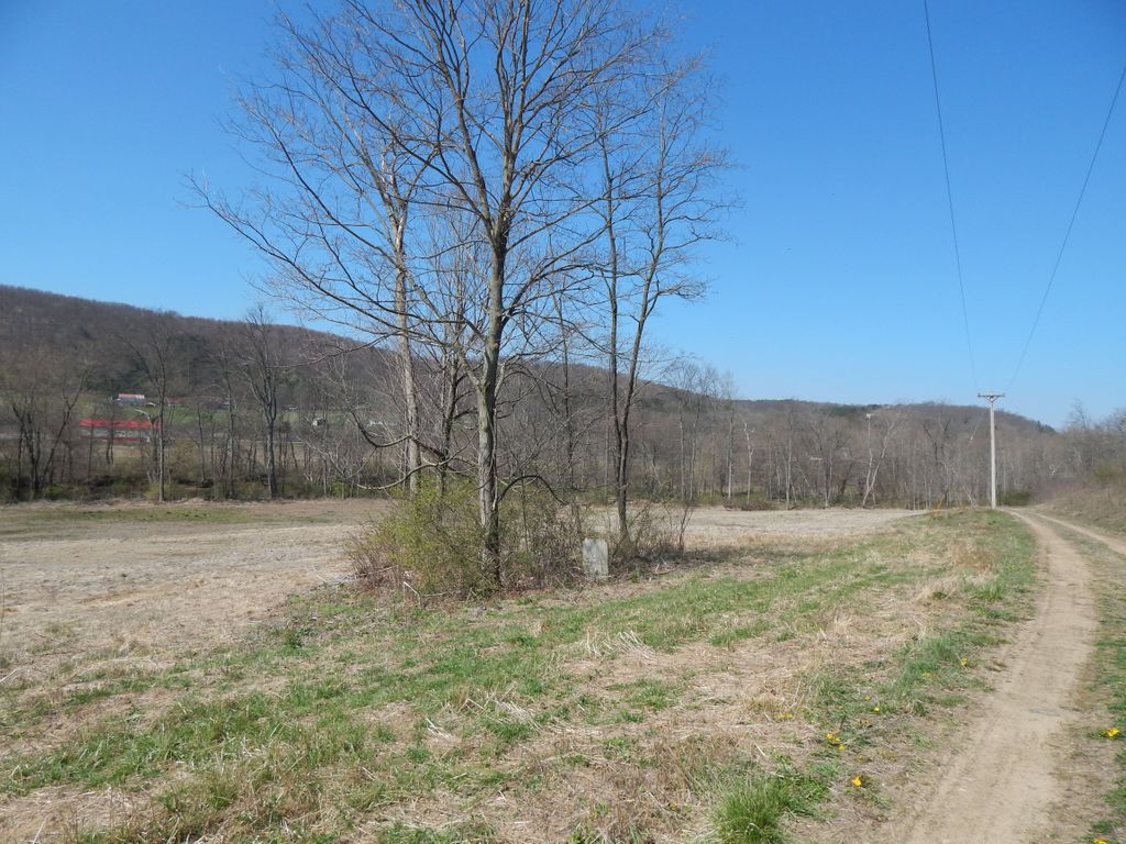
| Description | : | This small cemetery is located 10 feet off of the road in a small grove of trees. This possibly is a farm cemetery (not maintained) on Beaver Lane near Cessna in Bedford County Pennsylvania. It only contains two graves with footstones that are completely overgrown in the summer time so the stones are not able to be seen in the summer time. It was found in trying to locate the Old Ickes Cemetery Pigeon Hills transcribed by Tom Imler in 1975. His map shows this approximate location. That cemetery which has not been located is also a farm cemetery with seven marked graves... Read More |
frequently asked questions (FAQ):
-
Where is Beaver Lane Cemetery?
Beaver Lane Cemetery is located at Cessna, Bedford County ,Pennsylvania ,USA.
-
Beaver Lane Cemetery cemetery's updated grave count on graveviews.com?
0 memorials
-
Where are the coordinates of the Beaver Lane Cemetery?
Latitude: 40.1085106
Longitude: -78.5497407
Nearby Cemetories:
1. Anderson Cemetery
Cessna, Bedford County, USA
Coordinate: 40.0963060, -78.5330390
2. Christian Light Church Cemetery
Cessna, Bedford County, USA
Coordinate: 40.1039000, -78.5241000
3. Saint John's Lutheran Church Cemetery
Cessna, Bedford County, USA
Coordinate: 40.0968300, -78.5251900
4. Saint Pauls Reformed Church Cemetery
Cessna, Bedford County, USA
Coordinate: 40.0852460, -78.5231280
5. Fishertown Cemetery
Fishertown, Bedford County, USA
Coordinate: 40.1197357, -78.5878830
6. Fishertown Brethren Cemetery
Fishertown, Bedford County, USA
Coordinate: 40.1227300, -78.5880220
7. Fishertown Lutheran Cemetery
Fishertown, Bedford County, USA
Coordinate: 40.1255500, -78.5861900
8. Stone Church Cemetery
Fishertown, Bedford County, USA
Coordinate: 40.1337000, -78.5939000
9. Mount Smith Cemetery
Bedford, Bedford County, USA
Coordinate: 40.0703354, -78.5162506
10. Messiah Lutheran Church Cemetery
Dutch Corner, Bedford County, USA
Coordinate: 40.1033000, -78.4898000
11. J S Imler Cemetery
Bedford County, USA
Coordinate: 40.0867540, -78.4794070
12. Bedford County Memorial Park
Bedford, Bedford County, USA
Coordinate: 40.0539017, -78.5081024
13. Osterburg Community Cemetery
Osterburg, Bedford County, USA
Coordinate: 40.1666700, -78.5154800
14. Old Union Cemetery
Osterburg, Bedford County, USA
Coordinate: 40.1677080, -78.5183640
15. Bowser Farm Cemetery
Oppenheimer, Bedford County, USA
Coordinate: 40.1364640, -78.4746120
16. Trinity Reformed Church Cemetery
Osterburg, Bedford County, USA
Coordinate: 40.1674309, -78.5170975
17. Lutheran Cemetery at Osterburg
Osterburg, Bedford County, USA
Coordinate: 40.1665600, -78.5136500
18. Pleasant Hill Reformed Church Cemetery
Imlertown, Bedford County, USA
Coordinate: 40.0947914, -78.4669113
19. William Clark Sr. Cemetery
Alum Bank, Bedford County, USA
Coordinate: 40.1682400, -78.5840400
20. Albright Cemetery
Dutch Corner, Bedford County, USA
Coordinate: 40.0970000, -78.4640000
21. Cuppett Family Cemetery
New Paris, Bedford County, USA
Coordinate: 40.1114578, -78.6401596
22. New Paris Community Cemetery
New Paris, Bedford County, USA
Coordinate: 40.1117900, -78.6404900
23. George Michael Imler Family Cemetery
Bedford County, USA
Coordinate: 40.1202540, -78.4579400
24. Horn United Methodist Church Cemetery
Alum Bank, Bedford County, USA
Coordinate: 40.1767000, -78.5838000