
| Memorials | : | 0 |
| Location | : | Alum Bank, Bedford County, USA |
| Coordinate | : | 40.1682400, -78.5840400 |
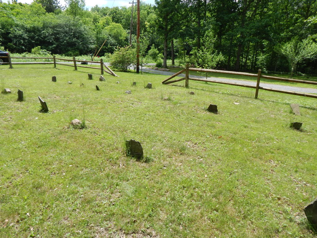
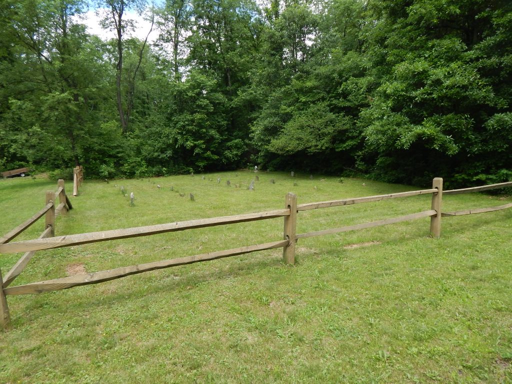
| Description | : | This cemetery is located on Ridge Market Road(T544) just off of Rt. 56 (Quaker Valley Road). Thomas Imler and his wife who transcribed many of Bedford County Pennsylvania Cemeteries were intrigued by this cemetery but could not find information on it. He mentioned that it had markers but they had no inscriptions. The cemetery is located before the Snook Covered Bridge coming from Rt. 56. From Rt. 56 you would turn at the old stone house. Eventually he did find out that it was a public cemetery started by William Clark Sr. It was used until about 1840 when the... Read More |
frequently asked questions (FAQ):
-
Where is William Clark Sr. Cemetery?
William Clark Sr. Cemetery is located at Alum Bank, Bedford County ,Pennsylvania ,USA.
-
William Clark Sr. Cemetery cemetery's updated grave count on graveviews.com?
0 memorials
-
Where are the coordinates of the William Clark Sr. Cemetery?
Latitude: 40.1682400
Longitude: -78.5840400
Nearby Cemetories:
1. Horn United Methodist Church Cemetery
Alum Bank, Bedford County, USA
Coordinate: 40.1767000, -78.5838000
2. Hoover Cemetery
Alum Bank, Bedford County, USA
Coordinate: 40.1853910, -78.5921790
3. Pleasantville Cemetery
Alum Bank, Bedford County, USA
Coordinate: 40.1836400, -78.6133400
4. Stone Church Cemetery
Fishertown, Bedford County, USA
Coordinate: 40.1337000, -78.5939000
5. Thomas Callihan Family Cemetery
Alum Bank, Bedford County, USA
Coordinate: 40.1835940, -78.6327630
6. Fishertown Lutheran Cemetery
Fishertown, Bedford County, USA
Coordinate: 40.1255500, -78.5861900
7. Mock Church Cemetery
Alum Bank, Bedford County, USA
Coordinate: 40.1662407, -78.6400223
8. Fishertown Brethren Cemetery
Fishertown, Bedford County, USA
Coordinate: 40.1227300, -78.5880220
9. Fishertown Cemetery
Fishertown, Bedford County, USA
Coordinate: 40.1197357, -78.5878830
10. McDonald Farm Cemetery
Bedford County, USA
Coordinate: 40.2151330, -78.5673170
11. Old Union Cemetery
Osterburg, Bedford County, USA
Coordinate: 40.1677080, -78.5183640
12. Trinity Reformed Church Cemetery
Osterburg, Bedford County, USA
Coordinate: 40.1674309, -78.5170975
13. Osterburg Community Cemetery
Osterburg, Bedford County, USA
Coordinate: 40.1666700, -78.5154800
14. Lutheran Cemetery at Osterburg
Osterburg, Bedford County, USA
Coordinate: 40.1665600, -78.5136500
15. Imler Saint Paul Brethren Cemetery
Imler, Bedford County, USA
Coordinate: 40.2059937, -78.5238647
16. Mount Union Cemetery
Lovely, Bedford County, USA
Coordinate: 40.2247086, -78.6118469
17. Imler Valley Cemetery
Imler, Bedford County, USA
Coordinate: 40.2105713, -78.5224533
18. Beaver Lane Cemetery
Cessna, Bedford County, USA
Coordinate: 40.1085106, -78.5497407
19. New Paris Community Cemetery
New Paris, Bedford County, USA
Coordinate: 40.1117900, -78.6404900
20. Cuppett Family Cemetery
New Paris, Bedford County, USA
Coordinate: 40.1114578, -78.6401596
21. Christian Light Church Cemetery
Cessna, Bedford County, USA
Coordinate: 40.1039000, -78.5241000
22. Fickes Cemetery
King, Bedford County, USA
Coordinate: 40.2074410, -78.4919870
23. Anderson Cemetery
Cessna, Bedford County, USA
Coordinate: 40.0963060, -78.5330390
24. Saint John's Lutheran Church Cemetery
Cessna, Bedford County, USA
Coordinate: 40.0968300, -78.5251900