
| Memorials | : | 0 |
| Location | : | Rowley Regis, Metropolitan Borough of Sandwell, England |
| Phone | : | 0121 468 3200 |
| Website | : | www.beechesroadbaptistchapel.org.uk/ |
| Coordinate | : | 52.4733300, -2.0451000 |
frequently asked questions (FAQ):
-
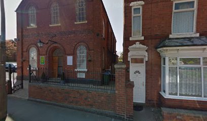
Where is Beeches Road Baptist Chapel?
Beeches Road Baptist Chapel is located at 81 Beeches Rd, Rowley Regis Rowley Regis, Metropolitan Borough of Sandwell ,West Midlands , B65 0BPEngland.
-
Beeches Road Baptist Chapel cemetery's updated grave count on graveviews.com?
0 memorials
-
Where are the coordinates of the Beeches Road Baptist Chapel?
Latitude: 52.4733300
Longitude: -2.0451000
Nearby Cemetories:
1. St. Paul's Churchyard
Halesowen, Metropolitan Borough of Dudley, England
Coordinate: 52.4738474, -2.0360769
2. Rowley Regis Cemetery
Rowley Regis, Metropolitan Borough of Sandwell, England
Coordinate: 52.4800670, -2.0546830
3. Rowley Regis Crematorium
Rowley Regis, Metropolitan Borough of Sandwell, England
Coordinate: 52.4801170, -2.0565480
4. Quinton Cemetery
Halesowen, Metropolitan Borough of Dudley, England
Coordinate: 52.4631800, -2.0202190
5. St Luke's Churchyard
Cradley Heath, Metropolitan Borough of Dudley, England
Coordinate: 52.4733130, -2.0788730
6. Halesowen Cemetery
Halesowen, Metropolitan Borough of Dudley, England
Coordinate: 52.4500800, -2.0535400
7. Christ Churchyard
Quinton, Metropolitan Borough of Birmingham, England
Coordinate: 52.4619800, -2.0095500
8. St. John's Church Dudley Wood
Cradley Heath, Metropolitan Borough of Dudley, England
Coordinate: 52.4745685, -2.0865011
9. St. Peter's Churchyard
Cradley, Metropolitan Borough of Dudley, England
Coordinate: 52.4644514, -2.0877236
10. Halesowen Abbey
Hales, Shropshire Unitary Authority, England
Coordinate: 52.4460000, -2.0350000
11. St Andrews Churchyard
Netherton, Metropolitan Borough of Dudley, England
Coordinate: 52.4904500, -2.0913400
12. Cradley Park Lane Unitarian Chapel
Cradley, Metropolitan Borough of Dudley, England
Coordinate: 52.4635800, -2.0971880
13. St. Andrew's Churchyard
Netherton, Metropolitan Borough of Dudley, England
Coordinate: 52.4907600, -2.0924390
14. Christ Church Churchyard
Quarry Bank, Metropolitan Borough of Dudley, England
Coordinate: 52.4724270, -2.1056680
15. St. John Churchyard
Kates Hill, Metropolitan Borough of Dudley, England
Coordinate: 52.5087060, -2.0722890
16. Thimblemill Cemetery
Smethwick, Metropolitan Borough of Sandwell, England
Coordinate: 52.4826200, -1.9826400
17. Oldbury Cemetery
Smethwick, Metropolitan Borough of Sandwell, England
Coordinate: 52.4992710, -1.9932620
18. St. Thomas Churchyard
Dudley, Metropolitan Borough of Dudley, England
Coordinate: 52.5078800, -2.0881300
19. St Edmund King and Martyr Churchyard
Dudley, Metropolitan Borough of Dudley, England
Coordinate: 52.5119250, -2.0803230
20. Dudley Cemetery
Dudley, Metropolitan Borough of Dudley, England
Coordinate: 52.5052950, -2.0956290
21. Smethwick Cemetery
Smethwick, Metropolitan Borough of Sandwell, England
Coordinate: 52.4868370, -1.9753820
22. Christ Church, The Lye and Stambermill
Lye, Metropolitan Borough of Dudley, England
Coordinate: 52.4574720, -2.1140040
23. Dudley Castle Crypt
Dudley, Metropolitan Borough of Dudley, England
Coordinate: 52.5144850, -2.0797650
24. Smethwick Old Churchyard
Smethwick, Metropolitan Borough of Sandwell, England
Coordinate: 52.4869000, -1.9724600