
| Memorials | : | 0 |
| Location | : | Quinton, Metropolitan Borough of Birmingham, England |
| Coordinate | : | 52.4619800, -2.0095500 |
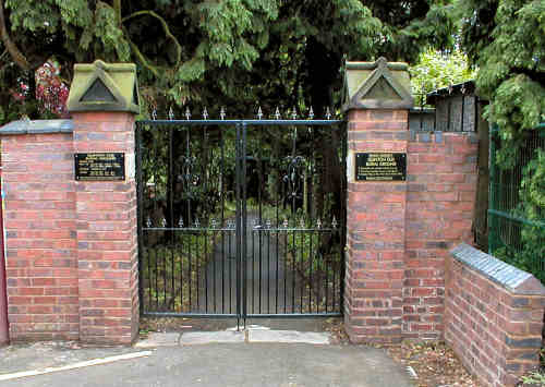
| Description | : | In February 1889, the CHURCHYARD was closed to interments by an order in Council. To that date, and from the year of its consecration, 1840, 1415 persons had been buried there. In due course the Churchyard was “put in proper condition” and it was decreed that all future costs for its maintenance be met by the Overseers of the Parish. A few months after the closure the Rector and Wardens conveyed, Alexander Macomb Chance, for the sum of £158, one acre of glebe land - to be used as a NEW BURIAL GROUND. Mr. Chance divided the land and conveyed the... Read More |
frequently asked questions (FAQ):
-
Where is Christ Churchyard?
Christ Churchyard is located at 773a Hagley Road West Quinton, Metropolitan Borough of Birmingham ,West Midlands , B32 1AJEngland.
-
Christ Churchyard cemetery's updated grave count on graveviews.com?
0 memorials
-
Where are the coordinates of the Christ Churchyard?
Latitude: 52.4619800
Longitude: -2.0095500
Nearby Cemetories:
1. Quinton Cemetery
Halesowen, Metropolitan Borough of Dudley, England
Coordinate: 52.4631800, -2.0202190
2. St. Paul's Churchyard
Halesowen, Metropolitan Borough of Dudley, England
Coordinate: 52.4738474, -2.0360769
3. Halesowen Abbey
Hales, Shropshire Unitary Authority, England
Coordinate: 52.4460000, -2.0350000
4. Beeches Road Baptist Chapel
Rowley Regis, Metropolitan Borough of Sandwell, England
Coordinate: 52.4733300, -2.0451000
5. Thimblemill Cemetery
Smethwick, Metropolitan Borough of Sandwell, England
Coordinate: 52.4826200, -1.9826400
6. Halesowen Cemetery
Halesowen, Metropolitan Borough of Dudley, England
Coordinate: 52.4500800, -2.0535400
7. St. Peter's Churchyard
Harborne, Metropolitan Borough of Birmingham, England
Coordinate: 52.4533600, -1.9589050
8. Smethwick Cemetery
Smethwick, Metropolitan Borough of Sandwell, England
Coordinate: 52.4868370, -1.9753820
9. Rowley Regis Cemetery
Rowley Regis, Metropolitan Borough of Sandwell, England
Coordinate: 52.4800670, -2.0546830
10. Smethwick Old Churchyard
Smethwick, Metropolitan Borough of Sandwell, England
Coordinate: 52.4869000, -1.9724600
11. Rowley Regis Crematorium
Rowley Regis, Metropolitan Borough of Sandwell, England
Coordinate: 52.4801170, -2.0565480
12. St. Mary's Churchyard
Harborne, Metropolitan Borough of Birmingham, England
Coordinate: 52.4566000, -1.9540700
13. Oldbury Cemetery
Smethwick, Metropolitan Borough of Sandwell, England
Coordinate: 52.4992710, -1.9932620
14. St Leonard Churchyard
Frankley, Bromsgrove District, England
Coordinate: 52.4216690, -2.0029960
15. Lodge Hill Cemetery and Crematorium
Birmingham, Metropolitan Borough of Birmingham, England
Coordinate: 52.4384670, -1.9537400
16. St Luke's Churchyard
Cradley Heath, Metropolitan Borough of Dudley, England
Coordinate: 52.4733130, -2.0788730
17. Saint Marys Church
Selly Oak, Metropolitan Borough of Birmingham, England
Coordinate: 52.4380500, -1.9457100
18. St. Peter's Churchyard
Cradley, Metropolitan Borough of Dudley, England
Coordinate: 52.4644514, -2.0877236
19. Friends Meeting House Burial Ground
Bournville, Metropolitan Borough of Birmingham, England
Coordinate: 52.4363270, -1.9424810
20. St. John's Church Dudley Wood
Cradley Heath, Metropolitan Borough of Dudley, England
Coordinate: 52.4745685, -2.0865011
21. Cradley Park Lane Unitarian Chapel
Cradley, Metropolitan Borough of Dudley, England
Coordinate: 52.4635800, -2.0971880
22. Birmingham Prison Cemetery
Birmingham, Metropolitan Borough of Birmingham, England
Coordinate: 52.4932060, -1.9372360
23. St Bartholomew Churchyard
Edgbaston, Metropolitan Borough of Birmingham, England
Coordinate: 52.4606870, -1.9170890
24. St Laurence Churchyard Extension
Northfield, Metropolitan Borough of Birmingham, England
Coordinate: 52.4121060, -1.9641390