
| Memorials | : | 0 |
| Location | : | Northfield, Franklin County, USA |
| Coordinate | : | 42.6501200, -72.4560300 |
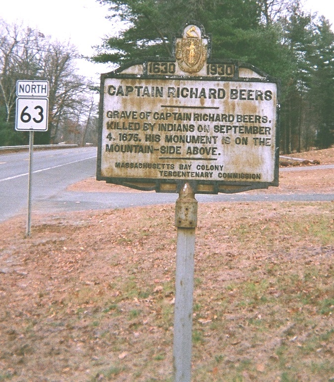
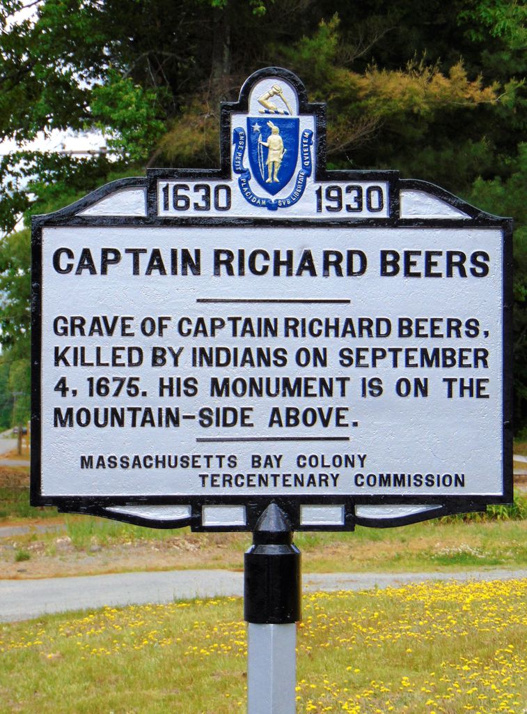
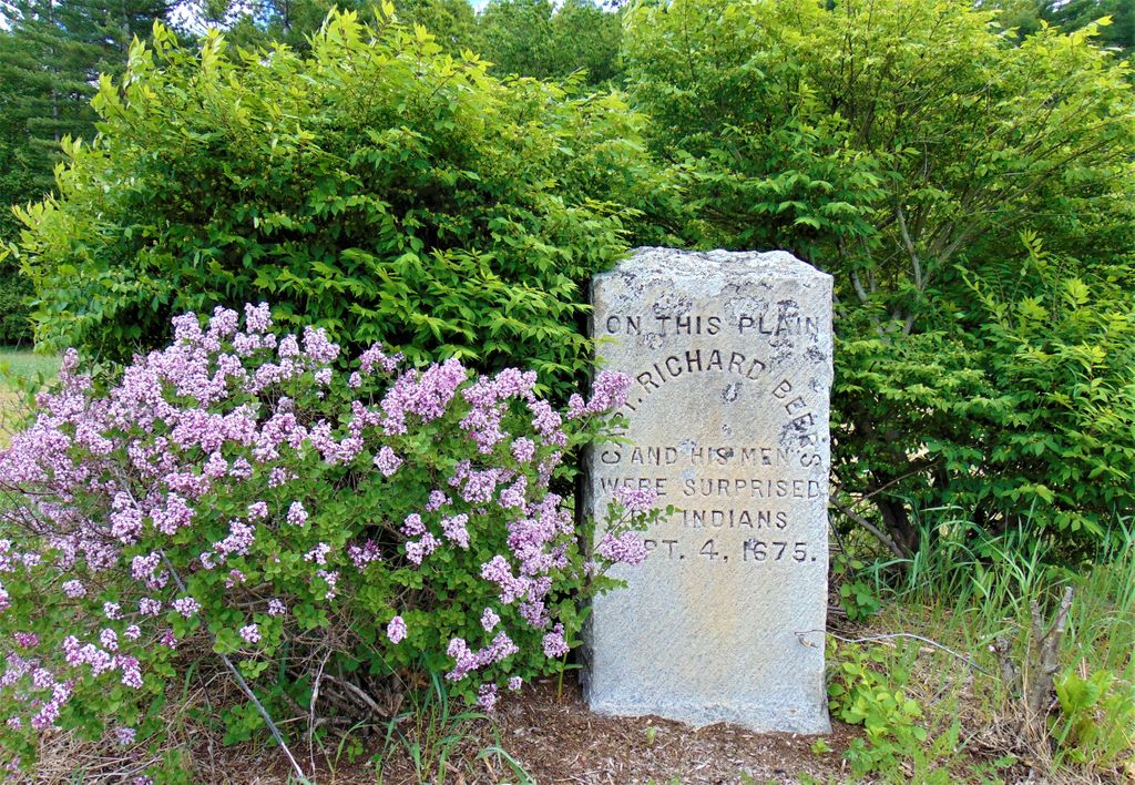
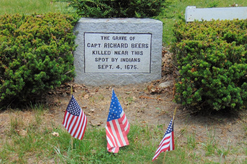
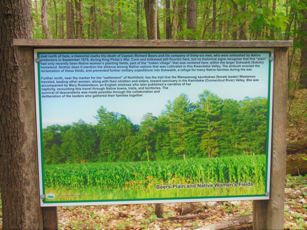
| Description | : | Early in King Philip's War Captain Richard Beers and 36 mounted soldiers were ambushed by 150 Indians near Northfield, MA. Capt Beers and nineteen of his men were killed, and sixteen of the soldiers managed to escape. The Indians were led by Monaco, a Nashaway sachem. A marker on Beers' mountain identifies the area where Capt. Beers and his men were buried. Only Capt. Beers is identified by name on the markers. The Massachusetts Historical Commission does not refer to this cemetery in MACRIS. |
frequently asked questions (FAQ):
-
Where is Beers Ambush Gravesite?
Beers Ambush Gravesite is located at South Mountain Road Northfield, Franklin County ,Massachusetts ,USA.
-
Beers Ambush Gravesite cemetery's updated grave count on graveviews.com?
0 memorials
-
Where are the coordinates of the Beers Ambush Gravesite?
Latitude: 42.6501200
Longitude: -72.4560300
Nearby Cemetories:
1. North Cemetery
Gill, Franklin County, USA
Coordinate: 42.6514160, -72.4817630
2. South Mountain Road Cemetery
Northfield, Franklin County, USA
Coordinate: 42.6375008, -72.4167023
3. Gill Center Cemetery
Gill, Franklin County, USA
Coordinate: 42.6413803, -72.4983063
4. Mount Hermon Cemetery
Northfield, Franklin County, USA
Coordinate: 42.6790800, -72.4821100
5. Saint Marys Cemetery
Northfield, Franklin County, USA
Coordinate: 42.6868910, -72.4448190
6. Northfield Farms Cemetery
Northfield, Franklin County, USA
Coordinate: 42.6124992, -72.4741974
7. Center Cemetery
Northfield, Franklin County, USA
Coordinate: 42.6954308, -72.4613342
8. Coller Cemetery
Northfield, Franklin County, USA
Coordinate: 42.6563988, -72.3930969
9. Durkee Burial Lot
Northfield, Franklin County, USA
Coordinate: 42.6070000, -72.4861000
10. Pentecost Cemetery
Northfield, Franklin County, USA
Coordinate: 42.7010200, -72.4539900
11. West Gill Cemetery
Gill, Franklin County, USA
Coordinate: 42.6442700, -72.5280500
12. Erving Center Cemetery
Erving, Franklin County, USA
Coordinate: 42.6033300, -72.4056800
13. West Northfield Cemetery
Northfield, Franklin County, USA
Coordinate: 42.7117004, -72.4689026
14. Round Top Cemetery
Northfield, Franklin County, USA
Coordinate: 42.7120600, -72.4447300
15. Holton Cemetery
Erving, Franklin County, USA
Coordinate: 42.5799500, -72.4634600
16. Riverside Cemetery
Gill, Franklin County, USA
Coordinate: 42.6156006, -72.5410995
17. Center Cemetery
Bernardston, Franklin County, USA
Coordinate: 42.6695213, -72.5498505
18. Old Cemetery
Bernardston, Franklin County, USA
Coordinate: 42.6810989, -72.5444031
19. Diemand Family Cemetery
Wendell, Franklin County, USA
Coordinate: 42.5769900, -72.4520600
20. East Mineral Road Cemetery
Montague, Franklin County, USA
Coordinate: 42.5810500, -72.5086300
21. Greenfield Hebrew Congregation Cemetery
Greenfield, Franklin County, USA
Coordinate: 42.6409410, -72.5653360
22. Highland Cemetery
Montague, Franklin County, USA
Coordinate: 42.5778008, -72.5083008
23. South Vernon Cemetery
South Vernon, Windham County, USA
Coordinate: 42.7341400, -72.4691700
24. Log Plain Cemetery
Greenfield, Franklin County, USA
Coordinate: 42.6378320, -72.5725800