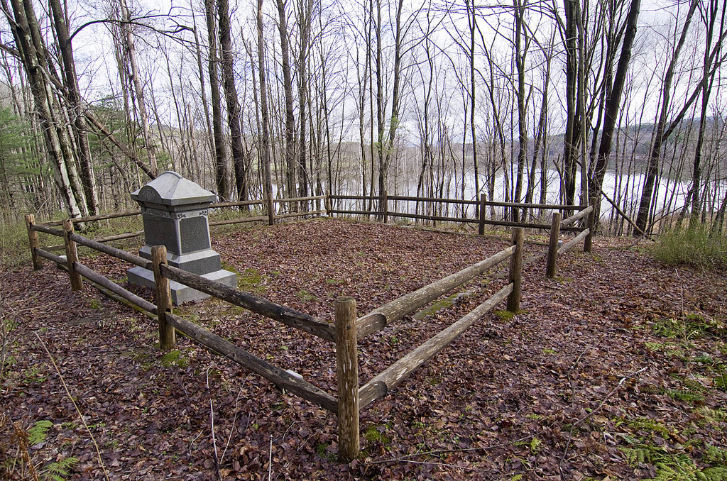
| Memorials | : | 0 |
| Location | : | Northfield, Franklin County, USA |
| Coordinate | : | 42.6070000, -72.4861000 |
| Description | : | This tiny family lot in the SW corner of Northfield, roughly 20' square, is on a knoll overlooking the CT River within an undeveloped unit of the CT River Greenway State Park. It is on the inside of a roughly 90° curve in the road, 150’ from the road at its closest point, and not directly accessible by motor vehicle. A single large granite monument facing NNE up the river bears three names and death dates. There are no other stones. A granite curb in good condition surrounds the lot, and just outside that is a wood rail fence of... Read More |
frequently asked questions (FAQ):
-
Where is Durkee Burial Lot?
Durkee Burial Lot is located at Pine Meadow Road Northfield, Franklin County ,Massachusetts ,USA.
-
Durkee Burial Lot cemetery's updated grave count on graveviews.com?
0 memorials
-
Where are the coordinates of the Durkee Burial Lot?
Latitude: 42.6070000
Longitude: -72.4861000
Nearby Cemetories:
1. Northfield Farms Cemetery
Northfield, Franklin County, USA
Coordinate: 42.6124992, -72.4741974
2. East Mineral Road Cemetery
Montague, Franklin County, USA
Coordinate: 42.5810500, -72.5086300
3. Holton Cemetery
Erving, Franklin County, USA
Coordinate: 42.5799500, -72.4634600
4. Highland Cemetery
Montague, Franklin County, USA
Coordinate: 42.5778008, -72.5083008
5. Gill Center Cemetery
Gill, Franklin County, USA
Coordinate: 42.6413803, -72.4983063
6. Diemand Family Cemetery
Wendell, Franklin County, USA
Coordinate: 42.5769900, -72.4520600
7. Riverside Cemetery
Gill, Franklin County, USA
Coordinate: 42.6156006, -72.5410995
8. North Cemetery
Gill, Franklin County, USA
Coordinate: 42.6514160, -72.4817630
9. West Gill Cemetery
Gill, Franklin County, USA
Coordinate: 42.6442700, -72.5280500
10. Beers Ambush Gravesite
Northfield, Franklin County, USA
Coordinate: 42.6501200, -72.4560300
11. Town Cemetery
Montague, Franklin County, USA
Coordinate: 42.5595000, -72.5070200
12. Our Lady of Czestochowa Cemetery
Montague, Franklin County, USA
Coordinate: 42.5846000, -72.5469400
13. Saint Annes Cemetery
Montague, Franklin County, USA
Coordinate: 42.5861300, -72.5480600
14. Saint Marys Cemetery
Montague, Franklin County, USA
Coordinate: 42.5852200, -72.5475100
15. Aaron Clark Memorial Cemetery
Montague, Franklin County, USA
Coordinate: 42.5836200, -72.5471600
16. Springdale Cemetery
Montague, Franklin County, USA
Coordinate: 42.5884700, -72.5530900
17. Dry Hill Cemetery
Montague, Franklin County, USA
Coordinate: 42.5558300, -72.4647600
18. Erving Center Cemetery
Erving, Franklin County, USA
Coordinate: 42.6033300, -72.4056800
19. South Mountain Road Cemetery
Northfield, Franklin County, USA
Coordinate: 42.6375008, -72.4167023
20. Fairway Avenue Cemetery
Montague, Franklin County, USA
Coordinate: 42.5924270, -72.5646970
21. Burnham Cemetery
Montague, Franklin County, USA
Coordinate: 42.5875300, -72.5720140
22. Greenfield Hebrew Congregation Cemetery
Greenfield, Franklin County, USA
Coordinate: 42.6409410, -72.5653360
23. High Street Cemetery
Greenfield, Franklin County, USA
Coordinate: 42.6044840, -72.5806660
24. Log Plain Cemetery
Greenfield, Franklin County, USA
Coordinate: 42.6378320, -72.5725800

