
| Memorials | : | 15 |
| Location | : | Montague, Franklin County, USA |
| Coordinate | : | 42.5810500, -72.5086300 |
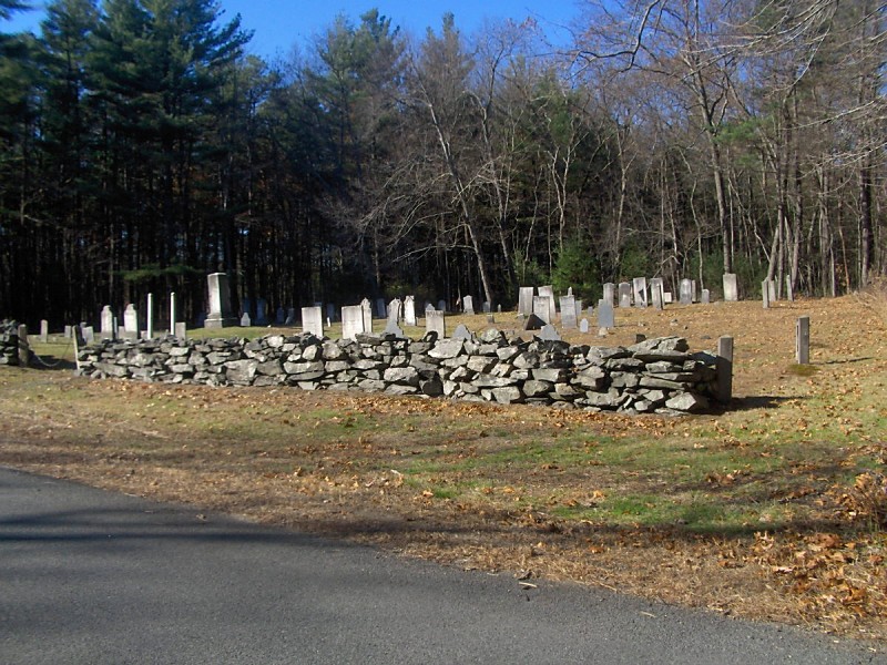
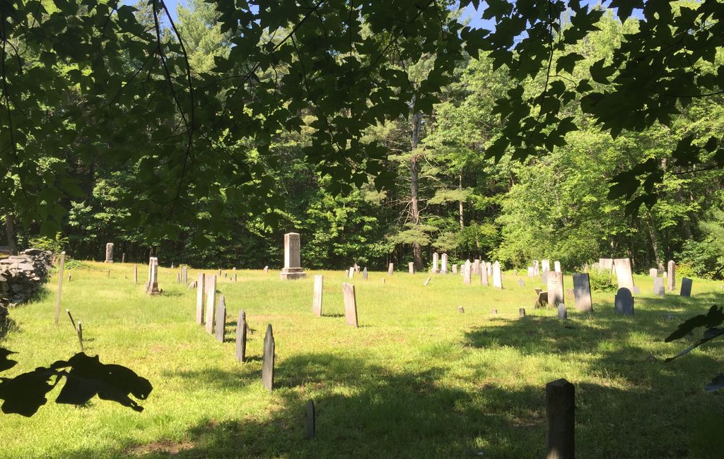
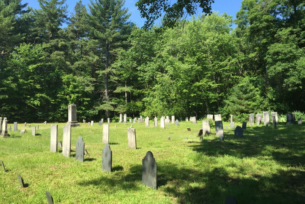
| Description | : | This is a town-owned cemetery. It is located in the village of Millers Falls. The oldest stone dates to 1814. This is a town-owned cemetery. The Town of Montague refers to this cemetery in MassGIS as Parcel ID: 25-15. The Massachusetts Historical Commission does not refer to this cemetery in MACRIS. This burial place is referenced to in the book "Vital Records of Montague, Massachusetts to the end of the year 1849" as G.R.6. |
frequently asked questions (FAQ):
-
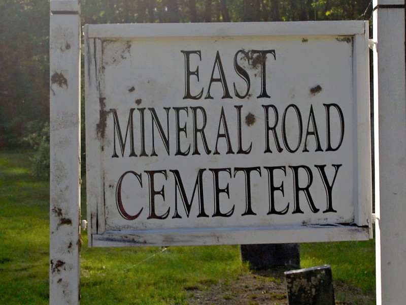
Where is East Mineral Road Cemetery?
East Mineral Road Cemetery is located at East Mineral Road Montague, Franklin County ,Massachusetts , 01349USA.
-
East Mineral Road Cemetery cemetery's updated grave count on graveviews.com?
15 memorials
-
Where are the coordinates of the East Mineral Road Cemetery?
Latitude: 42.5810500
Longitude: -72.5086300
Nearby Cemetories:
1. Highland Cemetery
Montague, Franklin County, USA
Coordinate: 42.5778008, -72.5083008
2. Town Cemetery
Montague, Franklin County, USA
Coordinate: 42.5595000, -72.5070200
3. Our Lady of Czestochowa Cemetery
Montague, Franklin County, USA
Coordinate: 42.5846000, -72.5469400
4. Aaron Clark Memorial Cemetery
Montague, Franklin County, USA
Coordinate: 42.5836200, -72.5471600
5. Saint Marys Cemetery
Montague, Franklin County, USA
Coordinate: 42.5852200, -72.5475100
6. Saint Annes Cemetery
Montague, Franklin County, USA
Coordinate: 42.5861300, -72.5480600
7. Durkee Burial Lot
Northfield, Franklin County, USA
Coordinate: 42.6070000, -72.4861000
8. Holton Cemetery
Erving, Franklin County, USA
Coordinate: 42.5799500, -72.4634600
9. Springdale Cemetery
Montague, Franklin County, USA
Coordinate: 42.5884700, -72.5530900
10. Northfield Farms Cemetery
Northfield, Franklin County, USA
Coordinate: 42.6124992, -72.4741974
11. Dry Hill Cemetery
Montague, Franklin County, USA
Coordinate: 42.5558300, -72.4647600
12. Diemand Family Cemetery
Wendell, Franklin County, USA
Coordinate: 42.5769900, -72.4520600
13. Riverside Cemetery
Gill, Franklin County, USA
Coordinate: 42.6156006, -72.5410995
14. Fairway Avenue Cemetery
Montague, Franklin County, USA
Coordinate: 42.5924270, -72.5646970
15. Elm Grove Cemetery
Montague, Franklin County, USA
Coordinate: 42.5418600, -72.5359000
16. Locust Hill Cemetery
Montague, Franklin County, USA
Coordinate: 42.5394700, -72.5363400
17. Burnham Cemetery
Montague, Franklin County, USA
Coordinate: 42.5875300, -72.5720140
18. East Deerfield Cemetery
Deerfield, Franklin County, USA
Coordinate: 42.5555992, -72.5642014
19. High Street Cemetery
Greenfield, Franklin County, USA
Coordinate: 42.6044840, -72.5806660
20. Gill Center Cemetery
Gill, Franklin County, USA
Coordinate: 42.6413803, -72.4983063
21. Old South Cemetery
Montague, Franklin County, USA
Coordinate: 42.5232500, -72.5360300
22. Chestnut Hill Cemetery
Montague, Franklin County, USA
Coordinate: 42.5228004, -72.4822006
23. West Gill Cemetery
Gill, Franklin County, USA
Coordinate: 42.6442700, -72.5280500
24. Federal Street Cemetery
Greenfield, Franklin County, USA
Coordinate: 42.5941400, -72.5977300