
| Memorials | : | 1 |
| Location | : | Feanwâlden, Dantumadeel Municipality, Netherlands |
| Coordinate | : | 53.2390761, 5.9921180 |
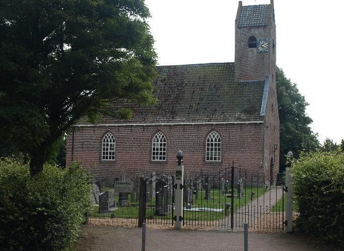
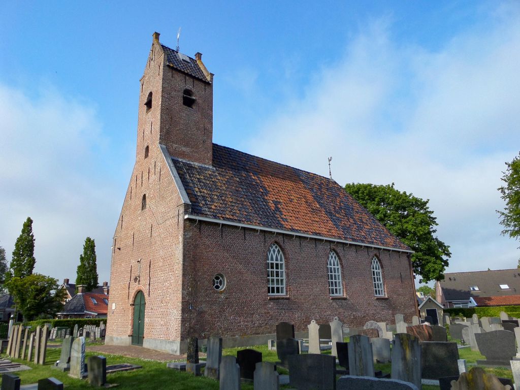
| Description | : | Johanneskerk Cemetery |
frequently asked questions (FAQ):
-
Where is Begraafplaats te Veenwouden Cemetery?
Begraafplaats te Veenwouden Cemetery is located at Feanwâlden, Dantumadeel Municipality ,Friesland ,Netherlands.
-
Begraafplaats te Veenwouden Cemetery cemetery's updated grave count on graveviews.com?
1 memorials
-
Where are the coordinates of the Begraafplaats te Veenwouden Cemetery?
Latitude: 53.2390761
Longitude: 5.9921180

Nearby Cemetories:
1. Feanwâlden Bûtefjild Cemetery
Feanwâlden, Dantumadeel Municipality, Netherlands
Coordinate: 53.2378864, 5.9815750
2. Begraafplaats De Westereen
Zwaagwesteinde, Dantumadeel Municipality, Netherlands
Coordinate: 53.2497819, 6.0273741
3. Begraafplaats Zwaagwesteinde
Zwaagwesteinde, Dantumadeel Municipality, Netherlands
Coordinate: 53.2580833, 6.0351062
4. Kerkhof Nederlands Hervormde kerk De Westereen
Zwaagwesteinde, Dantumadeel Municipality, Netherlands
Coordinate: 53.2583297, 6.0348107
5. Hoftsjerke begraafplaats
Hurdegaryp, Tytsjerksteradiel Municipality, Netherlands
Coordinate: 53.2175817, 5.9445193
6. Begraafplaats Twijzelerheide
Twijzelerheide, Achtkarspelen Municipality, Netherlands
Coordinate: 53.2413444, 6.0525175
7. Rêsthôf Broeksterwâld
Broeksterwoude, Dantumadeel Municipality, Netherlands
Coordinate: 53.2758766, 5.9907295
8. It Readtsjerkje hôf
Readtsjerk, Dantumadeel Municipality, Netherlands
Coordinate: 53.2562756, 5.9332706
9. Bergum Protestant Churchyard
Bergum, Tytsjerksteradiel Municipality, Netherlands
Coordinate: 53.1958500, 6.0016300
10. Damwoude General Cemetery
Damwâld, Dantumadeel Municipality, Netherlands
Coordinate: 53.2857700, 5.9996900
11. Rijperkerk Nederlands Hervormd Kerkhof
Rijperkerk, Tytsjerksteradiel Municipality, Netherlands
Coordinate: 53.2221200, 5.9183300
12. Akkerwoude Protestant Churchyard
Akkerwoude, Dantumadeel Municipality, Netherlands
Coordinate: 53.2909300, 5.9779800
13. Kerkhof Nederlands Hervormde Begraafplaats
Kollumerzwaag, Kollumerland en Nieuwkruisland Municipality, Netherlands
Coordinate: 53.2619801, 6.0736539
14. Begraafplaats Sint-Vituskerk
Tytsjerk, Tytsjerksteradiel Municipality, Netherlands
Coordinate: 53.2062242, 5.9142663
15. Marijetsjerke Begraafplaats
Oenkerk, Tytsjerksteradiel Municipality, Netherlands
Coordinate: 53.2537643, 5.8927362
16. Nederlands Hervormde begraafplaats Twizel
Twijzel, Achtkarspelen Municipality, Netherlands
Coordinate: 53.2388004, 6.0948838
17. Rêsthôf Driezum
Driezum, Dantumadeel Municipality, Netherlands
Coordinate: 53.2948039, 6.0418101
18. Kerkhof Alexanderkerk Rinsumageest
Rinsumageest, Dantumadeel Municipality, Netherlands
Coordinate: 53.2959488, 5.9429579
19. Begraafplaats Tillebuorren
Kootstertille, Achtkarspelen Municipality, Netherlands
Coordinate: 53.2116548, 6.0919066
20. Driesum Protestant Churchyard
Driezum, Dantumadeel Municipality, Netherlands
Coordinate: 53.2977400, 6.0460900
21. Begraafplaats Aldtsjerk
Aldtsjerk, Tytsjerksteradiel Municipality, Netherlands
Coordinate: 53.2648500, 5.8887300
22. Giekerk Martinuskerk
Giekerk, Tytsjerksteradiel Municipality, Netherlands
Coordinate: 53.2411660, 5.8785276
23. Begraafplaats Alde Dyk
Kootstertille, Achtkarspelen Municipality, Netherlands
Coordinate: 53.2191071, 6.1040850
24. Kerkhof Nederlands Hervormde Kerk
Suwâld, Tytsjerksteradiel Municipality, Netherlands
Coordinate: 53.1791922, 5.9273043