
| Memorials | : | 0 |
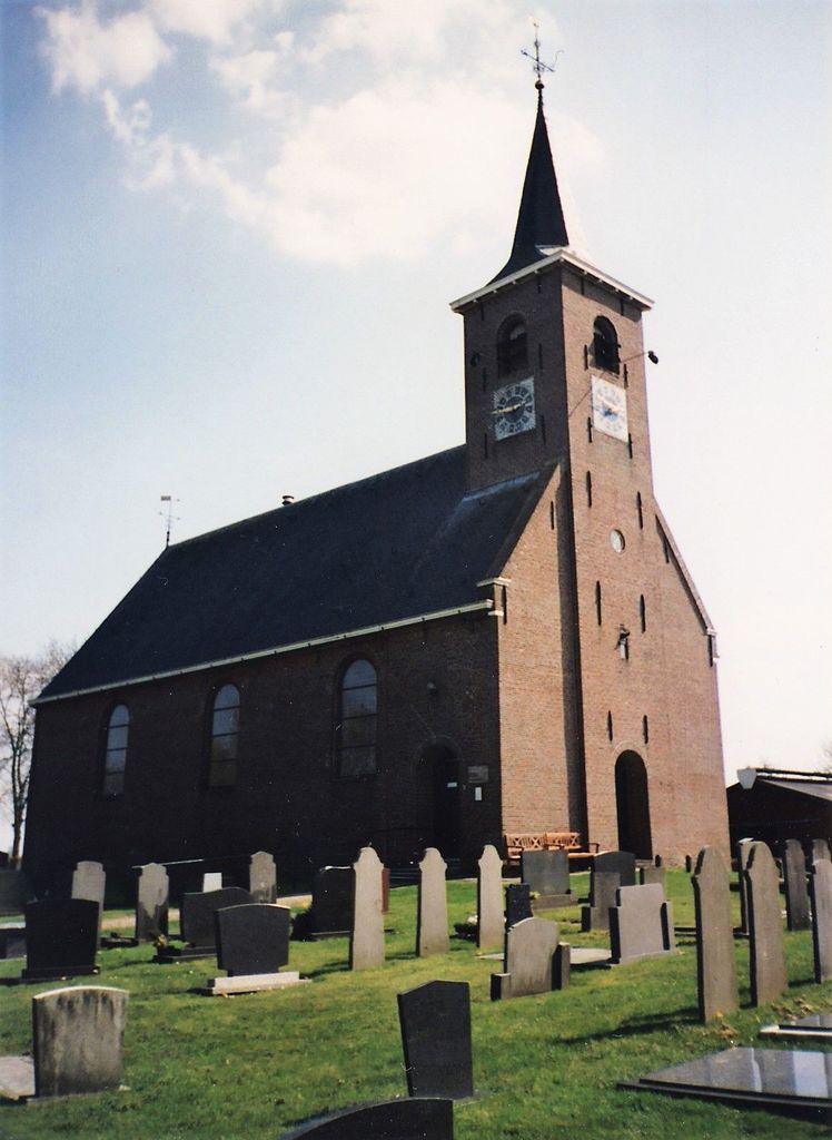
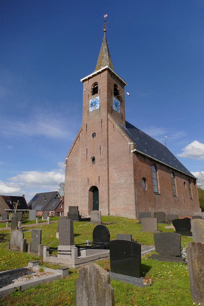
| Location | : | Rijperkerk, Tytsjerksteradiel Municipality, Netherlands |
| Coordinate | : | 53.2221200, 5.9183300 |
frequently asked questions (FAQ):
-
Where is Rijperkerk Nederlands Hervormd Kerkhof?
Rijperkerk Nederlands Hervormd Kerkhof is located at Ijpeijsingel Rijperkerk, Tytsjerksteradiel Municipality ,Friesland ,Netherlands.
-
Rijperkerk Nederlands Hervormd Kerkhof cemetery's updated grave count on graveviews.com?
0 memorials
-
Where are the coordinates of the Rijperkerk Nederlands Hervormd Kerkhof?
Latitude: 53.2221200
Longitude: 5.9183300
Nearby Cemetories:
1. Begraafplaats Sint-Vituskerk
Tytsjerk, Tytsjerksteradiel Municipality, Netherlands
Coordinate: 53.2062242, 5.9142663
2. Hoftsjerke begraafplaats
Hurdegaryp, Tytsjerksteradiel Municipality, Netherlands
Coordinate: 53.2175817, 5.9445193
3. Giekerk Martinuskerk
Giekerk, Tytsjerksteradiel Municipality, Netherlands
Coordinate: 53.2411660, 5.8785276
4. Marijetsjerke Begraafplaats
Oenkerk, Tytsjerksteradiel Municipality, Netherlands
Coordinate: 53.2537643, 5.8927362
5. It Readtsjerkje hôf
Readtsjerk, Dantumadeel Municipality, Netherlands
Coordinate: 53.2562756, 5.9332706
6. Feanwâlden Bûtefjild Cemetery
Feanwâlden, Dantumadeel Municipality, Netherlands
Coordinate: 53.2378864, 5.9815750
7. Kerkhof Nederlands Hervormde Kerk
Suwâld, Tytsjerksteradiel Municipality, Netherlands
Coordinate: 53.1791922, 5.9273043
8. Begraafplaats Aldtsjerk
Aldtsjerk, Tytsjerksteradiel Municipality, Netherlands
Coordinate: 53.2648500, 5.8887300
9. Begraafplaats te Veenwouden Cemetery
Feanwâlden, Dantumadeel Municipality, Netherlands
Coordinate: 53.2390761, 5.9921180
10. Bergum Protestant Churchyard
Bergum, Tytsjerksteradiel Municipality, Netherlands
Coordinate: 53.1958500, 6.0016300
11. Lekkum Churchyard
Lekkum, Leeuwarden Municipality, Netherlands
Coordinate: 53.2263300, 5.8194900
12. Sint-Vituskerk
Wyns, Tytsjerksteradiel Municipality, Netherlands
Coordinate: 53.2516880, 5.8322860
13. Begraafplaats Petruskerk Garyp
Garijp, Tytsjerksteradiel Municipality, Netherlands
Coordinate: 53.1668001, 5.9658672
14. Rêsthôf Broeksterwâld
Broeksterwoude, Dantumadeel Municipality, Netherlands
Coordinate: 53.2758766, 5.9907295
15. Begraafplaats De Westereen
Zwaagwesteinde, Dantumadeel Municipality, Netherlands
Coordinate: 53.2497819, 6.0273741
16. Kerkhof Hervormde Kerk Wartena
Wartena, Leeuwarden Municipality, Netherlands
Coordinate: 53.1495985, 5.8972222
17. Wartena General Cemetery
Wartena, Leeuwarden Municipality, Netherlands
Coordinate: 53.1489700, 5.8919100
18. Kerkhof Alexanderkerk Rinsumageest
Rinsumageest, Dantumadeel Municipality, Netherlands
Coordinate: 53.2959488, 5.9429579
19. Joodse begraafplaats
Leeuwarden, Leeuwarden Municipality, Netherlands
Coordinate: 53.2089720, 5.7912400
20. Akkerwoude Protestant Churchyard
Akkerwoude, Dantumadeel Municipality, Netherlands
Coordinate: 53.2909300, 5.9779800
21. Kerkhof Nederlands Hervormde kerk De Westereen
Zwaagwesteinde, Dantumadeel Municipality, Netherlands
Coordinate: 53.2583297, 6.0348107
22. Begraafplaats Zwaagwesteinde
Zwaagwesteinde, Dantumadeel Municipality, Netherlands
Coordinate: 53.2580833, 6.0351062
23. Agnestsjerke
Goutum, Leeuwarden Municipality, Netherlands
Coordinate: 53.1786867, 5.8068433
24. Damwoude General Cemetery
Damwâld, Dantumadeel Municipality, Netherlands
Coordinate: 53.2857700, 5.9996900