
| Memorials | : | 0 |
| Location | : | Cleburne County, USA |
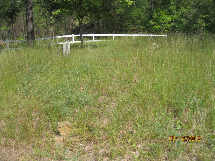
| Description | : | Township 15 Range 12 Section 29. Bengal Settlement is no longer extant; the Bengal Cemetery is the sole surviving remnant of that by-gone farming community. Generally, the cemetery is located West of the Tallapoosa River. By taking the Abernathy Exit off of Interstate 20 West, at the bottom of the egress turn left, proceeding underneath the I-20 bridge grade separation, then turn right onto Cleburne County Road 49. Continuing, take the second left paved hard-surfaced road entering onto an unnumbered road. As the pavement runs out in due course, follow on the dirt road, which extends to the narrow Tallapoosa... Read More |
frequently asked questions (FAQ):
-
Where is Bengal Cemetery?
Bengal Cemetery is located at Cleburne County, USA.
-
Bengal Cemetery cemetery's updated grave count on graveviews.com?
0 memorials
Nearby Cemetories:
1. Antioch Cemetery
Abernathy, Cleburne County, USA
Coordinate: 33.7756004, -85.5642014
2. Crossroads Cemetery
Abernathy, Cleburne County, USA
3. Harmony Primitive Baptist Church Cemetery
Abernathy, Cleburne County, USA
Coordinate: 33.5564003, -85.4068985
4. Walker Cemetery
Abernathy, Cleburne County, USA
Coordinate: 33.6342010, -85.3835983
5. Chulafinnee Baptist Church Cemetery
Chulafinnee, Cleburne County, USA
Coordinate: 33.6021996, -85.4056015
6. Chulafinnee Methodist Church Cemetery
Chulafinnee, Cleburne County, USA
Coordinate: 33.5691986, -85.4403000
7. Haywood - Oswalt Family Cemetery
Chulafinnee, Cleburne County, USA
Coordinate: 33.7991982, -85.3891983
8. Liberty Hill Methodist Church Cemetery
Chulafinnee, Cleburne County, USA
9. Ligon Family Cemetery
Chulafinnee, Cleburne County, USA
Coordinate: 33.9446983, -85.4302979
10. Macedonia Baptist Church Cemetery
Macedonia, Cleburne County, USA
Coordinate: 33.9455986, -85.4349976
11. Pleasant Grove United Methodist Church Cemetery
Macedonia, Cleburne County, USA
Coordinate: 33.9218740, -85.4745850
12. Roe Cemetery
Cleburne County, USA
Coordinate: 33.8464012, -85.5958023
13. Shoal Creek Cemetery
Cleburne County, USA
Coordinate: 33.7756004, -85.5642014
14. Slate Hill Cemetery
Cleburne County, USA
15. Crumleys Chapel Cemetery
Trickem, Cleburne County, USA
Coordinate: 33.5564003, -85.4068985
16. New Hopewell Cemetery
Trickem, Cleburne County, USA
Coordinate: 33.6342010, -85.3835983
17. Old Hopewell Cemetery
Trickem, Cleburne County, USA
Coordinate: 33.6021996, -85.4056015
18. Wise Chapel Cemetery
Trickem, Cleburne County, USA
Coordinate: 33.5691986, -85.4403000
19. Bethel Cemetery
Cleburne County, USA
Coordinate: 33.7991982, -85.3891983
20. Borden Cemetery
Borden Springs, Cleburne County, USA
21. Cherry Grove Cemetery
Borden Springs, Cleburne County, USA
Coordinate: 33.9446983, -85.4302979
22. Cherry Grove Original Church Cemetery
Borden Springs, Cleburne County, USA
Coordinate: 33.9455986, -85.4349976
23. Church of Christ Cemetery
Borden Springs, Cleburne County, USA
Coordinate: 33.9218740, -85.4745850
24. Dunn Cemetery
Cleburne County, USA
Coordinate: 33.8464012, -85.5958023