
| Memorials | : | 0 |
| Location | : | Ryan, Jefferson County, USA |
| Coordinate | : | 33.9678090, -97.9311980 |
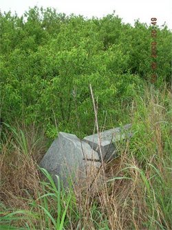
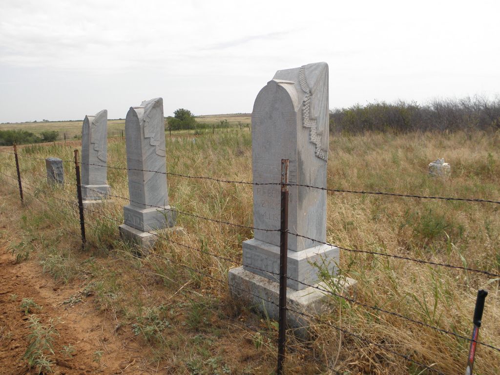
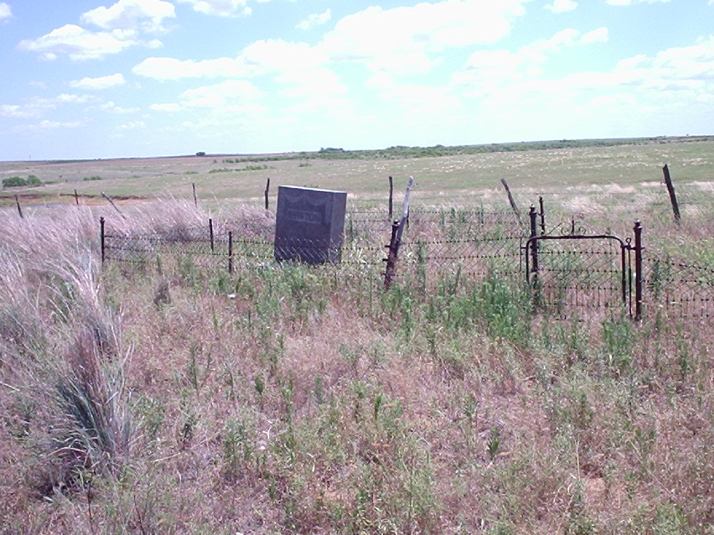
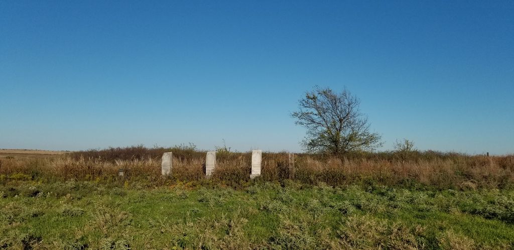
| Description | : | Abandoned cemetery six miles south of Ryan off U.S. Highway 81. From Ryan, Oklahoma, travel 6 miles south on US Hwy 81. Turn east onto dirt road(referred to locally as Shady Springs Road). Drive approximately 1/4 to 1/2 mile east, but be looking towards the south and you will be able to catch a glimpse of the old cemetery in a grass pasture about 1/4 mile off the road. It is not easy to see, so look carefully! You can leave your vehicle on the side of the road without causing any problem as it is not... Read More |
frequently asked questions (FAQ):
-
Where is Benton Cemetery?
Benton Cemetery is located at E 2100 Road Ryan, Jefferson County ,Oklahoma , 73565USA.
-
Benton Cemetery cemetery's updated grave count on graveviews.com?
0 memorials
-
Where are the coordinates of the Benton Cemetery?
Latitude: 33.9678090
Longitude: -97.9311980
Nearby Cemetories:
1. Ryan Cemetery
Ryan, Jefferson County, USA
Coordinate: 34.0102997, -97.9411011
2. Old Ryan Cemetery
Ryan, Jefferson County, USA
Coordinate: 34.0289760, -97.9743580
3. Terral Cemetery
Terral, Jefferson County, USA
Coordinate: 33.8972015, -97.9186020
4. Fleetwood Cemetery
Terral, Jefferson County, USA
Coordinate: 33.8964500, -97.8526900
5. Riverland Cemetery
Stanfield, Clay County, USA
Coordinate: 33.9836006, -98.0864029
6. Sugden Cemetery
Sugden, Jefferson County, USA
Coordinate: 34.0978012, -97.9807968
7. Oscar Cemetery
Jefferson County, USA
Coordinate: 33.9836006, -97.7455978
8. Hurnville Cemetery
Hurnville, Clay County, USA
Coordinate: 33.9708400, -98.1455470
9. Perry Grove Cemetery
Waurika, Jefferson County, USA
Coordinate: 34.1448420, -97.9766540
10. Benvanue Cemetery
Byers, Clay County, USA
Coordinate: 34.0568730, -98.1509390
11. Waurika Cemetery
Waurika, Jefferson County, USA
Coordinate: 34.1581001, -98.0314026
12. Cambridge Cemetery
Clay County, USA
Coordinate: 33.8293991, -98.1410980
13. Grady Cemetery
Jefferson County, USA
Coordinate: 34.0264015, -97.6517029
14. Riverside Cemetery
Byers, Clay County, USA
Coordinate: 34.0620000, -98.2060000
15. Petrolia Cemetery
Petrolia, Clay County, USA
Coordinate: 34.0039690, -98.2332660
16. Addington Cemetery
Addington, Jefferson County, USA
Coordinate: 34.2285995, -97.9606018
17. Hope Cemetery
Henrietta, Clay County, USA
Coordinate: 33.8200100, -98.2027500
18. Monument Hill Burial Site
Addington, Jefferson County, USA
Coordinate: 34.2453200, -97.9222600
19. Atlee Cemetery
Ringling, Jefferson County, USA
Coordinate: 34.0889015, -97.6260986
20. Cowboy Church Cemetery
Henrietta, Clay County, USA
Coordinate: 33.8038750, -98.2110310
21. Vieth Family Cemetery
Henrietta, Clay County, USA
Coordinate: 33.7425600, -98.1409500
22. Cullers Cemetery
Clay County, USA
Coordinate: 33.7263985, -98.1224976
23. Lone Star Cemetery
Hooper, Cotton County, USA
Coordinate: 34.1758080, -98.1758881
24. Smith Cemetery
McNab, Hempstead County, USA
Coordinate: 33.6820000, -98.0050000