
| Memorials | : | 0 |
| Location | : | Ryan, Jefferson County, USA |
| Coordinate | : | 34.0289760, -97.9743580 |
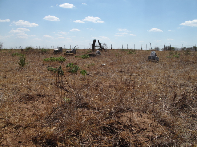
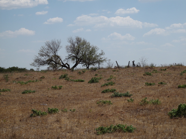
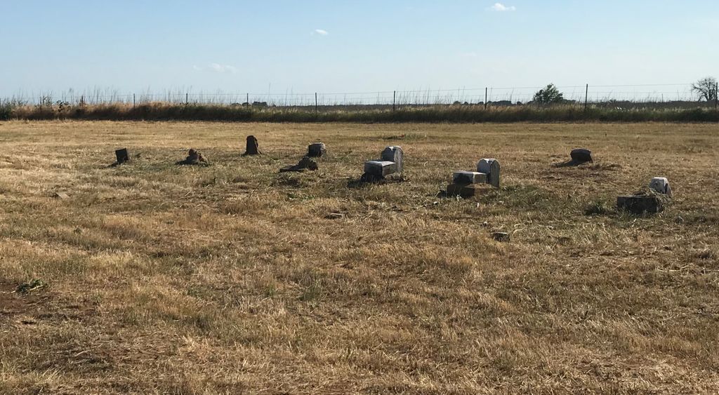
| Description | : | The old Ryan Cemetery is located on the north west side of Ryan. The cemetery does show on some county maps as a marked cross. This cemetery is out of sight of the road and is located on a ranch. It is on the east side of the crest of the hill. I did not get pictures of all the stones. There are some stones left and a number of unmarked graves. From Ryan take 32 Southwest bound to 3rd street turn right (Northwest bound) starts turn west into Main Street. Turn right on N2810 Rd,... Read More |
frequently asked questions (FAQ):
-
Where is Old Ryan Cemetery?
Old Ryan Cemetery is located at Ryan, Jefferson County ,Oklahoma ,USA.
-
Old Ryan Cemetery cemetery's updated grave count on graveviews.com?
0 memorials
-
Where are the coordinates of the Old Ryan Cemetery?
Latitude: 34.0289760
Longitude: -97.9743580
Nearby Cemetories:
1. Ryan Cemetery
Ryan, Jefferson County, USA
Coordinate: 34.0102997, -97.9411011
2. Sugden Cemetery
Sugden, Jefferson County, USA
Coordinate: 34.0978012, -97.9807968
3. Benton Cemetery
Ryan, Jefferson County, USA
Coordinate: 33.9678090, -97.9311980
4. Riverland Cemetery
Stanfield, Clay County, USA
Coordinate: 33.9836006, -98.0864029
5. Perry Grove Cemetery
Waurika, Jefferson County, USA
Coordinate: 34.1448420, -97.9766540
6. Waurika Cemetery
Waurika, Jefferson County, USA
Coordinate: 34.1581001, -98.0314026
7. Terral Cemetery
Terral, Jefferson County, USA
Coordinate: 33.8972015, -97.9186020
8. Benvanue Cemetery
Byers, Clay County, USA
Coordinate: 34.0568730, -98.1509390
9. Hurnville Cemetery
Hurnville, Clay County, USA
Coordinate: 33.9708400, -98.1455470
10. Fleetwood Cemetery
Terral, Jefferson County, USA
Coordinate: 33.8964500, -97.8526900
11. Riverside Cemetery
Byers, Clay County, USA
Coordinate: 34.0620000, -98.2060000
12. Oscar Cemetery
Jefferson County, USA
Coordinate: 33.9836006, -97.7455978
13. Addington Cemetery
Addington, Jefferson County, USA
Coordinate: 34.2285995, -97.9606018
14. Petrolia Cemetery
Petrolia, Clay County, USA
Coordinate: 34.0039690, -98.2332660
15. Monument Hill Burial Site
Addington, Jefferson County, USA
Coordinate: 34.2453200, -97.9222600
16. Lone Star Cemetery
Hooper, Cotton County, USA
Coordinate: 34.1758080, -98.1758881
17. Hastings Cemetery
Hastings, Jefferson County, USA
Coordinate: 34.2380981, -98.1232986
18. Cambridge Cemetery
Clay County, USA
Coordinate: 33.8293991, -98.1410980
19. Grady Cemetery
Jefferson County, USA
Coordinate: 34.0264015, -97.6517029
20. Hope Cemetery
Henrietta, Clay County, USA
Coordinate: 33.8200100, -98.2027500
21. Charlie Cemetery
Charlie, Clay County, USA
Coordinate: 34.0858000, -98.3211050
22. Atlee Cemetery
Ringling, Jefferson County, USA
Coordinate: 34.0889015, -97.6260986
23. Cowboy Church Cemetery
Henrietta, Clay County, USA
Coordinate: 33.8038750, -98.2110310
24. Diamond Cemetery
Stephens County, USA
Coordinate: 34.3319016, -98.0550003