| Memorials | : | 8 |
| Location | : | Liberty Township, Adams County, USA |
| Coordinate | : | 38.8058014, -83.6528015 |
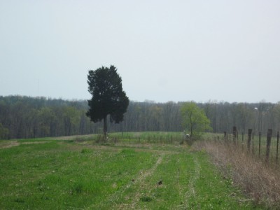
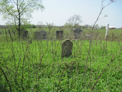
| Description | : | Traveling west on Rt 125 just after Brier Ridge Road on the left. Drive through the field along the fence line about 100 yards. Surrounded by barb wire fence. You can see the cemetery from Brier Ridge Road but not Rt 125. The cemetery is located in Bissinger Township, Adams County, Ohio, and is # 13147 (Bissinger Cemetery) in “Ohio Cemeteries 1803-2003”, compiled by the Ohio Genealogical Society. The U.S. Geological Survey (USGS) Geographic Names Information System (GNIS) feature ID for the cemetery is 1038065 (Bissinger Cemetery). |
frequently asked questions (FAQ):
-
Where is Bissinger Cemetery?
Bissinger Cemetery is located at Ohio State Route 125 Liberty Township, Adams County ,Ohio , 45693USA.
-
Bissinger Cemetery cemetery's updated grave count on graveviews.com?
8 memorials
-
Where are the coordinates of the Bissinger Cemetery?
Latitude: 38.8058014
Longitude: -83.6528015
Nearby Cemetories:
1. Brier Ridge Cemetery
Bentonville, Adams County, USA
Coordinate: 38.7786800, -83.6712500
2. Decatur Cemetery
Decatur, Brown County, USA
Coordinate: 38.8181000, -83.7011032
3. Smith Cemetery
Liberty Township, Adams County, USA
Coordinate: 38.7963620, -83.5934450
4. Kirker Cemetery
West Union, Adams County, USA
Coordinate: 38.7783012, -83.6027985
5. Lepley Family Cemetery
Liberty Township, Adams County, USA
Coordinate: 38.8375300, -83.5995300
6. Eckman Cemetery
Decatur, Brown County, USA
Coordinate: 38.8453903, -83.7043152
7. Woods Cemetery
Ripley, Brown County, USA
Coordinate: 38.7789001, -83.7225037
8. Hopewell Cemetery
Sprigg Township, Adams County, USA
Coordinate: 38.7432070, -83.6508880
9. Liberty Chapel Cemetery
Decatur, Brown County, USA
Coordinate: 38.8171997, -83.7350006
10. Evans Cemetery
Decatur, Brown County, USA
Coordinate: 38.8177470, -83.7354080
11. Reeves Cemetery
Decatur, Brown County, USA
Coordinate: 38.7913780, -83.7370450
12. West-Evans Cemetery
Russellville, Brown County, USA
Coordinate: 38.8332750, -83.7333830
13. Bentonville Union Church Cemetery
Bentonville, Adams County, USA
Coordinate: 38.7422500, -83.6193700
14. Hale Cemetery
West Union, Adams County, USA
Coordinate: 38.7753320, -83.5715390
15. Hickory Ridge Cemetery
Aberdeen, Brown County, USA
Coordinate: 38.7510986, -83.7127991
16. Adams County Poor Farm Cemetery
West Union, Adams County, USA
Coordinate: 38.7777050, -83.5673500
17. Pence Cemetery
Manchester, Adams County, USA
Coordinate: 38.7279100, -83.6582900
18. Cherry Fork Cemetery
Cherry Fork, Adams County, USA
Coordinate: 38.8795900, -83.6152900
19. Lee-Armstrong Cemetery
West Union, Adams County, USA
Coordinate: 38.7921100, -83.5482200
20. West Union Village Cemetery
West Union, Adams County, USA
Coordinate: 38.7889300, -83.5482400
21. Reeves Family Cemetery
Redoak, Brown County, USA
Coordinate: 38.7961000, -83.7608300
22. Nixon Chapel Cemetery
Tiffin Township, Adams County, USA
Coordinate: 38.7618880, -83.5593530
23. Collings Family Cemetery
West Union, Adams County, USA
Coordinate: 38.7853800, -83.5462500
24. Oak Grove Church Cemetery
West Union, Adams County, USA
Coordinate: 38.8451200, -83.5541000


