
| Memorials | : | 2 |
| Location | : | Harmony Township, Morrow County, USA |
| Coordinate | : | 40.4964500, -82.7482300 |
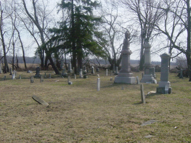
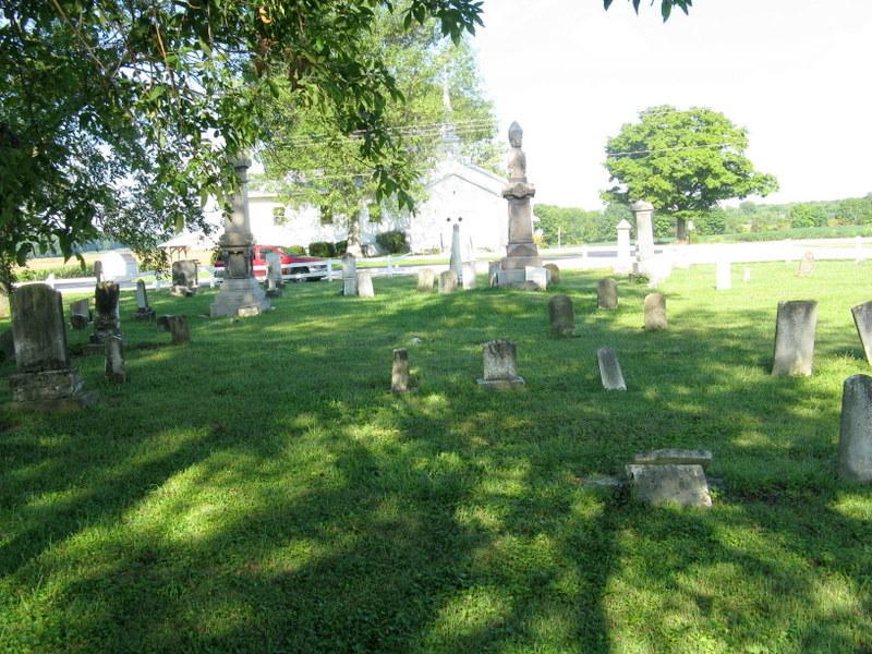
| Description | : | Blackbird M. E./ Harmony Chapel Cemetery is across from the Methodist Church in Harmony Twp. on County Road 20. The cemetery is located on the east side of Williamsport-Bloomingrove Road (County Road 20) at its intersection with Blackbird Road (County Road 123). The cemetery is located in Harmony Township, Morrow County, Ohio, and is # 8660 (Blackbird Methodist Episcopal Church Cemetery / Harmony Chapel Cemetery) in “Ohio Cemeteries 1803-2003”, compiled by the Ohio Genealogical Society. The U.S. Geological Survey (USGS) Geographic Names Information System (GNIS) feature ID for the cemetery is 1963213 (Harmony Chapel Cemetery / Blackbird Methodist... Read More |
frequently asked questions (FAQ):
-
Where is Blackbird Methodist Episcopal Church Cemetery?
Blackbird Methodist Episcopal Church Cemetery is located at Blackbird Road (County Road 123) and Williamsport-Bloomingrove Road (County Road 20). Harmony Township, Morrow County ,Ohio , 43338USA.
-
Blackbird Methodist Episcopal Church Cemetery cemetery's updated grave count on graveviews.com?
2 memorials
-
Where are the coordinates of the Blackbird Methodist Episcopal Church Cemetery?
Latitude: 40.4964500
Longitude: -82.7482300
Nearby Cemetories:
1. George Family Cemetery
Franklin Township, Morrow County, USA
Coordinate: 40.5164420, -82.7447810
2. Kenney Cemetery
Cardington, Morrow County, USA
Coordinate: 40.4895048, -82.7879549
3. Kelly Family Cemetery #2
Chesterville, Morrow County, USA
Coordinate: 40.5328050, -82.7670350
4. Pulaskiville Cemetery
Pulaskiville, Morrow County, USA
Coordinate: 40.5356200, -82.7112900
5. Chesterville Methodist Episcopal Cemetery
Chesterville, Morrow County, USA
Coordinate: 40.4798000, -82.6799780
6. Chesterville Presbyterian Cemetery
Chesterville, Morrow County, USA
Coordinate: 40.4798000, -82.6799780
7. Maple Grove Cemetery
Chesterville, Morrow County, USA
Coordinate: 40.4761009, -82.6782990
8. Center Corners Cemetery
Chesterville, Morrow County, USA
Coordinate: 40.5030000, -82.6725600
9. Buck Cemetery
Fulton, Morrow County, USA
Coordinate: 40.4813995, -82.8221970
10. Asbury Cemetery
Fulton, Morrow County, USA
Coordinate: 40.4812910, -82.8223880
11. Chester Baptist Cemetery
Morrow County, USA
Coordinate: 40.4483900, -82.6979500
12. Bryn Zion Cemetery
Mount Gilead, Morrow County, USA
Coordinate: 40.5567300, -82.7682300
13. Yankee Street Presbyterian Cemetery
Chesterville, Morrow County, USA
Coordinate: 40.5192270, -82.6690611
14. Quakerdom Cemetery
Mount Gilead, Morrow County, USA
Coordinate: 40.5167269, -82.8354570
15. Biggs Cemetery
Marengo, Morrow County, USA
Coordinate: 40.4328003, -82.7850037
16. Fulton Cemetery
Fulton, Morrow County, USA
Coordinate: 40.4625600, -82.8349000
17. Union Cemetery
Morrow County, USA
Coordinate: 40.5158900, -82.8426800
18. Rivercliff Cemetery
Mount Gilead, Morrow County, USA
Coordinate: 40.5475006, -82.8225021
19. Old Mount Gilead Presbyterian Cemetery
Mount Gilead, Morrow County, USA
Coordinate: 40.5459600, -82.8283300
20. Bethel Cemetery
Chesterville, Morrow County, USA
Coordinate: 40.4236723, -82.6998950
21. Morrow County Home Cemetery
Mount Gilead, Morrow County, USA
Coordinate: 40.5658770, -82.8065160
22. Hexsite Cemetery
Morrow County, USA
Coordinate: 40.5168991, -82.8550034
23. Sunfish Cemetery
Mount Gilead, Morrow County, USA
Coordinate: 40.5741000, -82.7964300
24. Mosher Cemetery
Morrow County, USA
Coordinate: 40.5155983, -82.8613968