
| Memorials | : | 0 |
| Location | : | Overveen, Bloemendaal Municipality, Netherlands |
| Coordinate | : | 52.4010500, 4.5759500 |
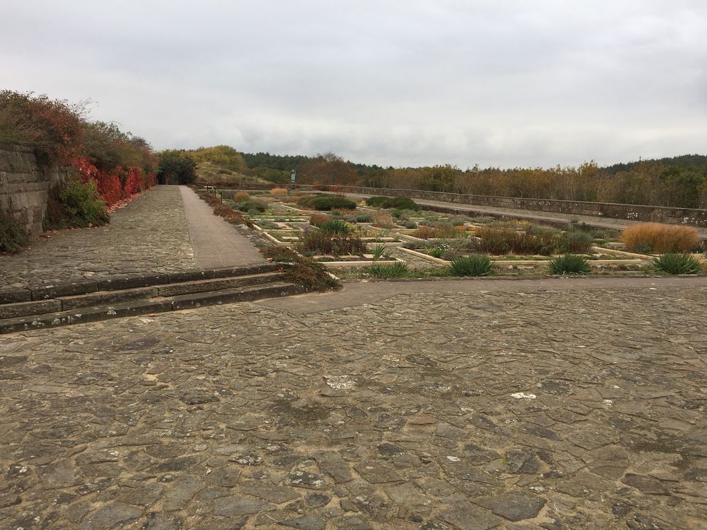
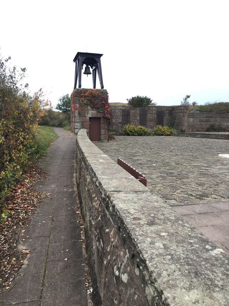
| Description | : | In 1945 it was decided a cemetery would be planned to honor the 372 World War II Dutch Resistance fighters who were killed by the invading Nazi army in the dunes near the village of Overveer. A total of 422 remains were found in the dunes but only 347 were actually reburied in the cemetery. The rest were taken to family plots elsewhere. The first reburial was Hannie Schaft on November 27, 1945 and her funeral was attended by Dutch royalty. The architecturally designed cemetery was completed on October 31, 1953 with the last reburial on December 9, 1955. Alternate... Read More |
frequently asked questions (FAQ):
-
Where is Bloemendaal Erebegraafplaats?
Bloemendaal Erebegraafplaats is located at Overveen, Bloemendaal Municipality ,Noord-Holland ,Netherlands.
-
Bloemendaal Erebegraafplaats cemetery's updated grave count on graveviews.com?
0 memorials
-
Where are the coordinates of the Bloemendaal Erebegraafplaats?
Latitude: 52.4010500
Longitude: 4.5759500


Nearby Cemetories:
1. Joodse Begraafplaats Duinland
Overveen, Bloemendaal Municipality, Netherlands
Coordinate: 52.3913000, 4.5989100
2. Bloemendaal General Cemetery
Bloemendaal, Bloemendaal Municipality, Netherlands
Coordinate: 52.4165100, 4.6121900
3. Joodse Begraafplaats Provinciaal Ziekenhuis Santpoort
Bloemendaal, Bloemendaal Municipality, Netherlands
Coordinate: 52.4181100, 4.6160400
4. Bloemendaal Sint Adelbertus Catholic Churchyard
Bloemendaal, Bloemendaal Municipality, Netherlands
Coordinate: 52.4112900, 4.6229100
5. Zandvoort Algemene Begraafplaats
Zandvoort, Zandvoort Municipality, Netherlands
Coordinate: 52.3758300, 4.5428200
6. Haarlem General Cemetery
Haarlem, Haarlem Municipality, Netherlands
Coordinate: 52.3948100, 4.6388300
7. Algemene Begraafplaats Kleverlaan
Haarlem Municipality, Netherlands
Coordinate: 52.3950000, 4.6389500
8. Joodse begraafplaats Kleverlaan
Haarlem, Haarlem Municipality, Netherlands
Coordinate: 52.3957320, 4.6397830
9. Haarlem Sint-Barbarabegraafplaats
Haarlem, Haarlem Municipality, Netherlands
Coordinate: 52.3988200, 4.6437400
10. Sint-Bavokerk
Haarlem, Haarlem Municipality, Netherlands
Coordinate: 52.3810680, 4.6372160
11. R.K.Kerkhof St. Bavo Berkenrode
Heemstede Municipality, Netherlands
Coordinate: 52.3522584, 4.6141497
12. Begraafplaats Duinhof
IJmuiden, Velsen Municipality, Netherlands
Coordinate: 52.4464790, 4.6244280
13. Akendam Cemetery
Haarlem, Haarlem Municipality, Netherlands
Coordinate: 52.4233700, 4.6574200
14. Begraafplaats & Crematorium Westerveld
Driehuis, Velsen Municipality, Netherlands
Coordinate: 52.4447200, 4.6315700
15. RC Cemetery Sint Jozef
Haarlem, Haarlem Municipality, Netherlands
Coordinate: 52.4232440, 4.6612690
16. Driehuis Velsen Crematorium
Driehuis, Velsen Municipality, Netherlands
Coordinate: 52.4478360, 4.6308560
17. Joodse begraafplaats Amsterdamsevaart
Haarlem, Haarlem Municipality, Netherlands
Coordinate: 52.3818800, 4.6663620
18. Ijmuiden Western Cemetery
IJmuiden, Velsen Municipality, Netherlands
Coordinate: 52.4593400, 4.6000500
19. Heemstede Algemene Begraafplaats
Heemstede, Heemstede Municipality, Netherlands
Coordinate: 52.3406700, 4.6197700
20. Spaarnwoude Cemetery
Spaarnwoude, Haarlemmerliede en Spaarnwoude Municipality, Netherlands
Coordinate: 52.4045521, 4.6939543
21. Vijfhuizen Jewish monument
Vijfhuizen, Haarlemmermeer Municipality, Netherlands
Coordinate: 52.3526102, 4.6795842
22. Rooms-Katholiek Kerkhof Sint Jozefkerk
Bennebroek, Bloemendaal Municipality, Netherlands
Coordinate: 52.3199979, 4.6008174
23. Algemene Begraafplaats De Meerterpen
Zwaanshoek, Haarlemmermeer Municipality, Netherlands
Coordinate: 52.3150382, 4.6199667
24. Wijk aan zee Protestant Cemetery
Wijk aan Zee, Beverwijk Municipality, Netherlands
Coordinate: 52.4920400, 4.5913800