
| Memorials | : | 0 |
| Location | : | Bloemendaal, Bloemendaal Municipality, Netherlands |
| Coordinate | : | 52.4112900, 4.6229100 |
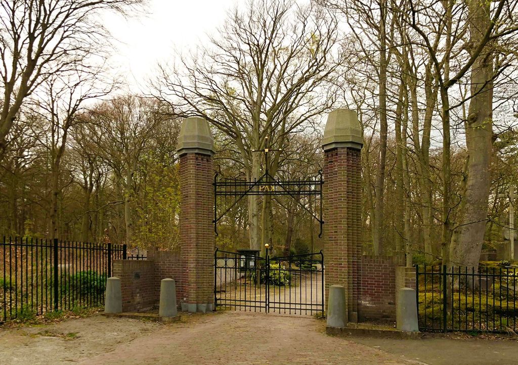
| Description | : | Bloemendaal is 5 kilometres north west of Haarlem, and 2 kilometres west of the main Haarlem-Alkmaar road. The cemetery is on the northern outskirts of the town, at the end of the road called Dennenweg. |
frequently asked questions (FAQ):
-
Where is Bloemendaal Sint Adelbertus Catholic Churchyard?
Bloemendaal Sint Adelbertus Catholic Churchyard is located at Dennenweg Bloemendaal, Bloemendaal Municipality ,Noord-Holland ,Netherlands.
-
Bloemendaal Sint Adelbertus Catholic Churchyard cemetery's updated grave count on graveviews.com?
0 memorials
-
Where are the coordinates of the Bloemendaal Sint Adelbertus Catholic Churchyard?
Latitude: 52.4112900
Longitude: 4.6229100

Nearby Cemetories:
1. Joodse Begraafplaats Provinciaal Ziekenhuis Santpoort
Bloemendaal, Bloemendaal Municipality, Netherlands
Coordinate: 52.4181100, 4.6160400
2. Bloemendaal General Cemetery
Bloemendaal, Bloemendaal Municipality, Netherlands
Coordinate: 52.4165100, 4.6121900
3. Haarlem Sint-Barbarabegraafplaats
Haarlem, Haarlem Municipality, Netherlands
Coordinate: 52.3988200, 4.6437400
4. Joodse begraafplaats Kleverlaan
Haarlem, Haarlem Municipality, Netherlands
Coordinate: 52.3957320, 4.6397830
5. Algemene Begraafplaats Kleverlaan
Haarlem Municipality, Netherlands
Coordinate: 52.3950000, 4.6389500
6. Haarlem General Cemetery
Haarlem, Haarlem Municipality, Netherlands
Coordinate: 52.3948100, 4.6388300
7. Akendam Cemetery
Haarlem, Haarlem Municipality, Netherlands
Coordinate: 52.4233700, 4.6574200
8. Joodse Begraafplaats Duinland
Overveen, Bloemendaal Municipality, Netherlands
Coordinate: 52.3913000, 4.5989100
9. RC Cemetery Sint Jozef
Haarlem, Haarlem Municipality, Netherlands
Coordinate: 52.4232440, 4.6612690
10. Bloemendaal Erebegraafplaats
Overveen, Bloemendaal Municipality, Netherlands
Coordinate: 52.4010500, 4.5759500
11. Sint-Bavokerk
Haarlem, Haarlem Municipality, Netherlands
Coordinate: 52.3810680, 4.6372160
12. Begraafplaats & Crematorium Westerveld
Driehuis, Velsen Municipality, Netherlands
Coordinate: 52.4447200, 4.6315700
13. Begraafplaats Duinhof
IJmuiden, Velsen Municipality, Netherlands
Coordinate: 52.4464790, 4.6244280
14. Driehuis Velsen Crematorium
Driehuis, Velsen Municipality, Netherlands
Coordinate: 52.4478360, 4.6308560
15. Joodse begraafplaats Amsterdamsevaart
Haarlem, Haarlem Municipality, Netherlands
Coordinate: 52.3818800, 4.6663620
16. Spaarnwoude Cemetery
Spaarnwoude, Haarlemmerliede en Spaarnwoude Municipality, Netherlands
Coordinate: 52.4045521, 4.6939543
17. Ijmuiden Western Cemetery
IJmuiden, Velsen Municipality, Netherlands
Coordinate: 52.4593400, 4.6000500
18. R.K.Kerkhof St. Bavo Berkenrode
Heemstede Municipality, Netherlands
Coordinate: 52.3522584, 4.6141497
19. Zandvoort Algemene Begraafplaats
Zandvoort, Zandvoort Municipality, Netherlands
Coordinate: 52.3758300, 4.5428200
20. Vijfhuizen Jewish monument
Vijfhuizen, Haarlemmermeer Municipality, Netherlands
Coordinate: 52.3526102, 4.6795842
21. Heemstede Algemene Begraafplaats
Heemstede, Heemstede Municipality, Netherlands
Coordinate: 52.3406700, 4.6197700
22. Zwanenburg Algemene Begraafplaats
Zwanenburg, Haarlemmermeer Municipality, Netherlands
Coordinate: 52.3769900, 4.7449800
23. Begraafplaats Houtrijk en Polanen
Zwanenburg, Haarlemmermeer Municipality, Netherlands
Coordinate: 52.3769720, 4.7453060
24. Beverwijk General Cemetery
Beverwijk, Beverwijk Municipality, Netherlands
Coordinate: 52.4932300, 4.6370000