
| Memorials | : | 10 |
| Location | : | Deerfield, Franklin County, USA |
| Coordinate | : | 42.4819700, -72.6038600 |
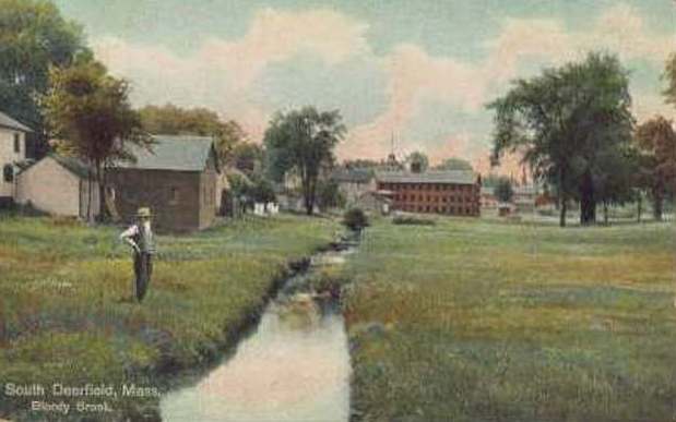
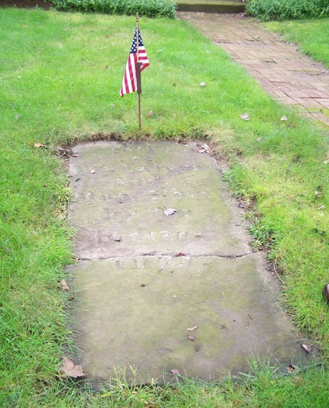
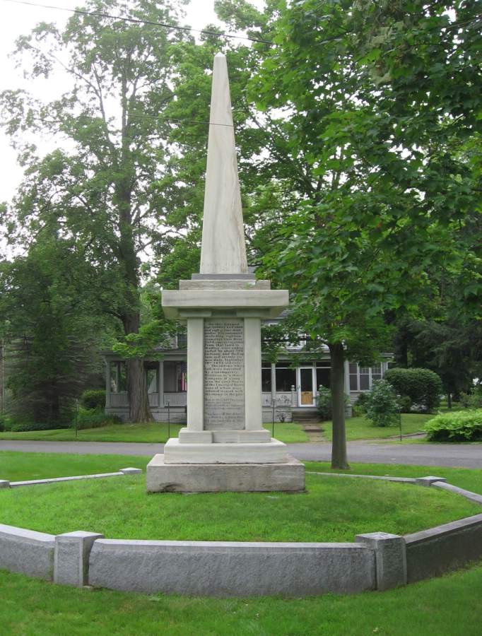
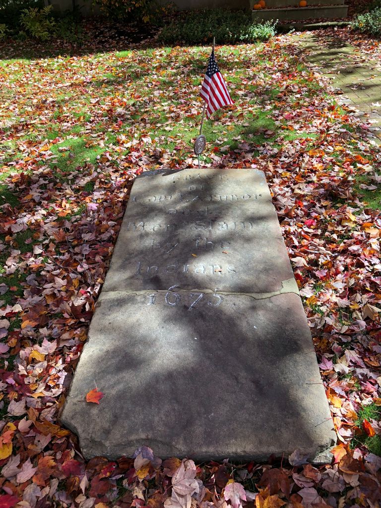
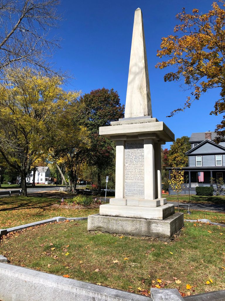
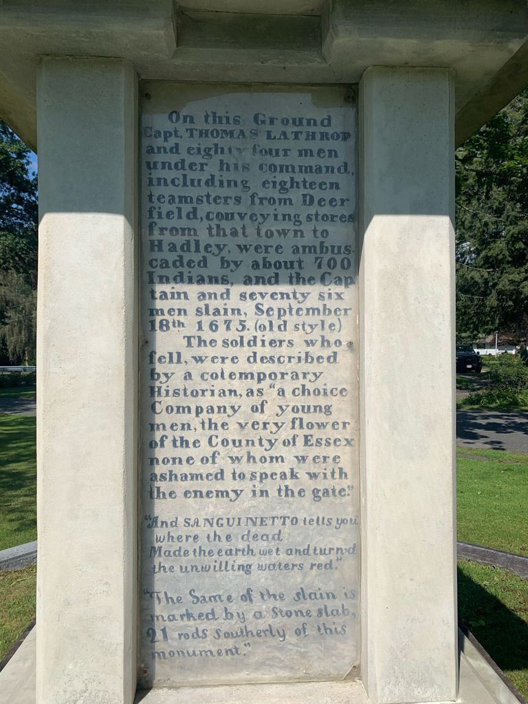
| Description | : | The slab that marks the mass grave is about 400 feet south of the monument that memorializes the event. The Massachusetts Historical Commission does not refer to this mass grave in MACRIS. The Battle of Bloody Brook took place during King Philip's War, a conflict between certain Native American tribes and colonists in New England in 1675 and 1676. The conflict is named for King Philip, also called Metacomet, chief of the Wampanoag. He was one of several Native American leaders who led warriors from various tribes. The war was touched off by the killing of a John Sassamon, a liaision... Read More |
frequently asked questions (FAQ):
-
Where is Bloody Brook Mass Grave?
Bloody Brook Mass Grave is located at North Main Street Deerfield, Franklin County ,Massachusetts ,USA.
-
Bloody Brook Mass Grave cemetery's updated grave count on graveviews.com?
10 memorials
-
Where are the coordinates of the Bloody Brook Mass Grave?
Latitude: 42.4819700
Longitude: -72.6038600
Nearby Cemetories:
1. Sugarloaf Street Cemetery
South Deerfield, Franklin County, USA
Coordinate: 42.4762800, -72.6071500
2. Holy Name of Jesus Cemetery
Deerfield, Franklin County, USA
Coordinate: 42.4706800, -72.6071300
3. Saint Stanislaus Cemetery
Deerfield, Franklin County, USA
Coordinate: 42.4707985, -72.6082993
4. Brookside Cemetery
Deerfield, Franklin County, USA
Coordinate: 42.4707985, -72.6106033
5. Holy Ghost Ukrainian Catholic Cemetery
Whately, Franklin County, USA
Coordinate: 42.4639015, -72.6097031
6. Ward Cemetery
Deerfield, Franklin County, USA
Coordinate: 42.4806700, -72.5774600
7. Riverside Cemetery
Sunderland, Franklin County, USA
Coordinate: 42.4611015, -72.5864029
8. Mill River Cemetery
Deerfield, Franklin County, USA
Coordinate: 42.5011890, -72.6377770
9. East Whately Cemetery
Whately, Franklin County, USA
Coordinate: 42.4446983, -72.5994034
10. Pine Nook Cemetery
Deerfield, Franklin County, USA
Coordinate: 42.5086300, -72.5661400
11. North Sunderland Cemetery
Sunderland, Franklin County, USA
Coordinate: 42.4972000, -72.5492020
12. Center Cemetery
Whately, Franklin County, USA
Coordinate: 42.4431000, -72.6363983
13. Boyden Cemetery
Conway, Franklin County, USA
Coordinate: 42.4832993, -72.6667023
14. South Part Cemetery
Conway, Franklin County, USA
Coordinate: 42.4625015, -72.6707993
15. David L Scott Gravesite
Whately, Franklin County, USA
Coordinate: 42.4315660, -72.6290920
16. Savage Farm Cemetery
Deerfield, Franklin County, USA
Coordinate: 42.5336700, -72.6245300
17. Laurel Hill Cemetery
Deerfield, Franklin County, USA
Coordinate: 42.5416670, -72.5973020
18. Old Deerfield Burying Ground
Deerfield, Franklin County, USA
Coordinate: 42.5449982, -72.6097031
19. Mount Toby Cemetery
Leverett, Franklin County, USA
Coordinate: 42.4894810, -72.5174400
20. Old South Cemetery
Montague, Franklin County, USA
Coordinate: 42.5232500, -72.5360300
21. Russellville Cemetery
Hadley, Hampshire County, USA
Coordinate: 42.4199982, -72.5755997
22. Long Plain Cemetery
Leverett, Franklin County, USA
Coordinate: 42.4510994, -72.5250015
23. Bradstreet Cemetery
Hatfield, Hampshire County, USA
Coordinate: 42.4108467, -72.5941238
24. South Centre Cemetery
Conway, Franklin County, USA
Coordinate: 42.5015940, -72.6973490