
| Memorials | : | 9 |
| Location | : | Leverett, Franklin County, USA |
| Coordinate | : | 42.4894810, -72.5174400 |
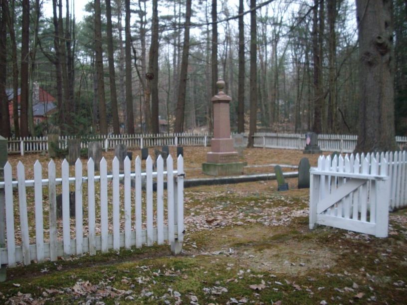
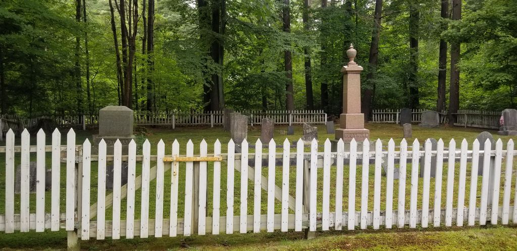
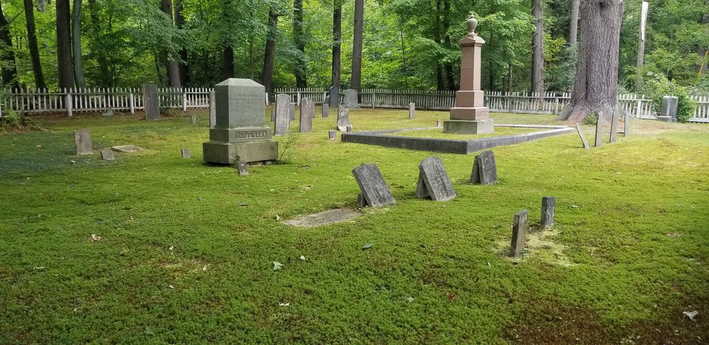
| Description | : | This cemetery is owned and operated by the Leverett Cemetery Association. The Massachusetts Historical Commission does not refer to this cemetery in MACRIS. |
frequently asked questions (FAQ):
-
Where is Mount Toby Cemetery?
Mount Toby Cemetery is located at Long Plain Road (Route 63) Leverett, Franklin County ,Massachusetts ,USA.
-
Mount Toby Cemetery cemetery's updated grave count on graveviews.com?
9 memorials
-
Where are the coordinates of the Mount Toby Cemetery?
Latitude: 42.4894810
Longitude: -72.5174400
Nearby Cemetories:
1. Marvell Cemetery
Leverett, Franklin County, USA
Coordinate: 42.5028000, -72.5042038
2. Jackson Hill Cemetery
Leverett, Franklin County, USA
Coordinate: 42.5028000, -72.5028000
3. North Sunderland Cemetery
Sunderland, Franklin County, USA
Coordinate: 42.4972000, -72.5492020
4. North Cemetery
Leverett, Franklin County, USA
Coordinate: 42.4673720, -72.4983230
5. Mount Hope Cemetery
Leverett, Franklin County, USA
Coordinate: 42.5111008, -72.4906006
6. Plain View Cemetery
Leverett, Franklin County, USA
Coordinate: 42.4972100, -72.4751900
7. Moores Corner Cemetery
Leverett, Franklin County, USA
Coordinate: 42.4924200, -72.4730700
8. Old South Cemetery
Montague, Franklin County, USA
Coordinate: 42.5232500, -72.5360300
9. Long Plain Cemetery
Leverett, Franklin County, USA
Coordinate: 42.4510994, -72.5250015
10. Pine Nook Cemetery
Deerfield, Franklin County, USA
Coordinate: 42.5086300, -72.5661400
11. Patrick Cemetery
Leverett, Franklin County, USA
Coordinate: 42.4995800, -72.4619500
12. Chestnut Hill Cemetery
Montague, Franklin County, USA
Coordinate: 42.5228004, -72.4822006
13. Ward Cemetery
Deerfield, Franklin County, USA
Coordinate: 42.4806700, -72.5774600
14. Gardner Cemetery
Leverett, Franklin County, USA
Coordinate: 42.5036011, -72.4574966
15. Locust Hill Cemetery
Montague, Franklin County, USA
Coordinate: 42.5394700, -72.5363400
16. Elm Grove Cemetery
Montague, Franklin County, USA
Coordinate: 42.5418600, -72.5359000
17. Riverside Cemetery
Sunderland, Franklin County, USA
Coordinate: 42.4611015, -72.5864029
18. East Leverett Cemetery
Leverett, Franklin County, USA
Coordinate: 42.4357224, -72.4857788
19. Locks Village Cemetery
Shutesbury, Franklin County, USA
Coordinate: 42.5010200, -72.4364000
20. Wiley Cemetery
Leverett, Franklin County, USA
Coordinate: 42.4290200, -72.5304200
21. Bloody Brook Mass Grave
Deerfield, Franklin County, USA
Coordinate: 42.4819700, -72.6038600
22. Sugarloaf Street Cemetery
South Deerfield, Franklin County, USA
Coordinate: 42.4762800, -72.6071500
23. Holy Name of Jesus Cemetery
Deerfield, Franklin County, USA
Coordinate: 42.4706800, -72.6071300
24. Saint Stanislaus Cemetery
Deerfield, Franklin County, USA
Coordinate: 42.4707985, -72.6082993