
| Memorials | : | 0 |
| Location | : | Ice, Letcher County, USA |
| Coordinate | : | 37.1180300, -82.8745700 |
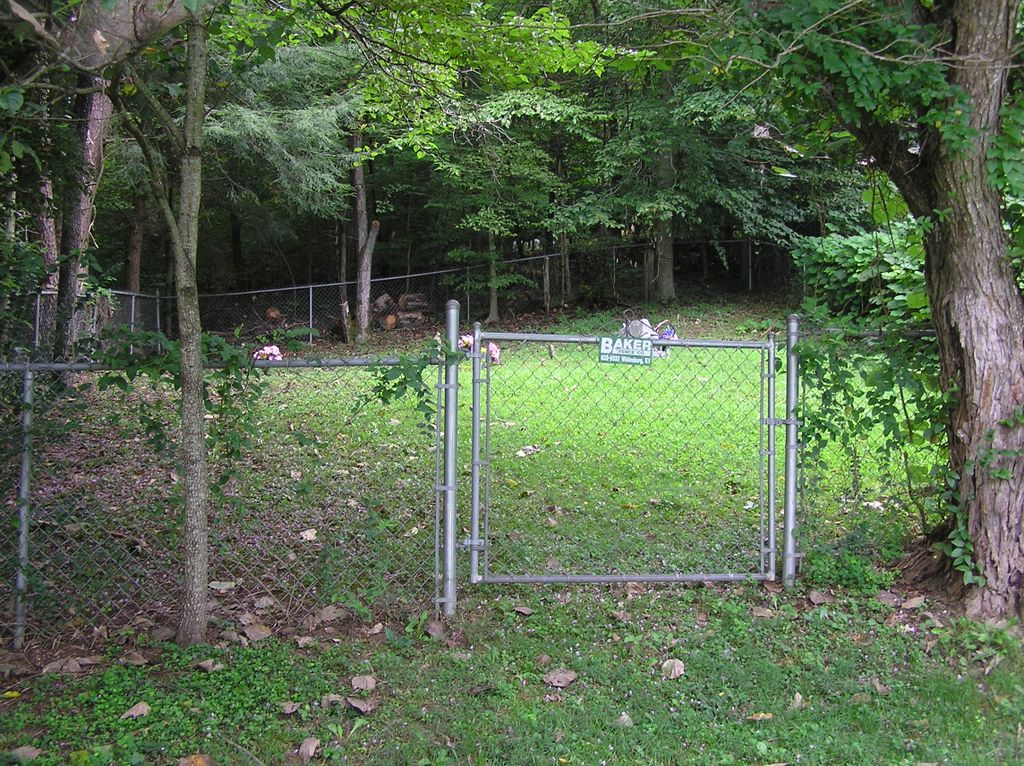
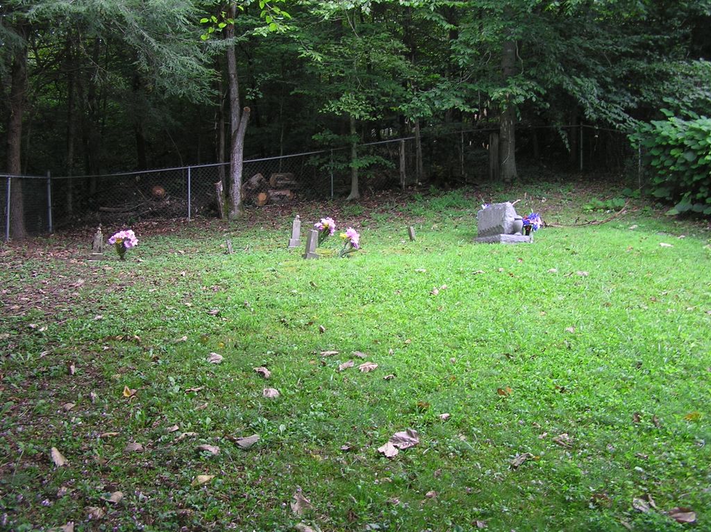
| Description | : | The Boatwright Cemetery, near the mouth of Dry Fork, is a small family cemetery located off of highway 588, just south of Dry Fork. The cemetery has a chainlink fence around it and only contains five graves. Directions: Take highway 15, just north of Whitesburg, to road 3401. Turn left on road 3401 and travel westward along Dry Fork for about 0.8 miles to highway 588. Turn left on highway 588 and head southward for about 0.25 miles; the cemetery is located on the hill off to the left (not normally visible coming from this direction because of trees and... Read More |
frequently asked questions (FAQ):
-
Where is Boatwright Cemetery?
Boatwright Cemetery is located at Dry Fork Ice, Letcher County ,Kentucky ,USA.
-
Boatwright Cemetery cemetery's updated grave count on graveviews.com?
0 memorials
-
Where are the coordinates of the Boatwright Cemetery?
Latitude: 37.1180300
Longitude: -82.8745700
Nearby Cemetories:
1. Boney Banks Cemetery
Ice, Letcher County, USA
Coordinate: 37.1167280, -82.8712130
2. Peaceful Hills Cemetery
Ice, Letcher County, USA
Coordinate: 37.1143890, -82.8666670
3. Combs Cemetery
Letcher County, USA
Coordinate: 37.1411018, -82.8814011
4. Campbell Cemetery
Crown, Letcher County, USA
Coordinate: 37.1388780, -82.8596650
5. Kingdom Come Cemetery
Letcher County, USA
Coordinate: 37.1134640, -82.9084490
6. Frazier Cemetery
Letcher County, USA
Coordinate: 37.1275300, -82.9182900
7. Cowan Creek Cemetery
Letcher County, USA
Coordinate: 37.0916800, -82.8408700
8. Nancy Jane Whitaker Cemetery
Hot Spot, Letcher County, USA
Coordinate: 37.1490040, -82.9046020
9. Stamper Cemetery
Kings Creek, Letcher County, USA
Coordinate: 37.0947200, -82.9231300
10. Fields Cemetery
Dongola, Letcher County, USA
Coordinate: 37.0932270, -82.8220650
11. Blair Cemetery
Jeremiah, Letcher County, USA
Coordinate: 37.1592830, -82.9099330
12. Collins Cemetery
Letcher County, USA
Coordinate: 37.1685982, -82.8582993
13. Red Shade Combs Cemetery
Isom, Letcher County, USA
Coordinate: 37.1706200, -82.8775400
14. Fields Meade Cemetery
Day, Letcher County, USA
Coordinate: 37.0663800, -82.8576200
15. Hop Gibson Cemetery
Letcher County, USA
Coordinate: 37.0896190, -82.8163350
16. Lum Craft Cemetery
Jeremiah, Letcher County, USA
Coordinate: 37.1697830, -82.9014670
17. Ben F. Blair Cemetery
Jeremiah, Letcher County, USA
Coordinate: 37.1656690, -82.9124630
18. Dinah Blair Branch Cemetery
Letcher County, USA
Coordinate: 37.0733140, -82.8314320
19. James Collins Cemetery
Isom, Letcher County, USA
Coordinate: 37.1753720, -82.8782840
20. Bill Blair Cemetery
Jeremiah, Letcher County, USA
Coordinate: 37.1702730, -82.9084550
21. James Blair Cemetery
Jeremiah, Letcher County, USA
Coordinate: 37.1703500, -82.9120500
22. Preston Blair Cemetery
Jeremiah, Letcher County, USA
Coordinate: 37.1703500, -82.9120500
23. Caudill Cemetery
Dongola, Letcher County, USA
Coordinate: 37.0919620, -82.8045430
24. Day Cemetery
Ermine, Letcher County, USA
Coordinate: 37.1123100, -82.7967900