
| Memorials | : | 0 |
| Location | : | Hamblen Township, Brown County, USA |
| Coordinate | : | 39.3138000, -86.1048000 |
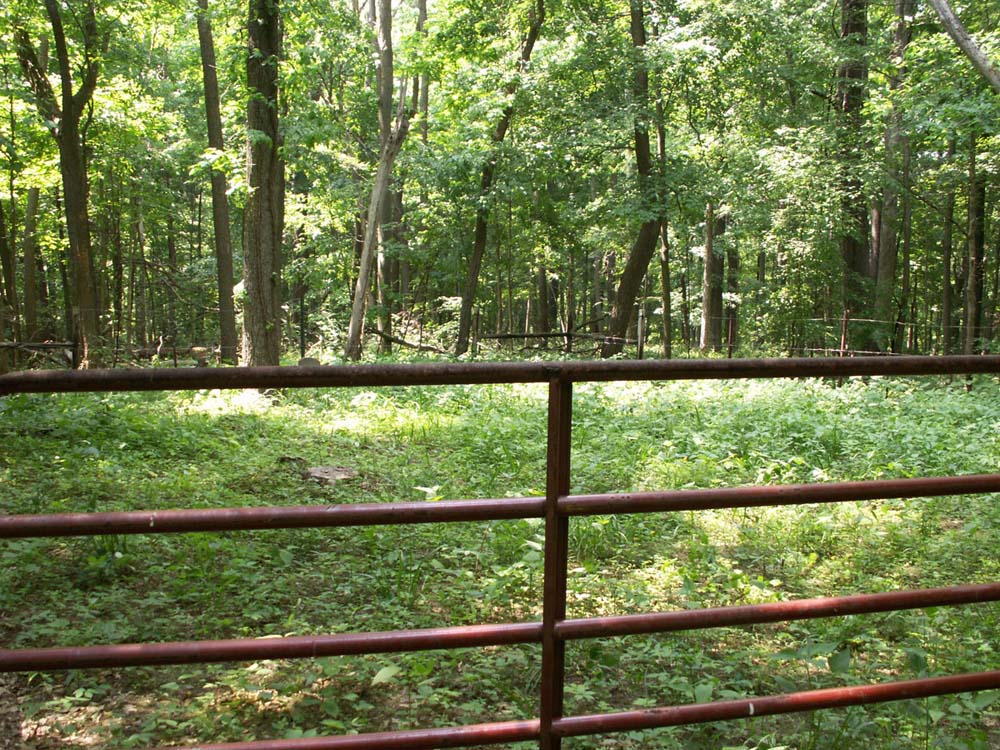
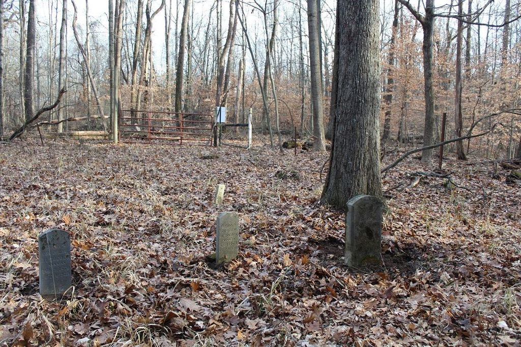
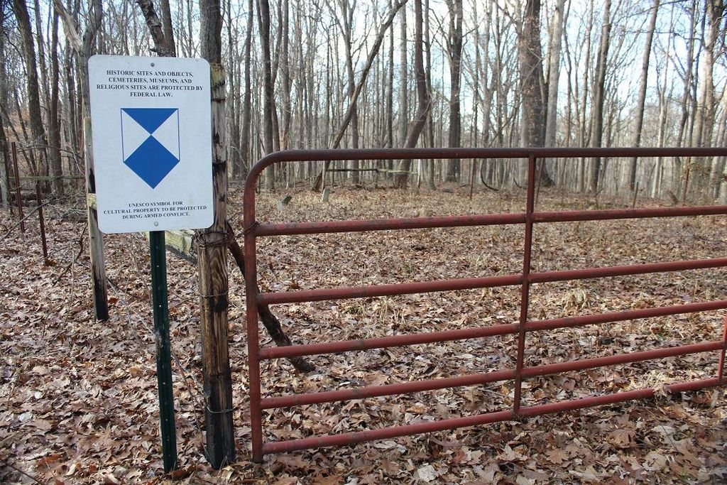
| Description | : | On the line between Sections 9 & 16, township 10N, range 4E. A small family cemetery is located in the woods within Camp Atterbury Military Reserve, about 500 feet east of its western boundary. Permission to enter the area is advised. Indiana Cemetery Locations, Volume 2, published by the Indiana Genealogical Society (01 April 2006), gives the primary cemetery name as Bocock Cemetery. The cemetery is listed in the Cemetery and Burial Grounds Registry of the Indiana Department of Natural Resources (DNR) and in the State Historical Architectural and Archaeological Research Database (SHAARD) with Cemetery Record Number CR-07-4 (Bocock). |
frequently asked questions (FAQ):
-
Where is Bocock Cemetery?
Bocock Cemetery is located at Cordry Drive Hamblen Township, Brown County ,Indiana , 46164USA.
-
Bocock Cemetery cemetery's updated grave count on graveviews.com?
0 memorials
-
Where are the coordinates of the Bocock Cemetery?
Latitude: 39.3138000
Longitude: -86.1048000
Nearby Cemetories:
1. Anderson Cemetery
Hamblen Township, Brown County, USA
Coordinate: 39.2989006, -86.0961075
2. Mount Moriah Cemetery
Brown County, USA
Coordinate: 39.2994194, -86.0928116
3. Handy Cemetery
Spearsville, Brown County, USA
Coordinate: 39.3364780, -86.1243850
4. Milnes Cemetery
Brown County, USA
Coordinate: 39.2845500, -86.1062530
5. Wilder Cemetery
Kansas, Bartholomew County, USA
Coordinate: 39.3314950, -86.0722800
6. Guthrie Cemetery
Kansas, Bartholomew County, USA
Coordinate: 39.2892700, -86.0678200
7. Duncan Cemetery
Spearsville, Brown County, USA
Coordinate: 39.3349991, -86.1539001
8. Mount Olive Graveyard
Johnson County, USA
Coordinate: 39.3431511, -86.1476898
9. Dean Cemetery
Hamblen Township, Brown County, USA
Coordinate: 39.3101080, -86.1661680
10. Taylor Cemetery
Christiansburg, Brown County, USA
Coordinate: 39.2743149, -86.1396332
11. Ohio Ridge Graveyard
Kansas, Bartholomew County, USA
Coordinate: 39.2717900, -86.0724300
12. Walker Cemetery
Beanblossom, Brown County, USA
Coordinate: 39.2929660, -86.1662650
13. Nineveh Christian Church Cemetery
Nineveh, Johnson County, USA
Coordinate: 39.3621674, -86.0793610
14. Zion Church Cemetery
Brown County, USA
Coordinate: 39.2762020, -86.1538840
15. Lickspring Baptist Church Cemetery
Trafalgar, Johnson County, USA
Coordinate: 39.3646469, -86.1276016
16. Jacobs Cemetery
Johnson County, USA
Coordinate: 39.3662470, -86.0855440
17. Hamblen-Taylor Cemetery
Brown County, USA
Coordinate: 39.2672234, -86.1428146
18. Mount Carmel Cemetery
Nineveh, Johnson County, USA
Coordinate: 39.3639832, -86.1395035
19. Taggart Cemetery
Brown County, USA
Coordinate: 39.2634811, -86.1400681
20. Kansas Cemetery
Kansas, Bartholomew County, USA
Coordinate: 39.3293991, -86.0322037
21. Waltz Cemetery
Brown County, USA
Coordinate: 39.2554660, -86.0937880
22. Old Nineveh Cemetery
Nineveh, Johnson County, USA
Coordinate: 39.3669624, -86.0665817
23. Chappell Cemetery
Hamblen Township, Brown County, USA
Coordinate: 39.2732320, -86.1674120
24. Sprunica Church Cemetery
Hamblen Township, Brown County, USA
Coordinate: 39.2834167, -86.1782150