
| Memorials | : | 0 |
| Location | : | Kansas, Bartholomew County, USA |
| Coordinate | : | 39.3314950, -86.0722800 |
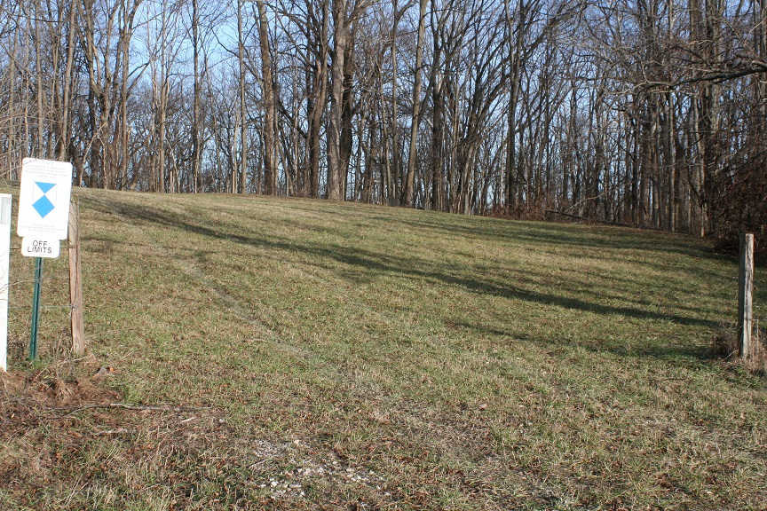
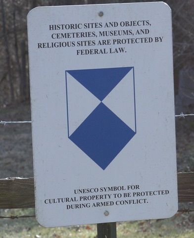
| Description | : | Wilder is a very small cemetery inside Camp Atterbury, one of a handful which were not moved when the Camp was established in 1942. It lies in the SW 1/4 of the SE 1/4, of Section 3, T10, R4. A plat drawing done by Graves Registration Platoon in 1977 noted eleven graves. Only three were found on a visit about twenty years later, including two which were completely delaminated and unreadable. Access to the cemetery is very limited, due to its location within a secure military base. |
frequently asked questions (FAQ):
-
Where is Wilder Cemetery?
Wilder Cemetery is located at Kansas, Bartholomew County ,Indiana ,USA.
-
Wilder Cemetery cemetery's updated grave count on graveviews.com?
0 memorials
-
Where are the coordinates of the Wilder Cemetery?
Latitude: 39.3314950
Longitude: -86.0722800
Nearby Cemetories:
1. Bocock Cemetery
Hamblen Township, Brown County, USA
Coordinate: 39.3138000, -86.1048000
2. Kansas Cemetery
Kansas, Bartholomew County, USA
Coordinate: 39.3293991, -86.0322037
3. Nineveh Christian Church Cemetery
Nineveh, Johnson County, USA
Coordinate: 39.3621674, -86.0793610
4. Old Nineveh Cemetery
Nineveh, Johnson County, USA
Coordinate: 39.3669624, -86.0665817
5. Mount Moriah Cemetery
Brown County, USA
Coordinate: 39.2994194, -86.0928116
6. Jacobs Cemetery
Johnson County, USA
Coordinate: 39.3662470, -86.0855440
7. Anderson Cemetery
Hamblen Township, Brown County, USA
Coordinate: 39.2989006, -86.0961075
8. Handy Cemetery
Spearsville, Brown County, USA
Coordinate: 39.3364780, -86.1243850
9. Guthrie Cemetery
Kansas, Bartholomew County, USA
Coordinate: 39.2892700, -86.0678200
10. Pritchard Cemetery (Defunct)
Nineveh, Johnson County, USA
Coordinate: 39.3682750, -86.0423480
11. POW Chapel Cemetery (Defunct)
Nineveh, Johnson County, USA
Coordinate: 39.3752940, -86.0688320
12. Garrison Cemetery (Defunct)
Kansas, Bartholomew County, USA
Coordinate: 39.3307620, -86.0105900
13. Ergenbright Graveyard
Kansas, Bartholomew County, USA
Coordinate: 39.3314340, -86.0100530
14. Milnes Cemetery
Brown County, USA
Coordinate: 39.2845500, -86.1062530
15. Lickspring Baptist Church Cemetery
Trafalgar, Johnson County, USA
Coordinate: 39.3646469, -86.1276016
16. Forsyth Cemetery
Franklin, Johnson County, USA
Coordinate: 39.3885000, -86.0776000
17. Mount Olive Graveyard
Johnson County, USA
Coordinate: 39.3431511, -86.1476898
18. Riggs Cemetery
Nineveh, Johnson County, USA
Coordinate: 39.3871540, -86.1000200
19. Ohio Ridge Graveyard
Kansas, Bartholomew County, USA
Coordinate: 39.2717900, -86.0724300
20. Thomas Jones Family Graves
Taylorsville, Bartholomew County, USA
Coordinate: 39.3183600, -85.9958700
21. Mount Carmel Cemetery
Nineveh, Johnson County, USA
Coordinate: 39.3639832, -86.1395035
22. Duncan Cemetery
Spearsville, Brown County, USA
Coordinate: 39.3349991, -86.1539001
23. Nay-Tremain Cemetery
Nineveh, Johnson County, USA
Coordinate: 39.4010620, -86.0416031
24. Dean Cemetery
Hamblen Township, Brown County, USA
Coordinate: 39.3101080, -86.1661680