
| Memorials | : | 0 |
| Location | : | Brown County, USA |
| Coordinate | : | 39.2845500, -86.1062530 |
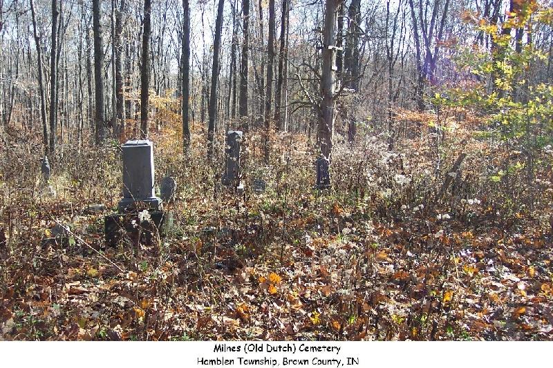
| Description | : | South edge of SE¼ of Section 20; Township 10N; Range 4E. An old, abandoned, small cemetery back in the woods. Drive east from Sweetwater Trail about one and three-fourths miles on Mt. Moriah Rd. to the point where it turns north. From this point take a dirt road south into the forest for about 1,000 ft. Here, go east on another unimproved road about 100 ft. The cemetery is on the north side of the road. There are probably some unmarked graves. |
frequently asked questions (FAQ):
-
Where is Milnes Cemetery?
Milnes Cemetery is located at Brown County ,Indiana ,USA.
-
Milnes Cemetery cemetery's updated grave count on graveviews.com?
0 memorials
-
Where are the coordinates of the Milnes Cemetery?
Latitude: 39.2845500
Longitude: -86.1062530


Nearby Cemetories:
1. Anderson Cemetery
Hamblen Township, Brown County, USA
Coordinate: 39.2989006, -86.0961075
2. Mount Moriah Cemetery
Brown County, USA
Coordinate: 39.2994194, -86.0928116
3. Taylor Cemetery
Christiansburg, Brown County, USA
Coordinate: 39.2743149, -86.1396332
4. Ohio Ridge Graveyard
Kansas, Bartholomew County, USA
Coordinate: 39.2717900, -86.0724300
5. Bocock Cemetery
Hamblen Township, Brown County, USA
Coordinate: 39.3138000, -86.1048000
6. Guthrie Cemetery
Kansas, Bartholomew County, USA
Coordinate: 39.2892700, -86.0678200
7. Waltz Cemetery
Brown County, USA
Coordinate: 39.2554660, -86.0937880
8. Hamblen-Taylor Cemetery
Brown County, USA
Coordinate: 39.2672234, -86.1428146
9. Taggart Cemetery
Brown County, USA
Coordinate: 39.2634811, -86.1400681
10. Zion Church Cemetery
Brown County, USA
Coordinate: 39.2762020, -86.1538840
11. Walker Cemetery
Beanblossom, Brown County, USA
Coordinate: 39.2929660, -86.1662650
12. Chappell Cemetery
Hamblen Township, Brown County, USA
Coordinate: 39.2732320, -86.1674120
13. Dean Cemetery
Hamblen Township, Brown County, USA
Coordinate: 39.3101080, -86.1661680
14. Handy Cemetery
Spearsville, Brown County, USA
Coordinate: 39.3364780, -86.1243850
15. Wilder Cemetery
Kansas, Bartholomew County, USA
Coordinate: 39.3314950, -86.0722800
16. Sprunica Church Cemetery
Hamblen Township, Brown County, USA
Coordinate: 39.2834167, -86.1782150
17. Powell Cemetery
Hamblen Township, Brown County, USA
Coordinate: 39.2303330, -86.0818330
18. Duncan Cemetery
Spearsville, Brown County, USA
Coordinate: 39.3349991, -86.1539001
19. Mount Olive Graveyard
Johnson County, USA
Coordinate: 39.3431511, -86.1476898
20. Richardson Cemetery
Spearsville, Brown County, USA
Coordinate: 39.3003310, -86.1909940
21. Kansas Cemetery
Kansas, Bartholomew County, USA
Coordinate: 39.3293991, -86.0322037
22. Goshen Church Cemetery
Spearsville, Brown County, USA
Coordinate: 39.2640800, -86.1965714
23. Watson Cemetery
Hamblen Township, Brown County, USA
Coordinate: 39.2795250, -86.2015000
24. Kennedy Cemetery
Spearsville, Brown County, USA
Coordinate: 39.3006590, -86.2026670