
| Memorials | : | 0 |
| Location | : | Ohatchee, Calhoun County, USA |
| Coordinate | : | 33.7851410, -86.0270691 |
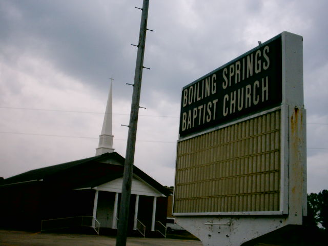
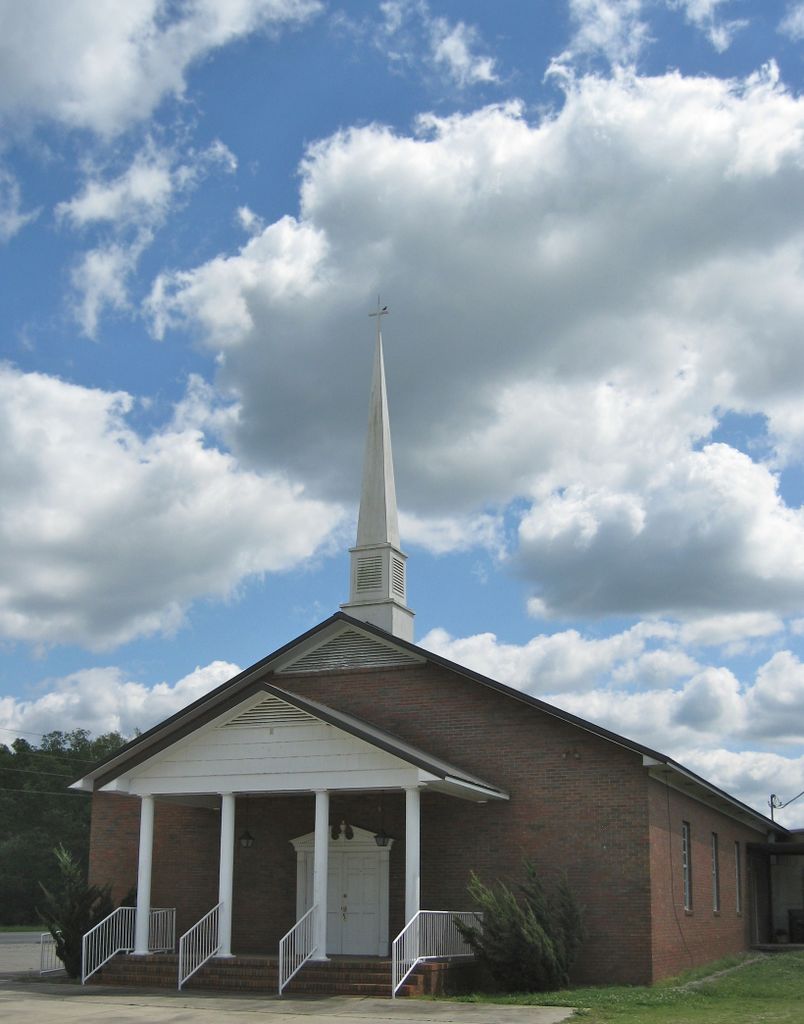
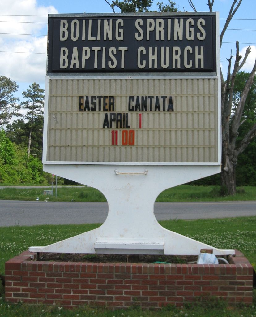
| Description | : | From Interstate 20 West take Exit 173 "Eastaboga" then merge right onto County Road 5 North for 4.5 miles until County Road 5 North is combined at Mudd Street with County Road 93 North, continue 7.3 miles North, turn left at Boiling Springs Road for 0.1 miles and, the cemetery is found in the 6500 Block of Boiling Springs Road. Alternatively, from US Hwy 431 South turn onto Alabama HWY 144 going to Ohatchee, turn onto Boiling Springs Road. The cemetery is located at the intersections of Boiling Springs Road and Mudd Sreet behind the Boiling Springs Baptist Church. |
frequently asked questions (FAQ):
-
Where is Boiling Springs Cemetery?
Boiling Springs Cemetery is located at 6510 Boiling Springs Road Ohatchee, Calhoun County ,Alabama , 36271-6337USA.
-
Boiling Springs Cemetery cemetery's updated grave count on graveviews.com?
0 memorials
-
Where are the coordinates of the Boiling Springs Cemetery?
Latitude: 33.7851410
Longitude: -86.0270691
Nearby Cemetories:
1. Ohatchee First Baptist Church Cemetery
Ohatchee, Calhoun County, USA
Coordinate: 33.7840030, -86.0082080
2. Ten Island Cemetery
Morrisville, Calhoun County, USA
Coordinate: 33.7999992, -86.0372009
3. Ohatchee Cemetery
Ohatchee, Calhoun County, USA
Coordinate: 33.8005981, -86.0038986
4. First Missionary Baptist Church of Ohatchee Cemete
Ohatchee, Calhoun County, USA
Coordinate: 33.7983600, -85.9967100
5. Ragan Chapel Cemetery
Francis, Calhoun County, USA
Coordinate: 33.7510986, -86.0460968
6. Middleton Cumberland Presbyterian Church Cemetery
Middleton, Calhoun County, USA
Coordinate: 33.7700005, -85.9835968
7. Oak Bowery Baptist Church Cemetery
Ohatchee, Calhoun County, USA
Coordinate: 33.7694016, -85.9839020
8. Ten Island Church Cemetery
Ohatchee, Calhoun County, USA
Coordinate: 33.7642083, -85.9794997
9. Green Cemetery
St. Clair County, USA
Coordinate: 33.8283005, -86.0635986
10. Martin Family Cemetery
Ohatchee, Calhoun County, USA
Coordinate: 33.8477100, -86.0276200
11. Green Family Cemetery
Southside, Etowah County, USA
Coordinate: 33.8598950, -86.0251330
12. Shady Glen Cemetery
Anniston, Calhoun County, USA
Coordinate: 33.7157600, -85.9924900
13. Mount Zion Methodist Church Cemetery
St. Clair County, USA
Coordinate: 33.8097560, -86.1152060
14. Crook Cemetery
Ohatchee, Calhoun County, USA
Coordinate: 33.7835999, -85.9332962
15. Vinson Cemetery
Sulphur Springs (Jacksonville West), Calhoun County, USA
Coordinate: 33.7056000, -86.0424000
16. Morrisville Cemetery
Morrisville, Calhoun County, USA
Coordinate: 33.7313220, -85.9543000
17. Providence Church Cemetery
Ragland, St. Clair County, USA
Coordinate: 33.7521230, -86.1198090
18. Bailey Springs Cemetery
Sulphur Springs (Francis Mill), Calhoun County, USA
Coordinate: 33.7118988, -86.0781021
19. Bethel United Methodist Church Cemetery
Ohatchee, Calhoun County, USA
Coordinate: 33.8636818, -85.9835968
20. Greensport Baptist Church Cemetery
St. Clair County, USA
Coordinate: 33.8070600, -86.1282690
21. Mount Olive Baptist Church Cemetery
Ohatchee, Calhoun County, USA
Coordinate: 33.7131004, -86.0899963
22. Heald Cemetery
St. Clair County, USA
Coordinate: 33.8561970, -86.0919250
23. Hebron Cemetery
Duke, Calhoun County, USA
Coordinate: 33.8389015, -85.9413986
24. Hampton Cemetery
Lowrimores Crossroads, Calhoun County, USA
Coordinate: 33.7482986, -85.9289017