
| Memorials | : | 0 |
| Location | : | Escambia County, USA |
| Coordinate | : | 31.1917000, -87.5978012 |
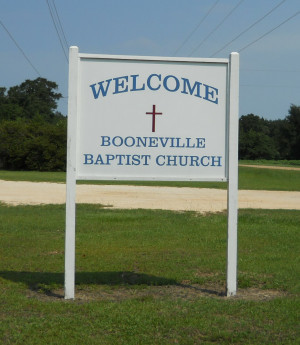
| Description | : | The cemetery was first established and recorded in 1972. The location is on Escambia County Hwy-30 west of the McCullough (also known as Jack Springs) community. The precise location on the Escambia County map is T-3-N, R-5-E, Section 30. The church/cemetery is well maintained and ample parking is available beneath a stand of red oak trees. To reach this small community church and cemetery from Atmore and Interstate-65, turn at the Creek Indian Escambia Hwy-1 and proceed north toward the Reservation headquarters and community center (the Judson Church and Indian Cemetery will be on the left). Continue northward on Hwy-1... Read More |
frequently asked questions (FAQ):
-
Where is Booneville Church Cemetery?
Booneville Church Cemetery is located at Escambia County ,Alabama ,USA.
-
Booneville Church Cemetery cemetery's updated grave count on graveviews.com?
0 memorials
-
Where are the coordinates of the Booneville Church Cemetery?
Latitude: 31.1917000
Longitude: -87.5978012

Nearby Cemetories:
1. Lindsey Cemetery
Escambia County, USA
Coordinate: 31.1966991, -87.5982971
2. Steadham Cemetery
Escambia County, USA
Coordinate: 31.1567001, -87.5768967
3. Corinth Primitive Baptist Church Cemetery
McCullough, Escambia County, USA
Coordinate: 31.1616420, -87.5656490
4. McCullough Community Cemetery
McCullough, Escambia County, USA
Coordinate: 31.1649323, -87.5476074
5. Jack Springs Cemetery
Escambia County, USA
Coordinate: 31.1646996, -87.5472031
6. Driskell Cemetery
Escambia County, USA
Coordinate: 31.1650009, -87.5466995
7. First Baptist Church Cemetery
McCullough, Escambia County, USA
Coordinate: 31.1580390, -87.5262200
8. Millers Cemetery
Baldwin County, USA
Coordinate: 31.1242008, -87.6417007
9. Semirah Springs Cemetery
Jeddo, Monroe County, USA
Coordinate: 31.2627792, -87.5555573
10. Milstead Cemetery
Lottie, Baldwin County, USA
Coordinate: 31.1104300, -87.6177700
11. Judson Indian Cemetery
Escambia County, USA
Coordinate: 31.1110992, -87.5658035
12. Lottie New Home Cemetery
Lottie, Baldwin County, USA
Coordinate: 31.1061993, -87.6408997
13. Poarch Baptist Church Indian Cemetery
Poarch, Escambia County, USA
Coordinate: 31.1209110, -87.5264240
14. Mims Plantation Family Cemetery
Uriah, Monroe County, USA
Coordinate: 31.2877800, -87.5800840
15. Mineola Cemetery
Uriah, Monroe County, USA
Coordinate: 31.2861004, -87.6418991
16. Poarch Mission Cemetery
Escambia County, USA
Coordinate: 31.1208000, -87.5124969
17. Lottie United Methodist Church Cemetery
Lottie, Baldwin County, USA
Coordinate: 31.0961200, -87.6388900
18. Peavy Family Cemetery
Mineola, Monroe County, USA
Coordinate: 31.2941220, -87.5978080
19. Huxford Cemetery
Huxford, Escambia County, USA
Coordinate: 31.2175007, -87.4813995
20. Tate Tunstall Family Cemetery
Blacksher, Baldwin County, USA
Coordinate: 31.2121830, -87.7194824
21. Pierce Rabb Cemetery
Atmore, Escambia County, USA
Coordinate: 31.1049060, -87.5223960
22. Lee Slaughter Family Cemetery
Baldwin County, USA
Coordinate: 31.2189121, -87.7233658
23. Williams Family Cemetery
Atmore, Escambia County, USA
Coordinate: 31.0880020, -87.5424800
24. Rolin Indian Cemetery
Poarch, Escambia County, USA
Coordinate: 31.0813860, -87.5629230