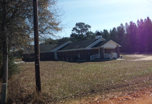
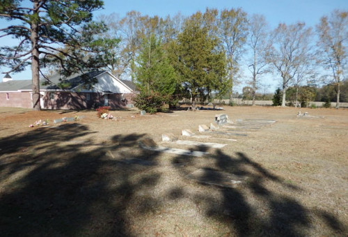
| Memorials | : | 1 |
| Location | : | McCullough, Escambia County, USA |
| Coordinate | : | 31.1580390, -87.5262200 |
| Description | : | To reach this church/cemetery come to McCullough, Alabama. From I-65 take Exit 54 and drive north towards the Creek Indian headquarters. Go 5.4 miles beyond to Booneville Road. At the Booneville intersection turn right and continue eastward to the rail tracks. Cross the tracks and turn right onto Center Street. On Center Street proceed another 7/10 mile (this is a dirt road), and the church/cemetery will be on the left. If coming from Huxford, turn onto CR-30 for a distance of 2.5 miles. At the curve stay straight and cross the rail tracks... Read More |
frequently asked questions (FAQ):
-
Where is First Baptist Church Cemetery?
First Baptist Church Cemetery is located at 611 Center Street McCullough, Escambia County ,Alabama , 36502USA.
-
First Baptist Church Cemetery cemetery's updated grave count on graveviews.com?
1 memorials
-
Where are the coordinates of the First Baptist Church Cemetery?
Latitude: 31.1580390
Longitude: -87.5262200
Nearby Cemetories:
1. Driskell Cemetery
Escambia County, USA
Coordinate: 31.1650009, -87.5466995
2. Jack Springs Cemetery
Escambia County, USA
Coordinate: 31.1646996, -87.5472031
3. McCullough Community Cemetery
McCullough, Escambia County, USA
Coordinate: 31.1649323, -87.5476074
4. Corinth Primitive Baptist Church Cemetery
McCullough, Escambia County, USA
Coordinate: 31.1616420, -87.5656490
5. Poarch Baptist Church Indian Cemetery
Poarch, Escambia County, USA
Coordinate: 31.1209110, -87.5264240
6. Poarch Mission Cemetery
Escambia County, USA
Coordinate: 31.1208000, -87.5124969
7. Steadham Cemetery
Escambia County, USA
Coordinate: 31.1567001, -87.5768967
8. Fountain Correctional Facility Cemetery
Atmore, Escambia County, USA
Coordinate: 31.1519170, -87.4688370
9. Pierce Rabb Cemetery
Atmore, Escambia County, USA
Coordinate: 31.1049060, -87.5223960
10. New Home Indian Cemetery
Poarch, Escambia County, USA
Coordinate: 31.1101300, -87.4967300
11. Judson Indian Cemetery
Escambia County, USA
Coordinate: 31.1110992, -87.5658035
12. Booneville Church Cemetery
Escambia County, USA
Coordinate: 31.1917000, -87.5978012
13. Huxford Cemetery
Huxford, Escambia County, USA
Coordinate: 31.2175007, -87.4813995
14. Williams Family Cemetery
Atmore, Escambia County, USA
Coordinate: 31.0880020, -87.5424800
15. Lindsey Cemetery
Escambia County, USA
Coordinate: 31.1966991, -87.5982971
16. Rolin Indian Cemetery
Poarch, Escambia County, USA
Coordinate: 31.0813860, -87.5629230
17. Davis Cemetery
Freemanville, Escambia County, USA
Coordinate: 31.0726766, -87.5204899
18. Freemanville Church Cemetery
Escambia County, USA
Coordinate: 31.0670260, -87.5216170
19. Milstead Cemetery
Lottie, Baldwin County, USA
Coordinate: 31.1104300, -87.6177700
20. Huxford Indian Cemetery
Escambia County, USA
Coordinate: 31.2237339, -87.4461136
21. Sardis Primitive Baptist Cemetery
Huxford, Escambia County, USA
Coordinate: 31.2245460, -87.4462800
22. Pleasant Grove Church Cemetery
Escambia County, USA
Coordinate: 31.1578007, -87.4105988
23. Huxford Community of Christ Cemetery
Huxford, Escambia County, USA
Coordinate: 31.2285830, -87.4414300
24. Mothershed Cemetery
Freemanville, Escambia County, USA
Coordinate: 31.0557900, -87.5318900


