
| Memorials | : | 0 |
| Location | : | Boven-Hardinxveld, Hardinxveld-Giessendam Municipality, Netherlands |
| Coordinate | : | 51.8268800, 4.8873100 |
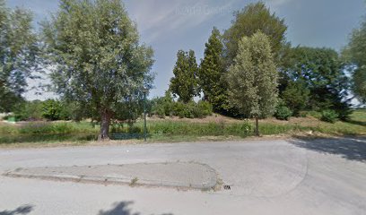
| Description | : | Hardinxveld is 15 kilometres east of Dordrecht and rather less west of Gorinchem, and is 42 kilometres north-north-east of Breda. Boven (Upper) Hardinxveld is part of the village and lies strung out along the north bank of the river Waal. The cemetery is about 1 kilometre east of the church, on the north side of the dyke road to Gorinchem. |
frequently asked questions (FAQ):
-
Where is Boven Hardinxveld General Cemetery?
Boven Hardinxveld General Cemetery is located at Boven-Hardinxveld, Hardinxveld-Giessendam Municipality ,Zuid-Holland ,Netherlands.
-
Boven Hardinxveld General Cemetery cemetery's updated grave count on graveviews.com?
0 memorials
-
Where are the coordinates of the Boven Hardinxveld General Cemetery?
Latitude: 51.8268800
Longitude: 4.8873100
Nearby Cemetories:
1. Werkendam Protestant Cemetery
Werkendam, Werkendam Municipality, Netherlands
Coordinate: 51.8129300, 4.8963800
2. Joodse Begraafplaats
Werkendam Municipality, Netherlands
Coordinate: 51.8072500, 4.9043100
3. Giessen-Oudekerk Churchyard
Giessen-Oudekerk, Giessenlanden Municipality, Netherlands
Coordinate: 51.8453275, 4.8658347
4. Algemene Begraafplaats Neder Hardinxveld
Neder-Hardinxveld, Hardinxveld-Giessendam Municipality, Netherlands
Coordinate: 51.8278580, 4.8369950
5. Gorinchem Old General Cemetery
Gorinchem, Gorinchem Municipality, Netherlands
Coordinate: 51.8379600, 4.9786700
6. Molenaarsgraaf Protestant Churchyard
Molenaarsgraaf, Molenwaard Municipality, Netherlands
Coordinate: 51.8752300, 4.8183800
7. Begraafplaats Ottoland
Ottoland, Molenwaard Municipality, Netherlands
Coordinate: 51.8932730, 4.8735990
8. Begraafplaats woudrichem
Woudrichem Municipality, Netherlands
Coordinate: 51.8142805, 4.9994250
9. Goudriaan Algemene Begraafplaats
Goudriaan, Molenwaard Municipality, Netherlands
Coordinate: 51.9036512, 4.8883253
10. Begraafplaats Noordeloos
Noordeloos, Giessenlanden Municipality, Netherlands
Coordinate: 51.9050436, 4.9412288
11. R.K.Kerkhof O.L.V. Onbevlekt Ontvangen
Hank, Werkendam Municipality, Netherlands
Coordinate: 51.7352615, 4.8947027
12. Giessen Nederlands Hervormd Cemetery
Giessen, Woudrichem Municipality, Netherlands
Coordinate: 51.7924700, 5.0370100
13. Algemene Begraafplaats
Nieuwpoort, Molenwaard Municipality, Netherlands
Coordinate: 51.9333740, 4.8683760
14. Willige-Langerak Churchyard
Willige Langerak, Krimpenerwaard Municipality, Netherlands
Coordinate: 51.9355100, 4.8829800
15. Andel oude Nederlands Hervormde begraafplaats
Andel, Woudrichem Municipality, Netherlands
Coordinate: 51.7838700, 5.0537100
16. Papendrecht Algemene Begraafplaats
Papendrecht, Papendrecht Municipality, Netherlands
Coordinate: 51.8253800, 4.6990500
17. Algemene Begraafplaats Schoonhoven
Schoonhoven, Krimpenerwaard Municipality, Netherlands
Coordinate: 51.9435400, 4.8547900
18. Roman Catholic Cemetery 1784-1873 (Defunct)
Schoonhoven, Krimpenerwaard Municipality, Netherlands
Coordinate: 51.9445176, 4.8547012
19. Joodse Begraafplaats
Schoonhoven, Krimpenerwaard Municipality, Netherlands
Coordinate: 51.9455500, 4.8546200
20. Poederoijen Protestant Churchyard
Poederoijen, Zaltbommel Municipality, Netherlands
Coordinate: 51.7861200, 5.0784600
21. Rooms-Katholieke Begraafplaats, Dordrecht
Dordrecht Municipality, Netherlands
Coordinate: 51.8076420, 4.6826178
22. Algemene Begraafplaats Dubbeldam
Dubbeldam, Dordrecht Municipality, Netherlands
Coordinate: 51.7848834, 4.6881348
23. Joodse Begraafplaats Dordrecht
Dordrecht, Dordrecht Municipality, Netherlands
Coordinate: 51.8018924, 4.6795589
24. Ameide Nieuwe Begraafplaats
Ameide, Zederik Municipality, Netherlands
Coordinate: 51.9493470, 4.9665220