
| Memorials | : | 0 |
| Location | : | Camden, Ray County, USA |
| Coordinate | : | 39.2153900, -94.0238700 |
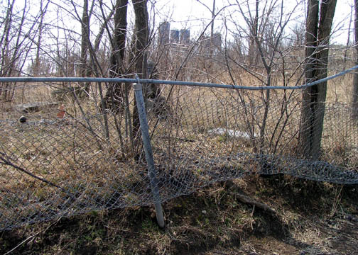
| Description | : | Shown as location #3 on Ray County History 1973 cemetery map Camden Township. Located one mile north of Camden, Missouri, in a field on the Vandiver Bros. Farm Ray County History 1973, p. 232: Cemeteries Not Listed on Map, #21; south and west of Richmond, on Robert Vandiver farm. DAR Index: Located near intersecton of West 72nd Street and Vandiver Road 1914 Plat Map: p. 68 section 22, cemetery marked on J.A. Brown farm, west of H.M. Brockman farm 1897 Plat Map: p 32 Section 22, cemetery marked on Asa Brockman farm Lisa: In the... Read More |
frequently asked questions (FAQ):
-
Where is Brockman-Hudgeons Cemetery?
Brockman-Hudgeons Cemetery is located at Camden, Ray County ,Missouri ,USA.
-
Brockman-Hudgeons Cemetery cemetery's updated grave count on graveviews.com?
0 memorials
-
Where are the coordinates of the Brockman-Hudgeons Cemetery?
Latitude: 39.2153900
Longitude: -94.0238700
Nearby Cemetories:
1. Happy Cemetery
Ray County, USA
Coordinate: 39.2121560, -94.0392570
2. Cravens Cemetery
Camden, Ray County, USA
Coordinate: 39.2118988, -94.0014038
3. Frazier Cemetery
Camden, Ray County, USA
Coordinate: 39.2236100, -93.9936100
4. Jackson Family Cemetery
Richmond, Ray County, USA
Coordinate: 39.2174030, -94.0568710
5. Camden City Cemetery
Camden, Ray County, USA
Coordinate: 39.1936700, -94.0470800
6. Smith-Jackson-Remley Cemetery
Fleming, Ray County, USA
Coordinate: 39.1951500, -94.0532100
7. Cooper Cemetery
Richmond, Ray County, USA
Coordinate: 39.2248500, -93.9852400
8. Craig Cemetery
Richmond, Ray County, USA
Coordinate: 39.2452400, -94.0378800
9. New Hope Primitive Baptist Church and Cemetery
Bluffton, Ray County, USA
Coordinate: 39.2497220, -94.0433330
10. King Cemetery
Richmond, Ray County, USA
Coordinate: 39.2400300, -93.9725100
11. Thomas A. Brown Cemetery
Richmond, Ray County, USA
Coordinate: 39.2503300, -94.0654800
12. Brasher Cemetery
Orrick, Ray County, USA
Coordinate: 39.2262573, -94.0856857
13. Bates Cemetery
Ray County, USA
Coordinate: 39.2385200, -94.0892300
14. Whitmer Cemetery
Richmond, Ray County, USA
Coordinate: 39.2562485, -93.9740067
15. South Point Cemetery
Orrick, Ray County, USA
Coordinate: 39.2233009, -94.0978012
16. Lewis Cemetery
Orrick, Ray County, USA
Coordinate: 39.2386017, -94.0935974
17. Ray County Cemetery
Richmond, Ray County, USA
Coordinate: 39.2712380, -93.9907810
18. Gordon Cemetery
Orrick, Ray County, USA
Coordinate: 39.2552986, -94.0871964
19. Presley Carter Family Cemetery
Richmond, Ray County, USA
Coordinate: 39.2796400, -94.0326300
20. Martin Family Cemetery
Richmond, Ray County, USA
Coordinate: 39.2768200, -93.9899500
21. Cates Cemetery
Richmond, Ray County, USA
Coordinate: 39.2832900, -94.0076500
22. Sunshine Cemetery
Richmond, Ray County, USA
Coordinate: 39.1611500, -93.9679000
23. Richmond Cemetery
Richmond, Ray County, USA
Coordinate: 39.2786430, -93.9856550
24. Sunny Slope Cemetery
Richmond, Ray County, USA
Coordinate: 39.2803001, -93.9867020