
| Memorials | : | 14 |
| Location | : | Brownsville, Dodge County, USA |
| Coordinate | : | 43.5995380, -88.5053440 |
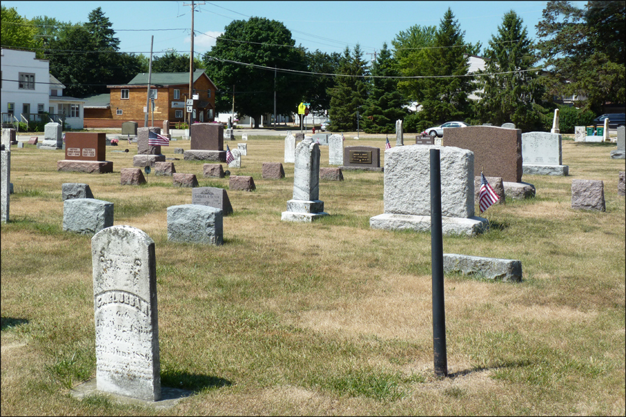
| Description | : | The community cemetery was begun prior to 1878, when Brownsville was founded. The earliest death date observed is 1848. Many graves are for early pioneer families and Civil War veterans. This community cemetery is adjoined to the north & east by the later, circa 1885 Saint Paul's Evangelical Lutheran Cemetery. An old corner post near the center of the two cemeteries denotes the bounderies. The community cemetery is unfenced and has no sign. |
frequently asked questions (FAQ):
-
Where is Brownsville Community Cemetery?
Brownsville Community Cemetery is located at Intersection of Highway 49 & County Trunk AY Brownsville, Dodge County ,Wisconsin , 75206USA.
-
Brownsville Community Cemetery cemetery's updated grave count on graveviews.com?
14 memorials
-
Where are the coordinates of the Brownsville Community Cemetery?
Latitude: 43.5995380
Longitude: -88.5053440
Nearby Cemetories:
1. Emanuel Cemetery
Knowles, Dodge County, USA
Coordinate: 43.5877991, -88.4997025
2. Saint Pauls Evangelical Lutheran Cemetery
Brownsville, Dodge County, USA
Coordinate: 43.6167200, -88.4889100
3. Mount Pleasant Cemetery
LeRoy, Dodge County, USA
Coordinate: 43.6167800, -88.5263000
4. Saint Luke Evangelical Lutheran Church Cemetery
Knowles, Dodge County, USA
Coordinate: 43.5718720, -88.5016540
5. Saint Marys Cemetery
Lomira, Dodge County, USA
Coordinate: 43.5903015, -88.4518967
6. Old Community Cemetery
Lomira, Dodge County, USA
Coordinate: 43.6086590, -88.4499060
7. Saint Andrews Church Cemetery
LeRoy, Dodge County, USA
Coordinate: 43.5732994, -88.5500336
8. Saint Johns Lutheran Cemetery
Lomira, Dodge County, USA
Coordinate: 43.5877266, -88.4469833
9. Salem Cemetery
Lomira, Dodge County, USA
Coordinate: 43.5872530, -88.4463790
10. Mount Pleasant Cemetery
Oakfield, Fond du Lac County, USA
Coordinate: 43.6391983, -88.5460968
11. Genesee Cemetery
Byron, Fond du Lac County, USA
Coordinate: 43.6613884, -88.5066681
12. Ebenezer Cemetery
Lomira, Dodge County, USA
Coordinate: 43.6156006, -88.4210968
13. Saint Peters Cemetery
Theresa, Dodge County, USA
Coordinate: 43.5367012, -88.4794006
14. Saint Pauls Evangelical Lutheran Cemetery
Lomira, Dodge County, USA
Coordinate: 43.5510050, -88.4430740
15. Miles Farm Cemetery
LeRoy, Dodge County, USA
Coordinate: 43.6251880, -88.5917650
16. Byron Cemetery
Byron, Fond du Lac County, USA
Coordinate: 43.6572189, -88.4505615
17. Tidyman Cemetery
LeRoy, Dodge County, USA
Coordinate: 43.5482370, -88.5810470
18. Saint Paul Cemetery
Kekoskee, Dodge County, USA
Coordinate: 43.5455310, -88.5809180
19. Union Cemetery
Theresa, Dodge County, USA
Coordinate: 43.5261002, -88.4514008
20. Kekoskee Cemetery
Kekoskee, Dodge County, USA
Coordinate: 43.5263390, -88.5612850
21. Oak Center Cemetery
Oak Center, Fond du Lac County, USA
Coordinate: 43.6466600, -88.6009400
22. Saint John Catholic Cemetery
Byron, Fond du Lac County, USA
Coordinate: 43.6744400, -88.4501000
23. Saint Gobki Cemetery
Theresa, Dodge County, USA
Coordinate: 43.5144005, -88.4803009
24. Avoca Cemetery
Oakfield, Fond du Lac County, USA
Coordinate: 43.6872215, -88.5319366