
| Memorials | : | 60 |
| Location | : | Brownsville, Dodge County, USA |
| Coordinate | : | 43.6167200, -88.4889100 |
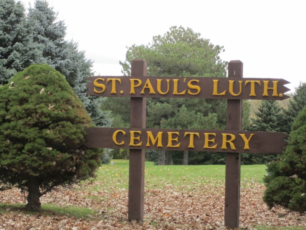
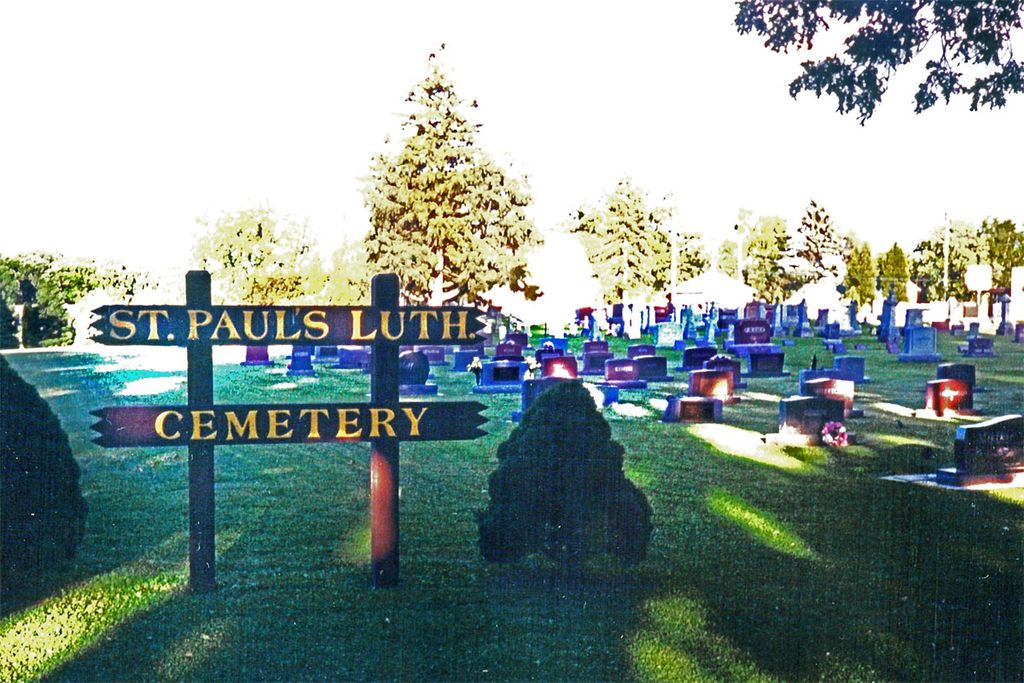
| Description | : | In 1885, St. John's Luthern Church of Lomira released fifteen of its member families, west of Lomira. These families founded St. Paul's Lutheran Church #2 and built a new church at Brownsville. (Note: St. Paul's Lutheran Church #1, also known as the Half-Way Church, was established about 1855, south of Lomira. Near midway between Lomira and Theresa.) The Brownsville congregation's first church was constructed about 1887 and a cemetery was started next to the church, at the north side of Brownsville's Main Street. This new cemetery adjoined an earlier community Cemetery. However, by 1910, the church building proved too small,... Read More |
frequently asked questions (FAQ):
-
Where is Saint Pauls Evangelical Lutheran Cemetery?
Saint Pauls Evangelical Lutheran Cemetery is located at Wisconsin 49 (Main St.) & County AY (Oak St.) Brownsville, Dodge County ,Wisconsin , 53006USA.
-
Saint Pauls Evangelical Lutheran Cemetery cemetery's updated grave count on graveviews.com?
59 memorials
-
Where are the coordinates of the Saint Pauls Evangelical Lutheran Cemetery?
Latitude: 43.6167200
Longitude: -88.4889100
Nearby Cemetories:
1. Brownsville Community Cemetery
Brownsville, Dodge County, USA
Coordinate: 43.5995380, -88.5053440
2. Mount Pleasant Cemetery
LeRoy, Dodge County, USA
Coordinate: 43.6167800, -88.5263000
3. Old Community Cemetery
Lomira, Dodge County, USA
Coordinate: 43.6086590, -88.4499060
4. Emanuel Cemetery
Knowles, Dodge County, USA
Coordinate: 43.5877991, -88.4997025
5. Saint Marys Cemetery
Lomira, Dodge County, USA
Coordinate: 43.5903015, -88.4518967
6. Saint Johns Lutheran Cemetery
Lomira, Dodge County, USA
Coordinate: 43.5877266, -88.4469833
7. Salem Cemetery
Lomira, Dodge County, USA
Coordinate: 43.5872530, -88.4463790
8. Saint Luke Evangelical Lutheran Church Cemetery
Knowles, Dodge County, USA
Coordinate: 43.5718720, -88.5016540
9. Genesee Cemetery
Byron, Fond du Lac County, USA
Coordinate: 43.6613884, -88.5066681
10. Mount Pleasant Cemetery
Oakfield, Fond du Lac County, USA
Coordinate: 43.6391983, -88.5460968
11. Byron Cemetery
Byron, Fond du Lac County, USA
Coordinate: 43.6572189, -88.4505615
12. Ebenezer Cemetery
Lomira, Dodge County, USA
Coordinate: 43.6156006, -88.4210968
13. Saint Andrews Church Cemetery
LeRoy, Dodge County, USA
Coordinate: 43.5732994, -88.5500336
14. Saint John Catholic Cemetery
Byron, Fond du Lac County, USA
Coordinate: 43.6744400, -88.4501000
15. Saint Pauls Evangelical Lutheran Cemetery
Lomira, Dodge County, USA
Coordinate: 43.5510050, -88.4430740
16. Miles Farm Cemetery
LeRoy, Dodge County, USA
Coordinate: 43.6251880, -88.5917650
17. Avoca Cemetery
Oakfield, Fond du Lac County, USA
Coordinate: 43.6872215, -88.5319366
18. Rohlf Cemetery
Eden, Fond du Lac County, USA
Coordinate: 43.6313460, -88.3804180
19. Saint Peters Cemetery
Theresa, Dodge County, USA
Coordinate: 43.5367012, -88.4794006
20. Oak Center Cemetery
Oak Center, Fond du Lac County, USA
Coordinate: 43.6466600, -88.6009400
21. Saint Martin's Catholic Cemetery
Ashford, Fond du Lac County, USA
Coordinate: 43.5855598, -88.3730011
22. Union Cemetery
Theresa, Dodge County, USA
Coordinate: 43.5261002, -88.4514008
23. Tidyman Cemetery
LeRoy, Dodge County, USA
Coordinate: 43.5482370, -88.5810470
24. Saint Paul Cemetery
Kekoskee, Dodge County, USA
Coordinate: 43.5455310, -88.5809180