
| Memorials | : | 0 |
| Location | : | Clark, Randolph County, USA |
| Coordinate | : | 39.2559260, -92.4175290 |
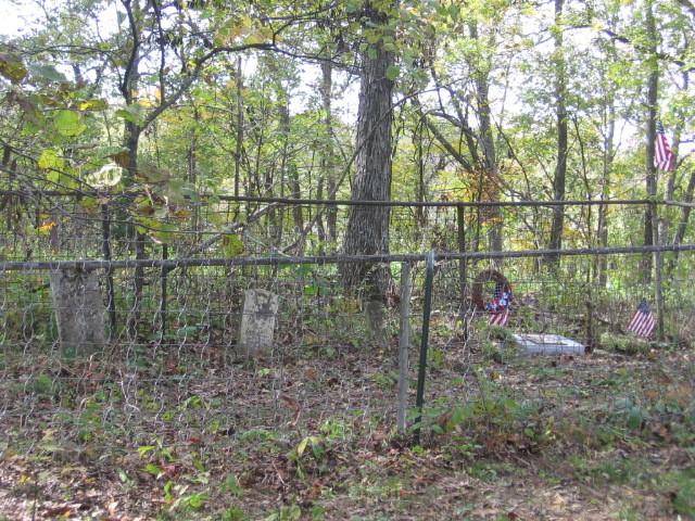
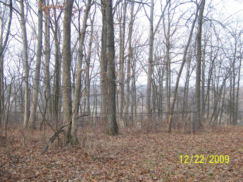
| Description | : | To get to Bruce cemetery, at Clark Missouri, from Highway 63, go West on Route B, approx. 5 miles to Route T. Turn left onto Route T, go approx. 2 to 2 1/2 miles, the road will curve left, right, then left, and a driveway is just after last curve, past a bridge. Cemetery is on left (north) side of the road, across part of a field, up a very steep hill, and is among the trees. Cemetery cannot be seen from the road, and there is no road to it, but the way has been cleared for vehicles or... Read More |
frequently asked questions (FAQ):
-
Where is Bruce Cemetery?
Bruce Cemetery is located at Clark, Randolph County ,Missouri ,USA.
-
Bruce Cemetery cemetery's updated grave count on graveviews.com?
0 memorials
-
Where are the coordinates of the Bruce Cemetery?
Latitude: 39.2559260
Longitude: -92.4175290
Nearby Cemetories:
1. Fairview Cemetery
Randolph County, USA
Coordinate: 39.2649994, -92.4229965
2. Robinson Cemetery
Rucker, Boone County, USA
Coordinate: 39.2265500, -92.4009200
3. Elington-Rice Cemetery
Randolph County, USA
Coordinate: 39.2744100, -92.3659200
4. Floyd Cemetery
Randolph County, USA
Coordinate: 39.2678760, -92.4835420
5. Mount Vernon Cemetery
Clark, Randolph County, USA
Coordinate: 39.2980990, -92.3704250
6. Hardin Cemetery
Randolph County, USA
Coordinate: 39.3103770, -92.4387990
7. Perche Church Cemetery
Rucker, Boone County, USA
Coordinate: 39.1990400, -92.4224400
8. Hamilton Cemetery
Randolph County, USA
Coordinate: 39.3074989, -92.4514008
9. Chapel Grove Cemetery
Clark, Randolph County, USA
Coordinate: 39.2658005, -92.3424988
10. Perkins Cemetery
Randolph County, USA
Coordinate: 39.3106150, -92.4488880
11. Duffield Cemetery
Randolph County, USA
Coordinate: 39.2984110, -92.4802210
12. Sandy Hook Cemetery
Higbee, Randolph County, USA
Coordinate: 39.2896996, -92.4899979
13. Lick Fork Cemetery
Sturgeon, Boone County, USA
Coordinate: 39.2139282, -92.3494873
14. Kimbrough-Brockman Cemetery
Randolph County, USA
Coordinate: 39.3285510, -92.4360870
15. Guren Cemetery
Howard County, USA
Coordinate: 39.2360992, -92.5113983
16. Myers Chapel Cemetery
Burton, Howard County, USA
Coordinate: 39.2220790, -92.5058920
17. Hubbard Cemetery
Randolph County, USA
Coordinate: 39.3341400, -92.4267300
18. Burton Rennolds Cemetery
Moniteau Township, Randolph County, USA
Coordinate: 39.2968276, -92.5059950
19. Crews-Adams Cemetery
Randolph County, USA
Coordinate: 39.2990210, -92.3256260
20. Lessley Cemetery
Higbee, Randolph County, USA
Coordinate: 39.2895630, -92.5184550
21. Harlow Cemetery
Randolph County, USA
Coordinate: 39.2780390, -92.5249910
22. Robb Cemetery
Higbee, Randolph County, USA
Coordinate: 39.2863580, -92.5231910
23. New Hope Cemetery
Burton, Howard County, USA
Coordinate: 39.2237587, -92.5260696
24. Mount Pleasant Christian Church Cemetery
Punkin Center, Howard County, USA
Coordinate: 39.1971100, -92.5080600